
TABLE HEAD
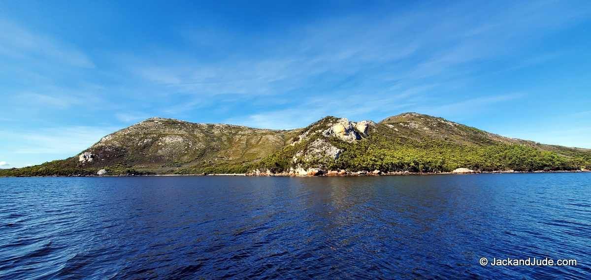
Nestled in the untamed beauty of Macquarie Harbour, Table Head awaits adventurous souls seeking a true bush experience. With no established tracks, the journey begins amidst narrow shore growth, leading explorers to the ascent. Reaching nearly 200 meters above sea level, the assent is manageable for moderately fit individuals, offering glimpses of Hells Gate, the Sorell Mountains, and the Southern Ocean along the way.
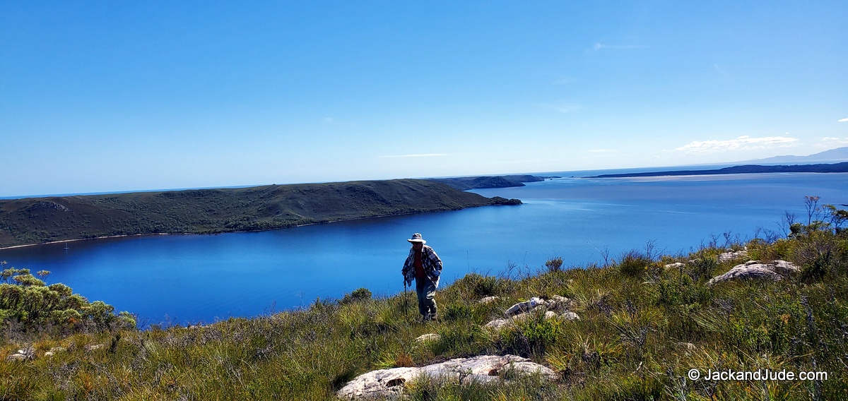
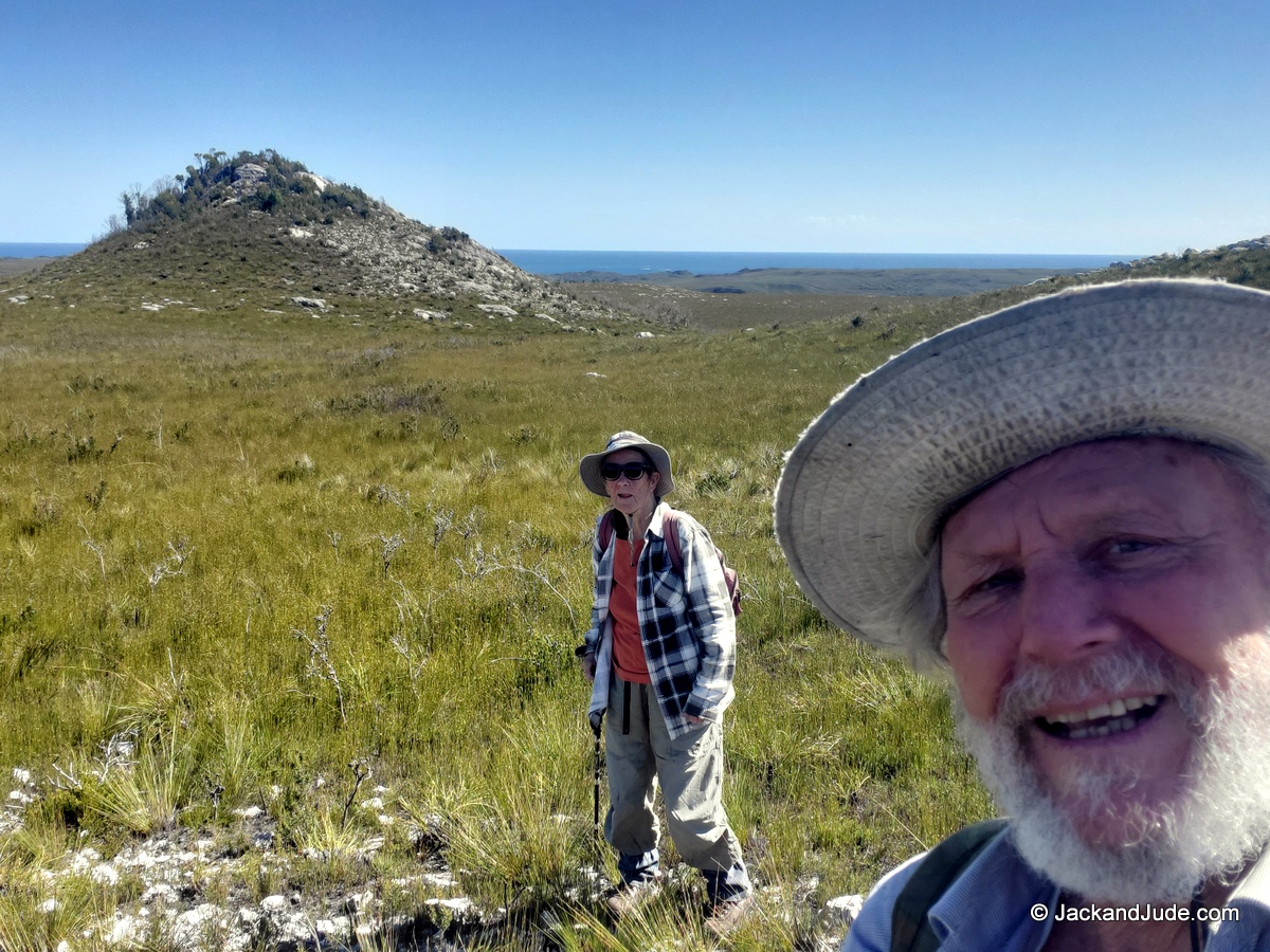
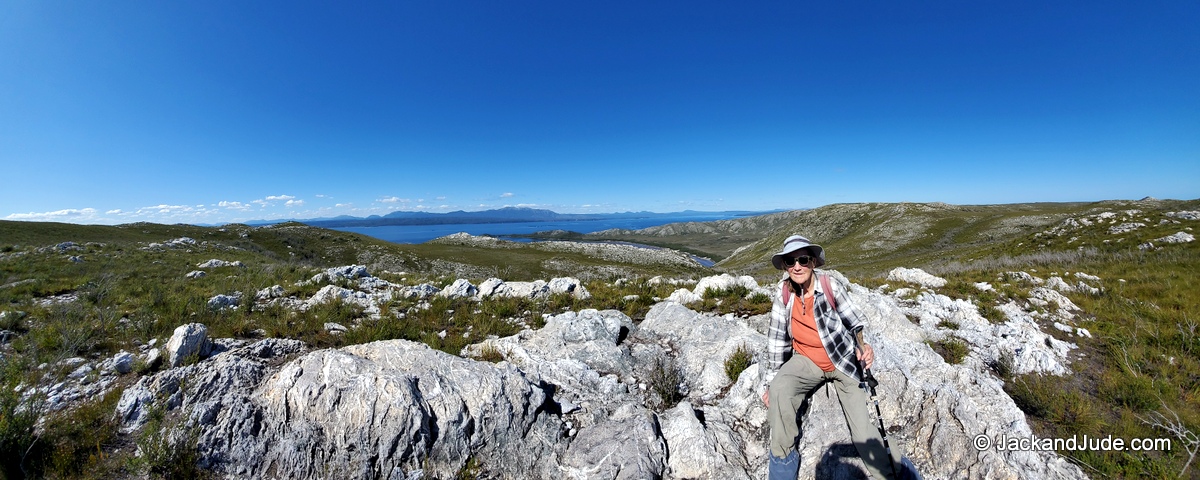
Upon reaching the plateau, a serene landscape unfolds, adorned with exquisite rock outcrops and panoramic views in every direction. However, the terrain demands respect, with short growth and patches of stone requiring careful navigation. While some may opt for better footing in the scrub, others will prefer to manoeuvre up and over obstacles.
Preparation is paramount, with good balance and wilderness experience essential for a safe journey. Adequate supplies and appropriate footwear ensure readiness for the adventure ahead.
In the heart of Macquarie Harbour, Table Head beckons intrepid travellers to explore its rugged charm and breathtaking vistas. So, lace up your boots, embrace the challenge, and discover the untamed beauty of Table Head.
Route, waypoints and Topo maps here
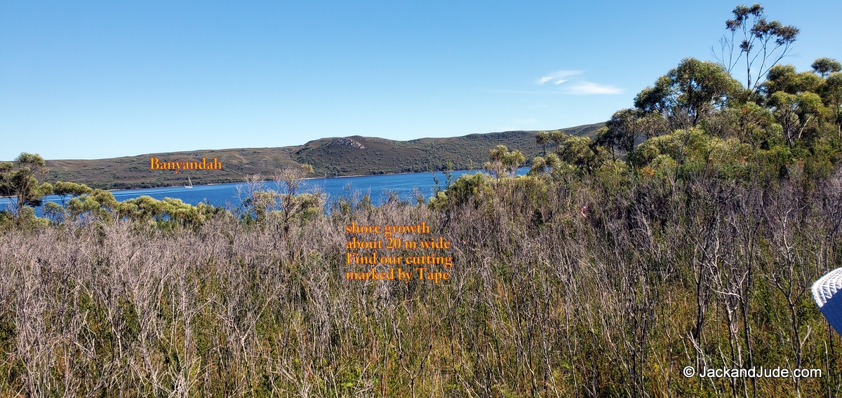
Looking back at the shore growth
Be wilderness wise ~
Copy our waypoints into your handheld GPS, or make you own to ensure a fast, safe return to your transport. The landing has two flat spots of swan grass, perfect to land a dinghy or kayak.

Not quite on the plateau, Betsy Bay to Hells Gate

One of many views of the “Gate”
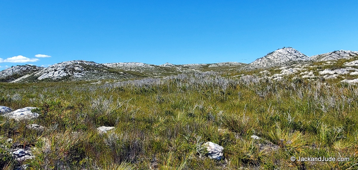
The Table Head Plateau
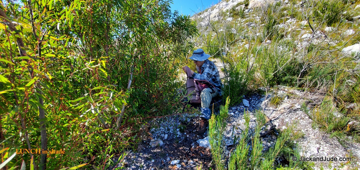
Lunch in shade
Our lunch spot was on the other side of that rocky pimple
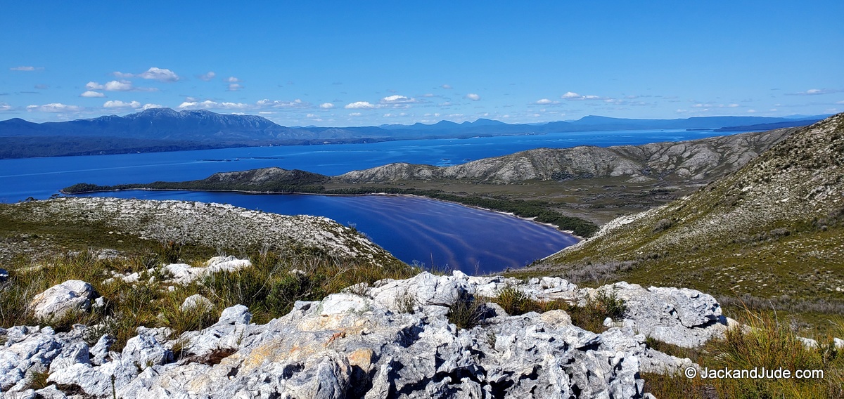
Liberty Bay – showing the extensive sand flats

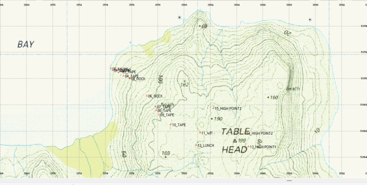
Topo Map g3531 showing our WAYPOINTS
H COORDINATE SYSTEM WGS 84
U LAT LON DM
F ID————— Latitude — Longitude — Alt(m)
W 00_KAYAK——— S42°17.1320′ E145°16.2562′ 1.0
W 01_ENTRY——— S42°17.1386′ E145°16.2655′ 4.5
W 02_EXIT———- S42°17.1368′ E145°16.2881′ 15.6
W 03_TAPE———- S42°17.1452′ E145°16.3097′ 21.2
W 04_TAPE———- S42°17.1622′ E145°16.3246′ 30.2
W 05_ROCK———- S42°17.1736′ E145°16.3577′ 38.1
W 06_ROCK———- S42°17.2468′ E145°16.4525′ 92.1
W 07_TAPE———- S42°17.2919′ E145°16.5000′ 129.3
W 08_TAPE———- S42°17.3070′ E145°16.5018′ 132.9
W 09_TAPE———- S42°17.3251′ E145°16.5166′ 153.8
W 10_TAPE———- S42°17.3666′ E145°16.5817′ 167.8
W 11_WP———— S42°17.4025′ E145°16.7423′ 177.0
W 12_LUNCH——— S42°17.4530′ E145°16.7205′ 173.2
W 13_HIGH POINT1— S42°17.4643′ E145°17.0099′ 195.3
W 14_HIGH POINT2— S42°17.4073′ E145°16.9918′ 210.4
W 15_HIGH POINT3— S42°17.3032′ E145°16.8192′ 193.8
TOPO Map Tasmania G3531