
Track Maintenance in Macquarie Harbour
So often we hear visiting yachties say there is little chance for walks ashore.
Well, we disagree – there are several tracks – if you know where to find them.
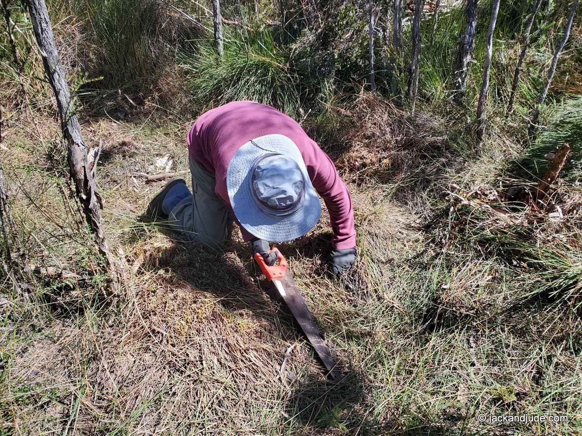
 Jack and Jude are members of the Macquarie Harbour Wildcare Group who help keep tracks open, which is a lot of work in a climate that promotes fast growth.
Betsy’s Bay Track ~
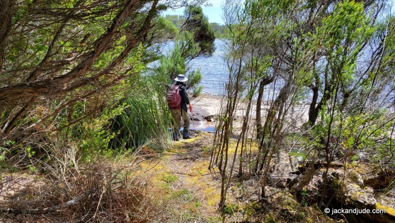
In February, we cleaned the Betsy’s Bay track that takes you to a magnificent beach on a lovely day walk to the wild west coast. The beginning of this track traverses thick shore growth before reaching an expansive button grass plains. There’s a wonderful campground at the start, with a fireplace and running water, and lovely views across the harbour to a range of mountains.
In two days of hard yakka, we cut back towering grasses that would discourage all but the hardiest. But now it’s an easy stroll to picturesque views of the harbour and mountains with your vessel in the picture.
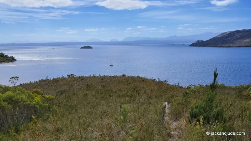
Track starts next to camp
We have made a webpage with videos that show waypoints for the 2 to 3 hour walk one way. Just be sure to wear long pants and good shoes – it’s still wild country.
Track to Mount Sorell and Sorell Plateau
Jack and Jude have climbed the 1,144 m high Mount Sorell – twice. But, to be honest, we did not make the summut on our first attempt. One of the toughest parts of the journey is getting through the thick shore growth. About a dozen years ago, a kind soul fixed that by hacking a narrow track to the first high point. From there, the journey becomes much easier. Mind, there is no track after a few hundred metres. But, if you’re wilderness savy, it’s a magnificent journey through open country achieved by many. We made it to the highest peak in a three day adventure and our ancient legs knew they’d been tested.
Sorell Plateau – A much easier day walk to the summit of the Sorell Plateau. Great place for a picnic. Outstanding views over the harbour and Southern Ocean. Here is a guide with map and waypoints.
Every few years, we tidy up the track through the shore growth and make sure the red ribbons marking the track are intact. We did this at the end of February, so it’ll be an easy hike to open ground for several years to come.

Other Walks ~
Goulds Track – Historical track first cut in 1862 and used by thousands to find a new life on the west coast. Also used by the Piners to get supplies to their Gordon River camps, and by Hydro when survey for the Gordon below Franklin Dam. First 2 km marked and clear through a magnificent wet forest on what was a Piners Shoe Road. Start 100 m upstream of Sir John Falls. Map and photos HERE.
Eagle Creek – One of Tasmanian’s most superb wet rainforest is challenging. First used by the Sir John Franklin group in 1842, more recently by Pack-Rafters using it to reach the Franklin River. Presently it needs a trim. Trevor Norton hopes to get to that after Stormbreaker’s season ends. Starts at Eagle Creek campsite on the Gordon River.
Betsys Bay Walks –
There are several off-track walks through low vegatation to points of interest and grand views.
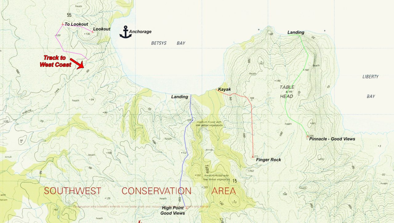
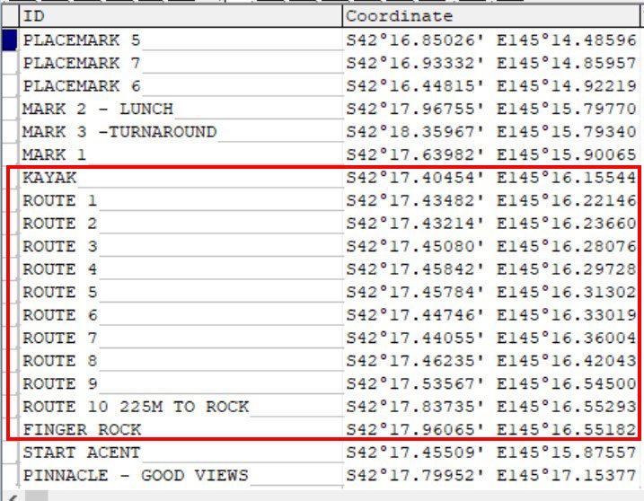
We finally found an easy route to Finger Rock that can be seen from the anchorage. Our first attempt saw us take the wrong side of the creek, which took us on a lovely walk to a high point overlooking a vast forest seperating us from our intended destination.
Second time, we landed on the east side of all the little creeks and pushed through a bit of fringe growth to gain the open slopes. And then within an hour’s easy trekking, we came to the impresive rock formation, with 360 degree views taking in Hells Gate, the Southern Ocean, vast button grass plains and a lot of Macquarie Harbour to the mountain ranges. We’ll post our waypoints.
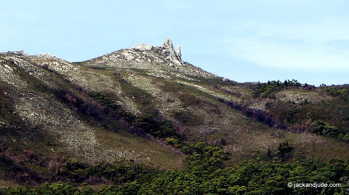
Finger Rock – A destination seen from the anchorage that we have long wanted to reach
 Kayak landing at furthest EAST inlet - shallow walk ashore.


Betsys Bay walks – Finger Rock
Till next time, enjoy life while you can.