
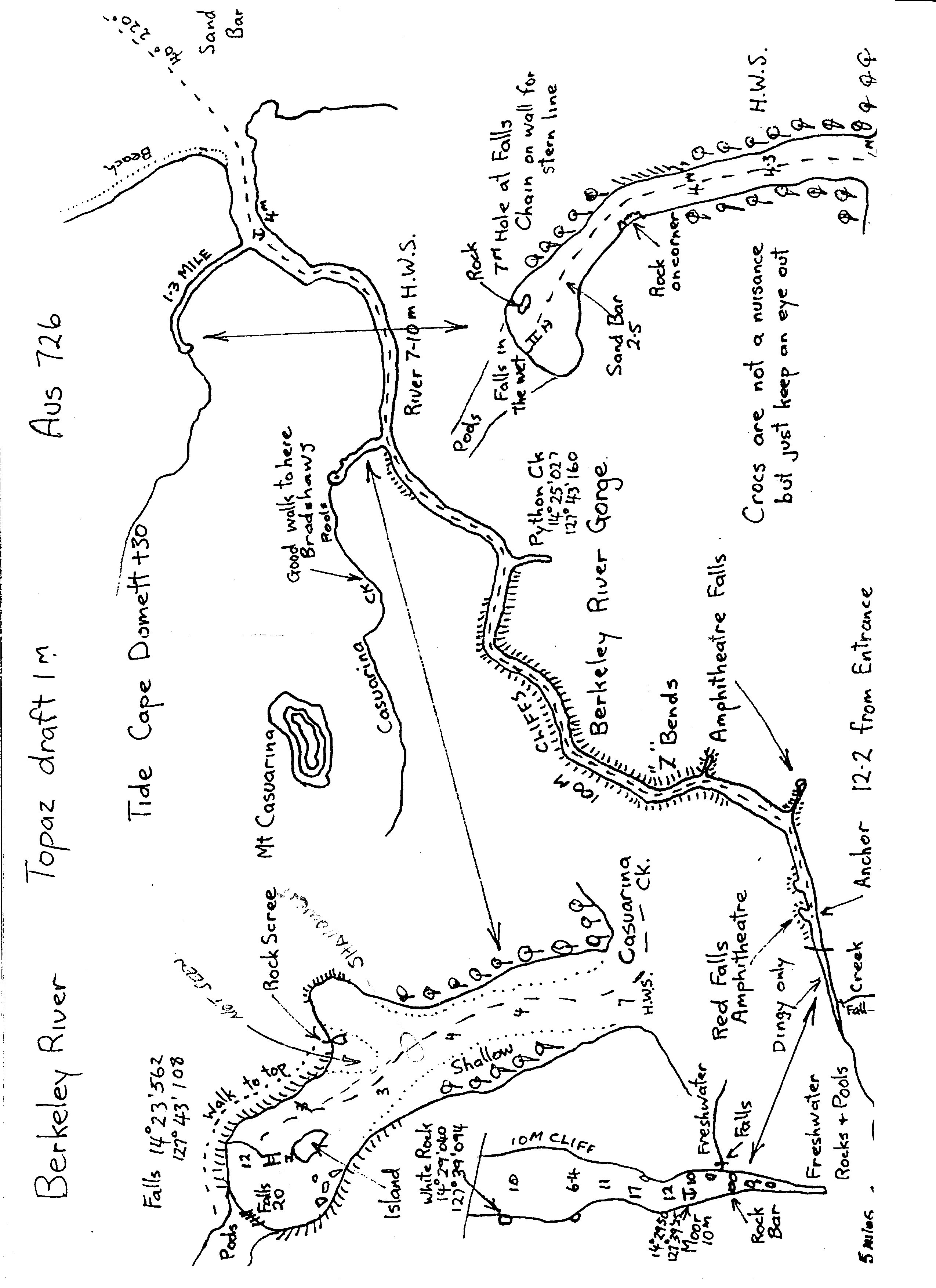
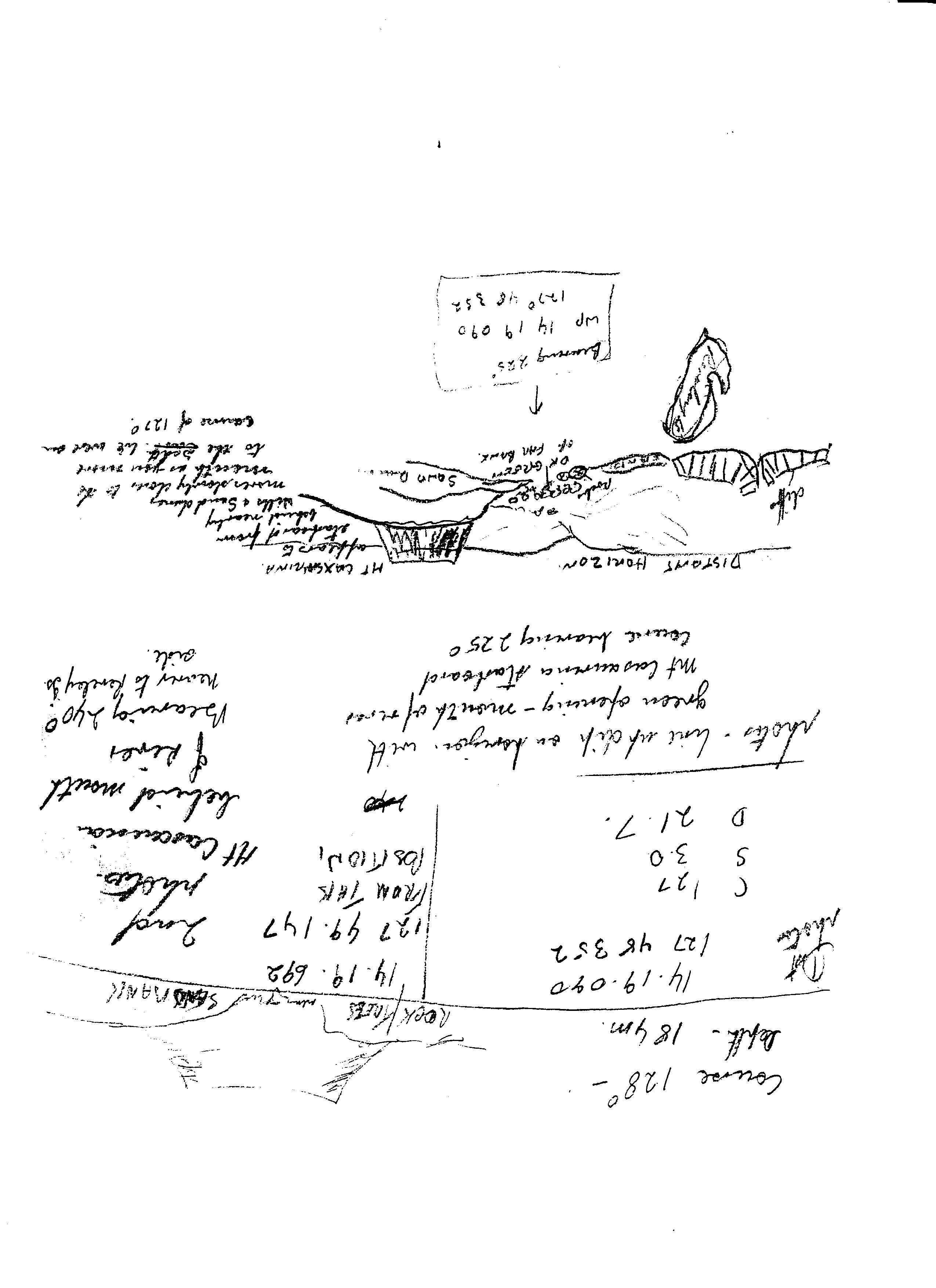
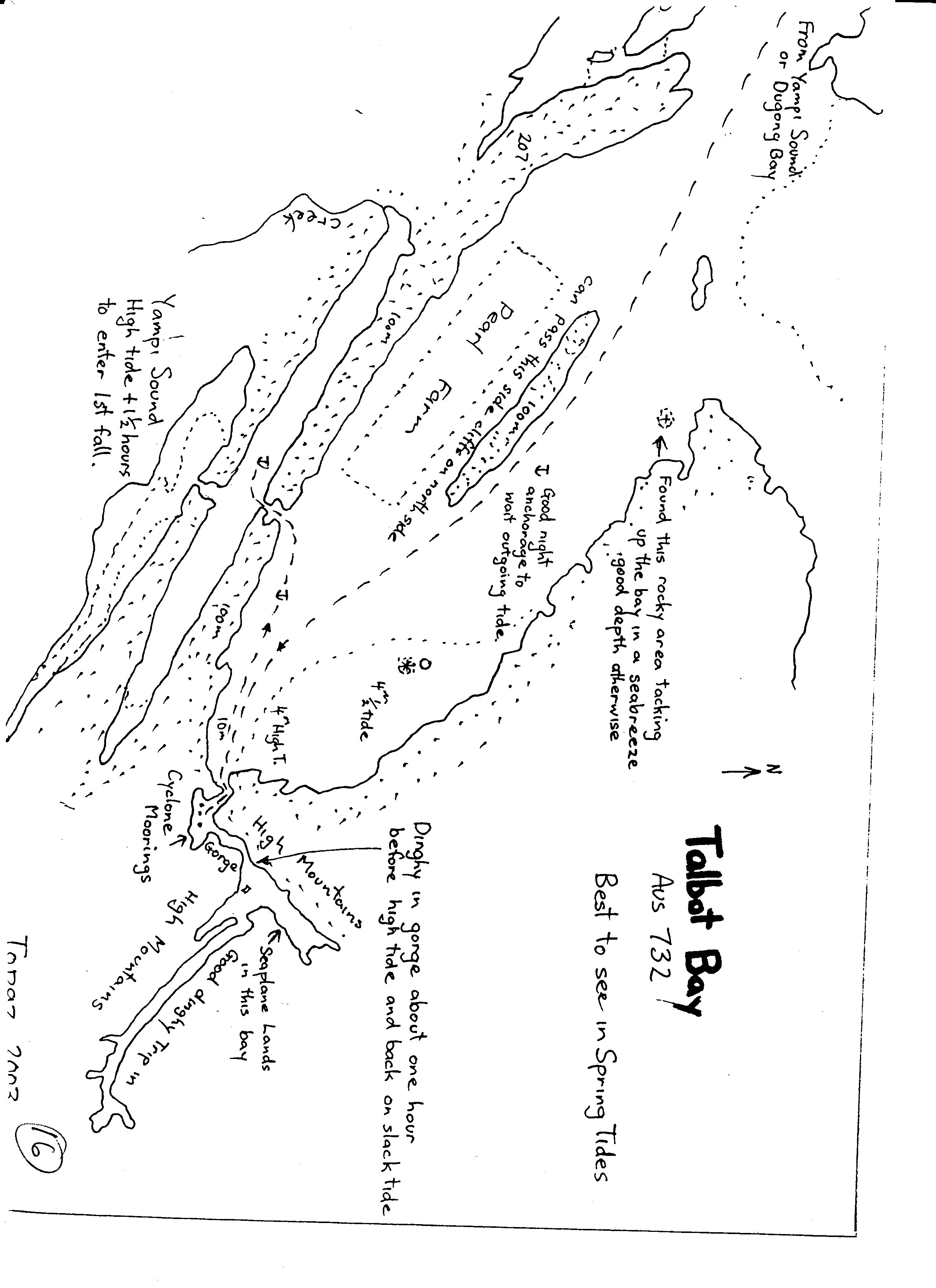
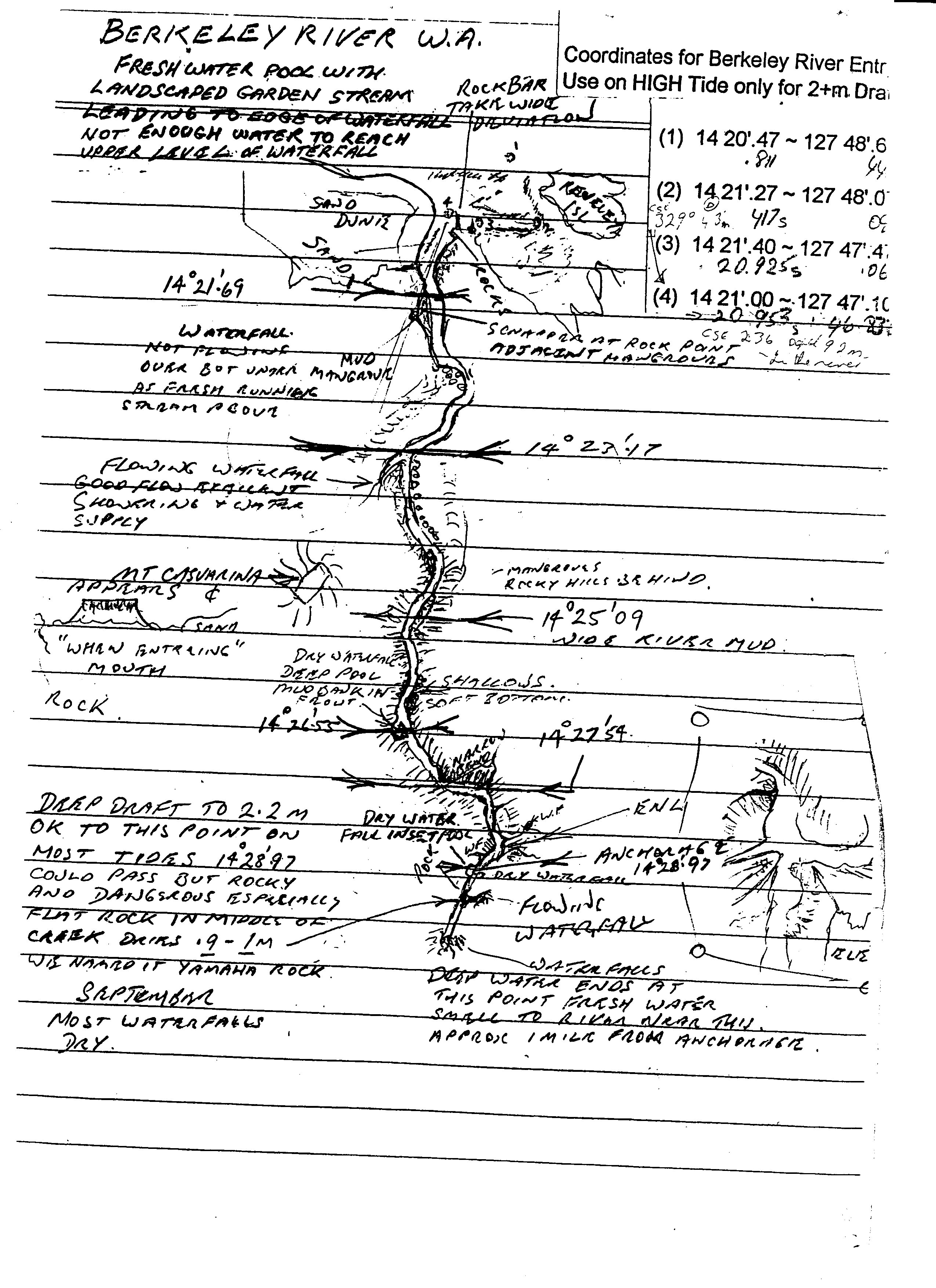
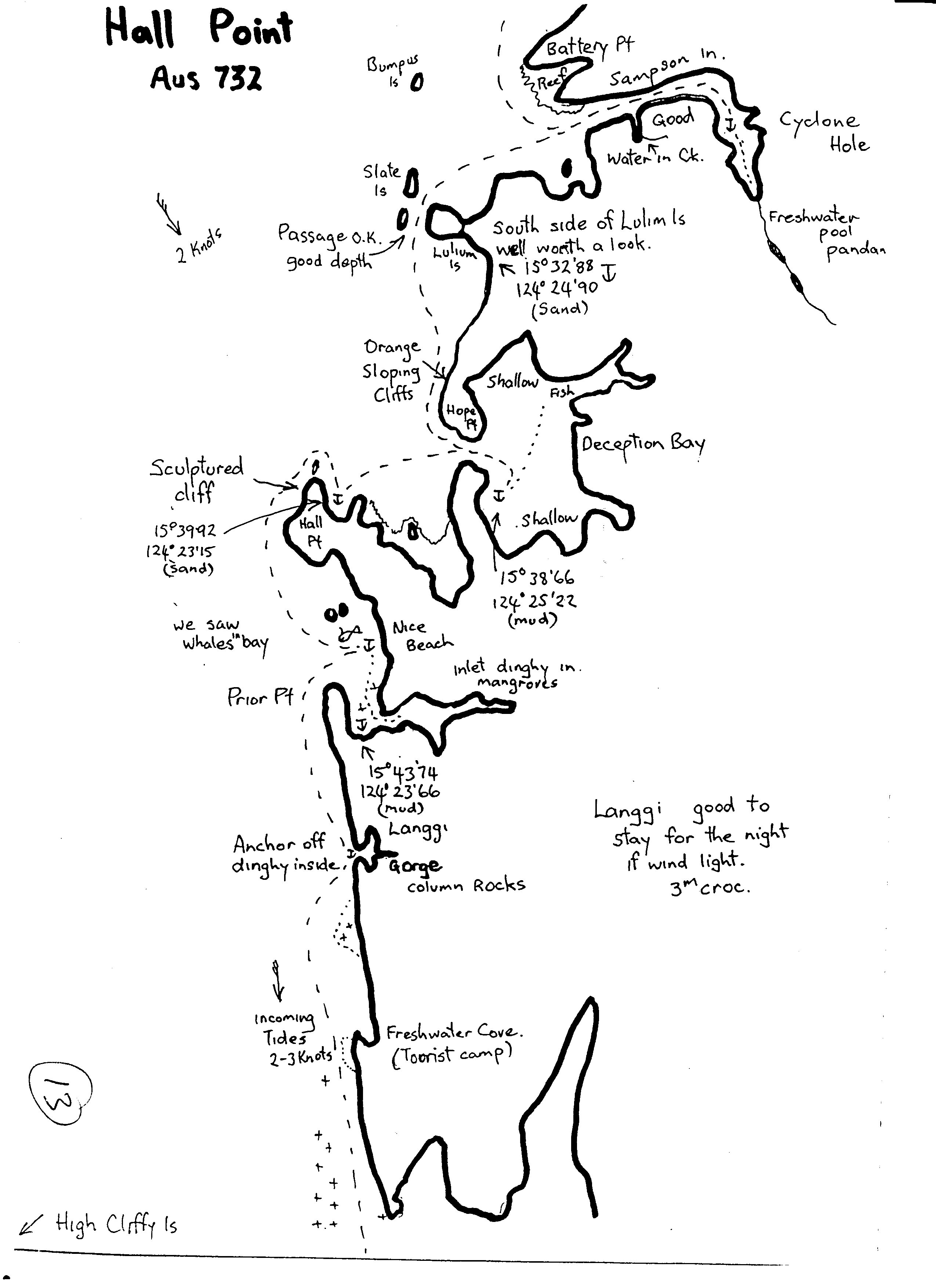
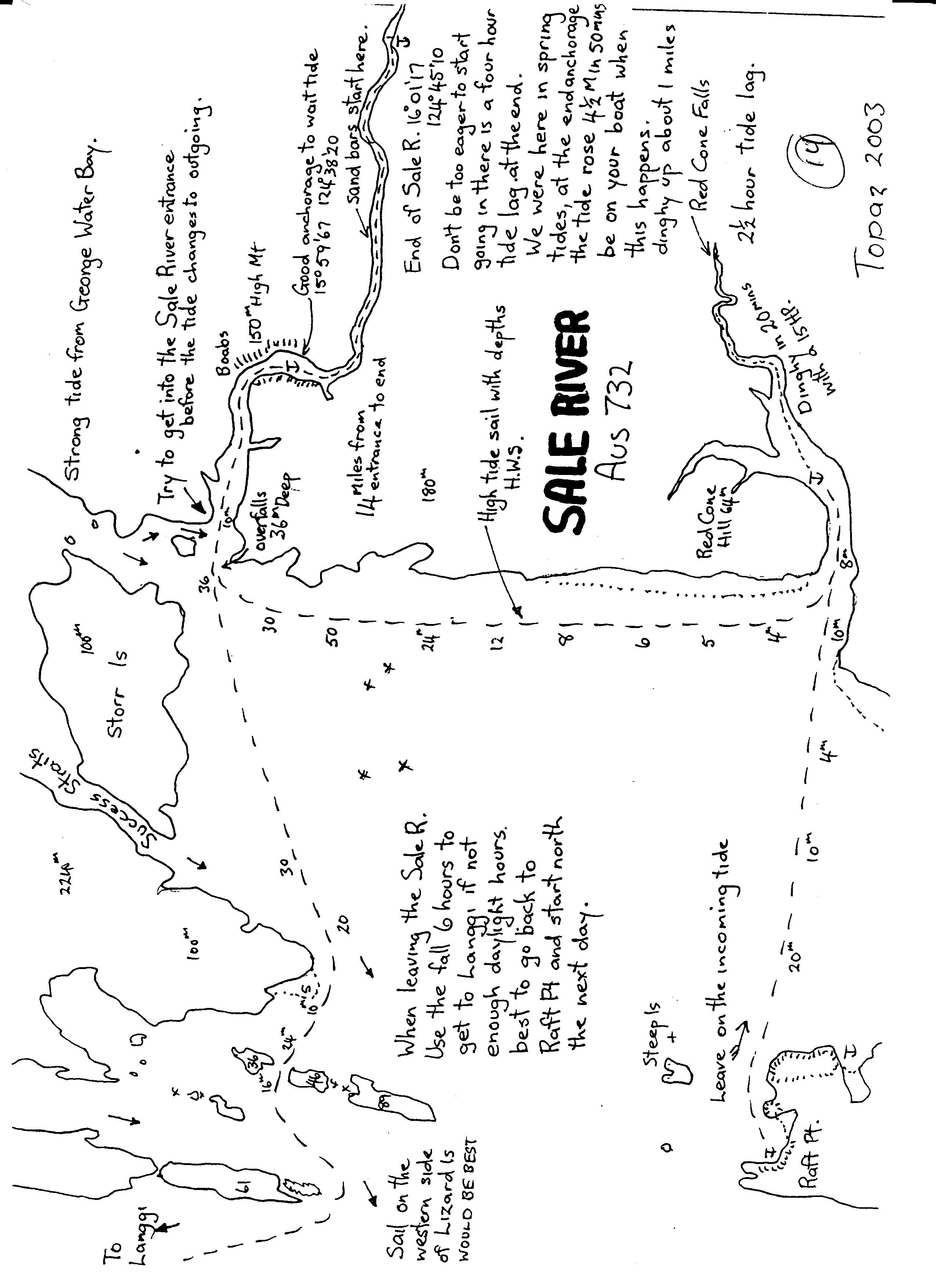
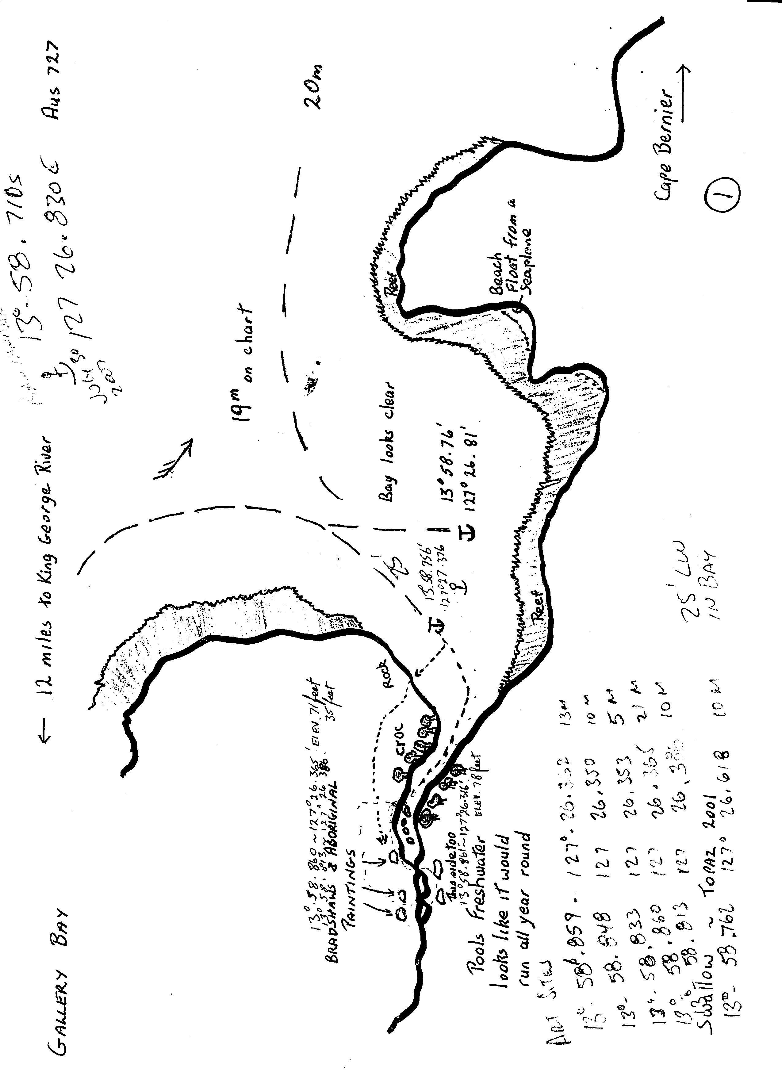
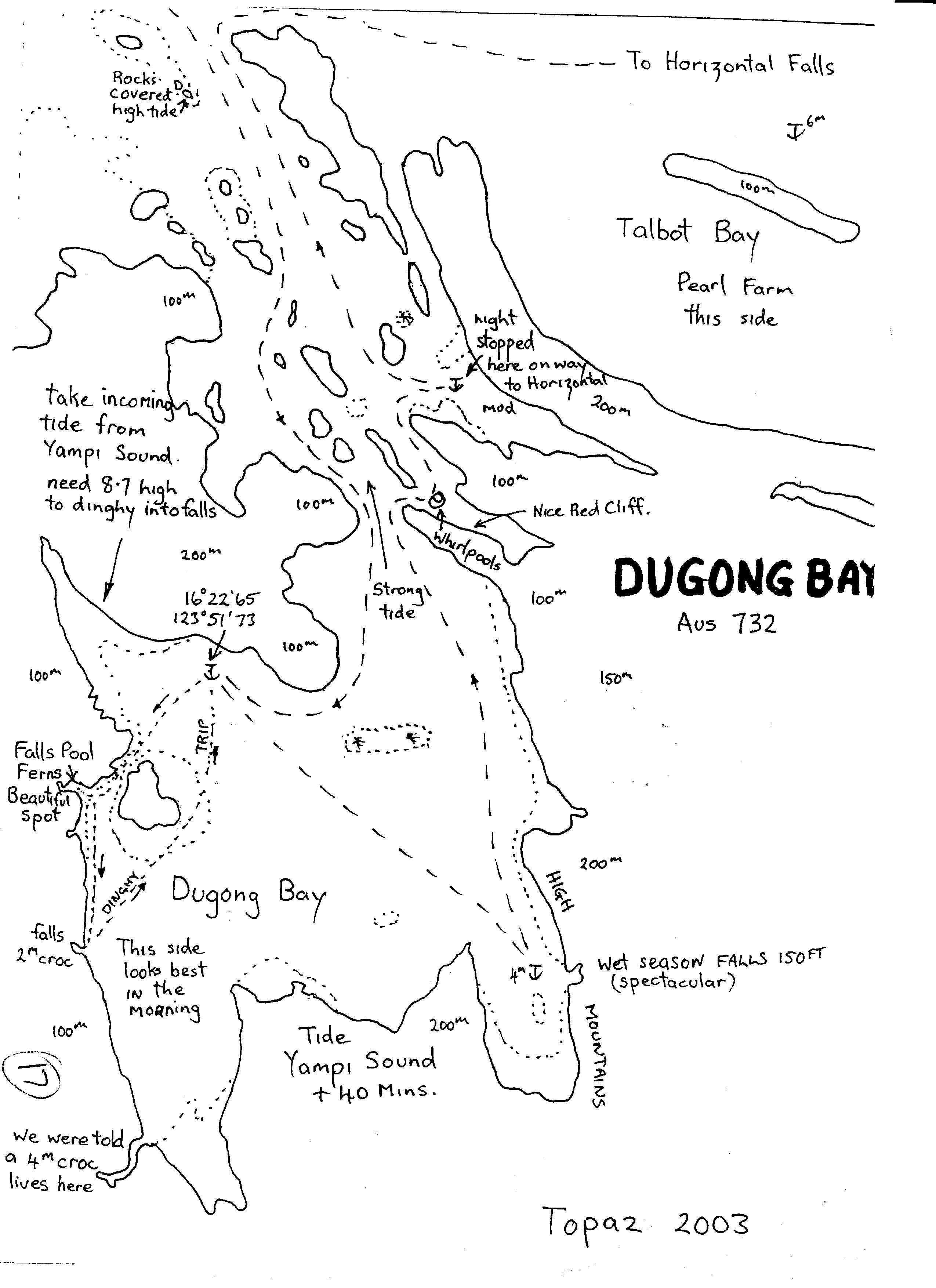
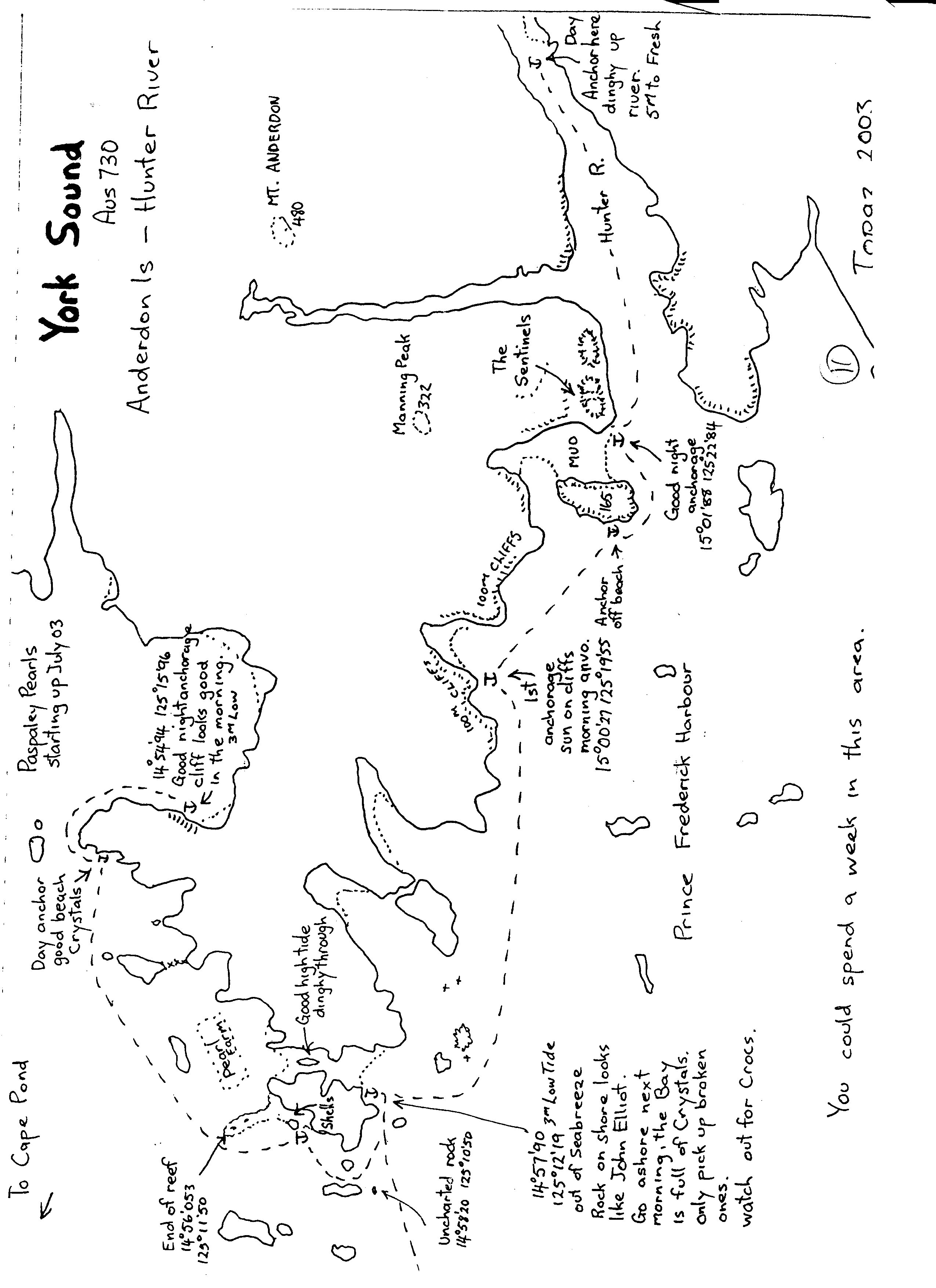
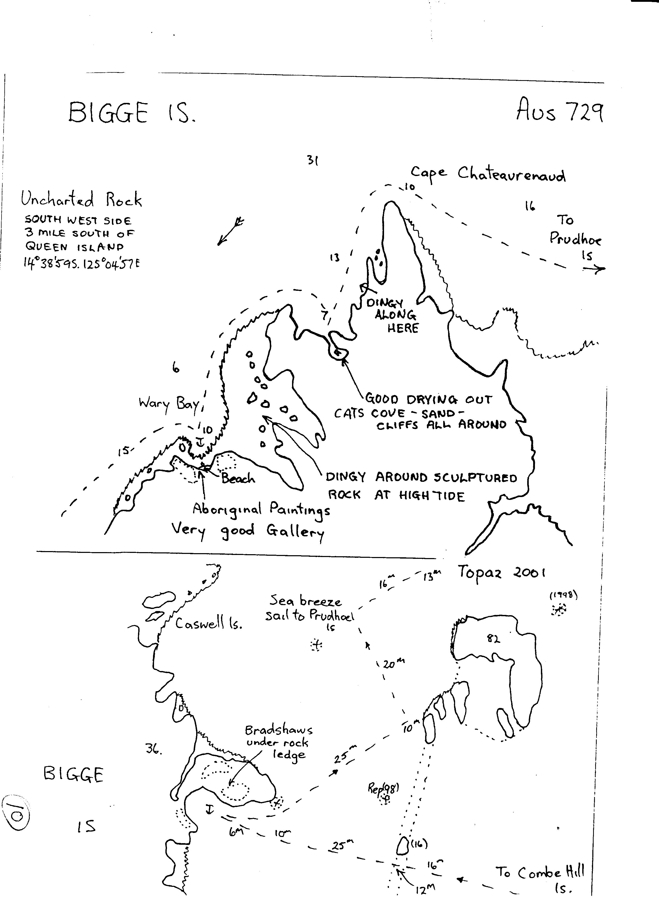
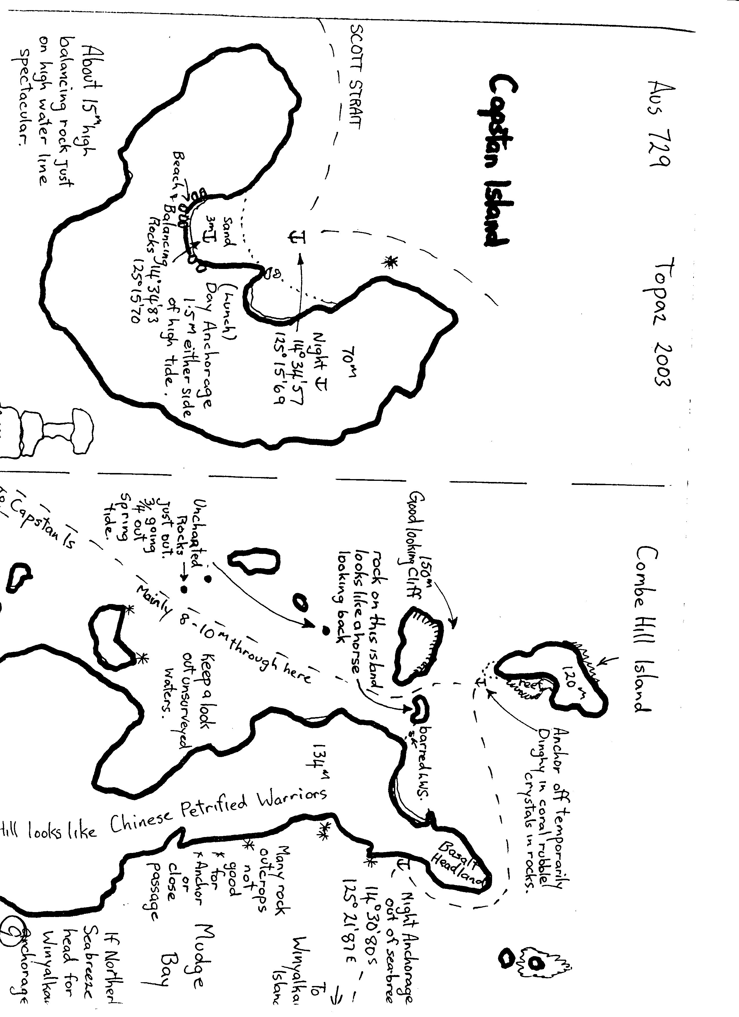
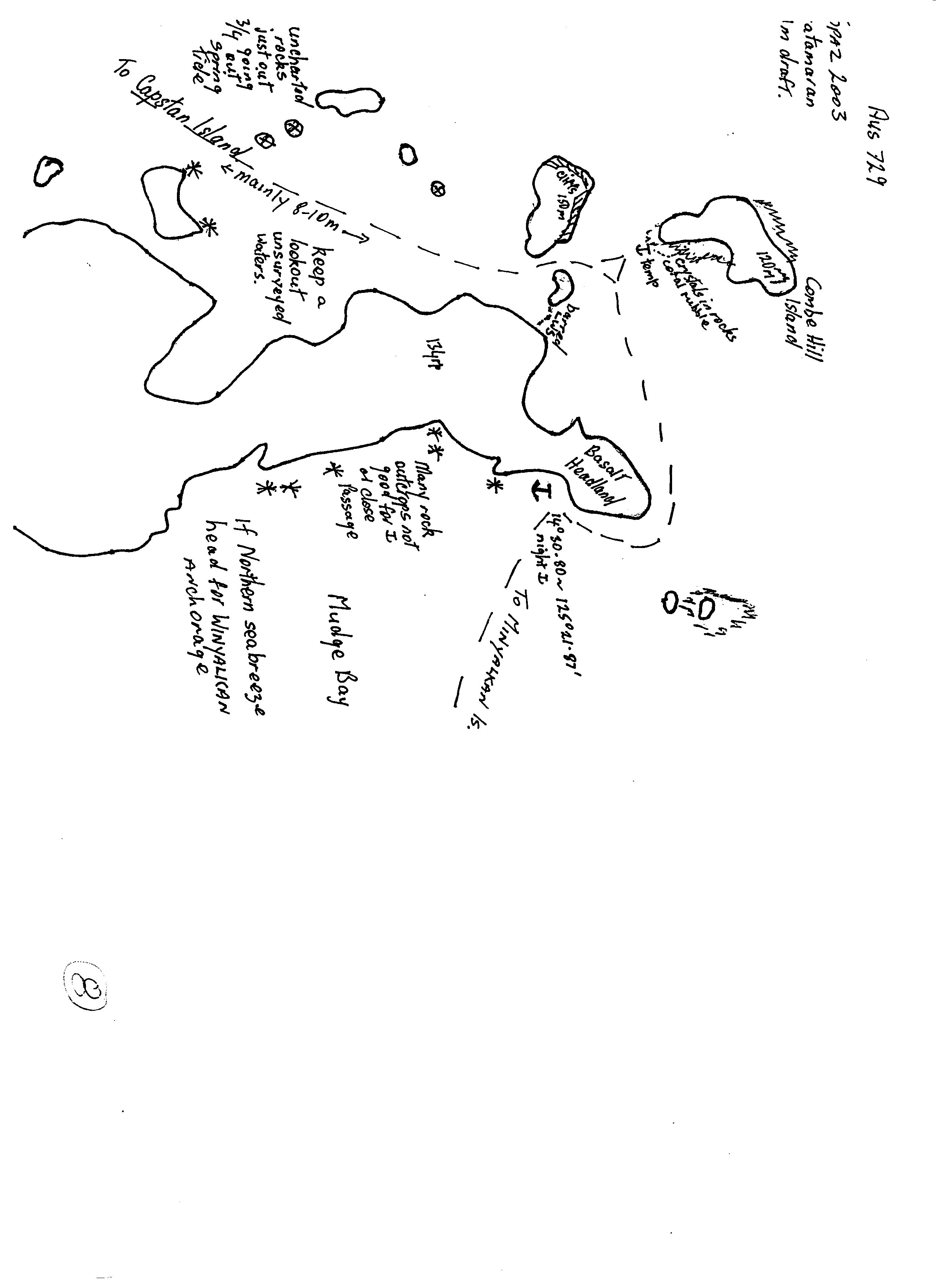
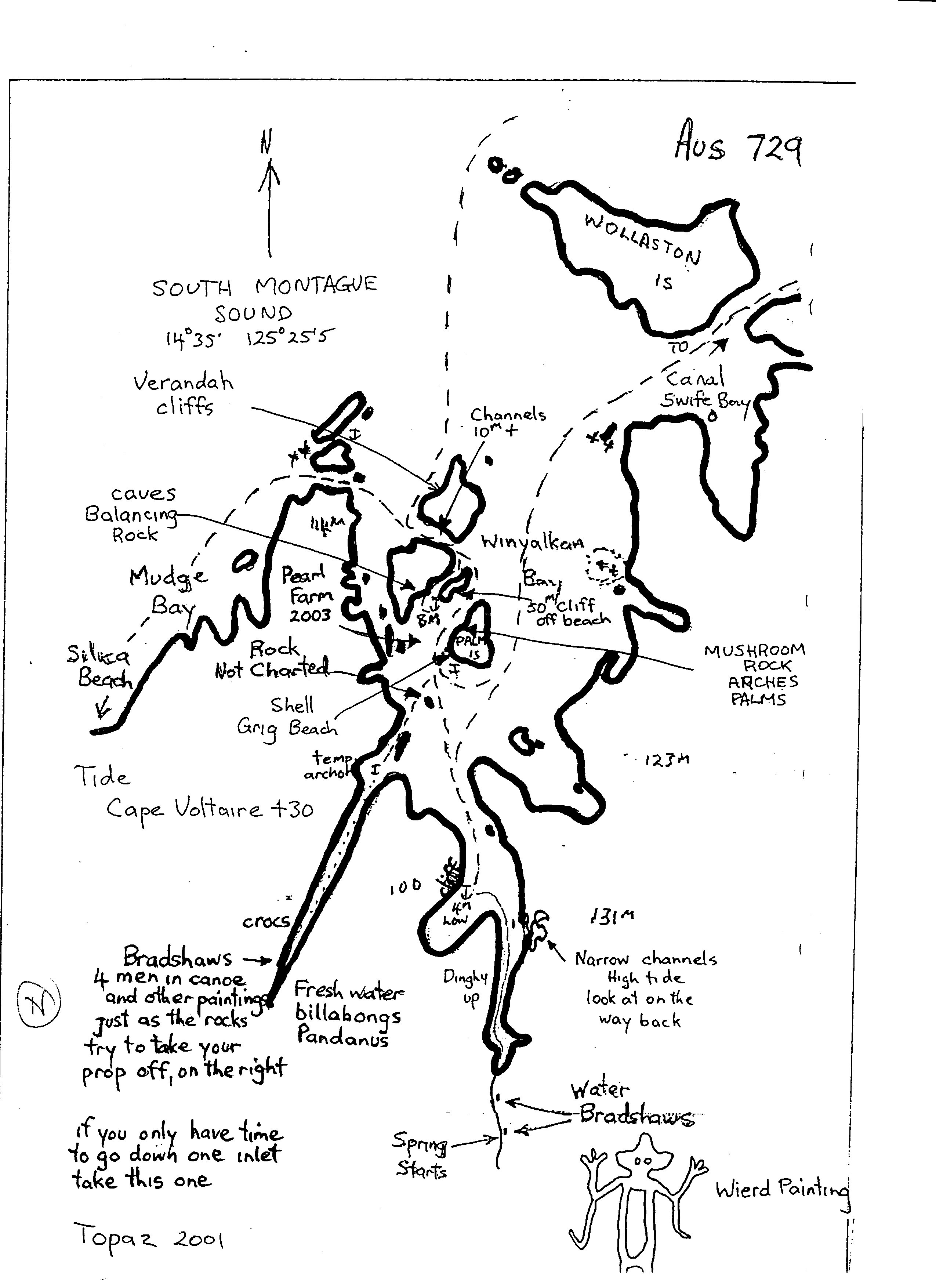
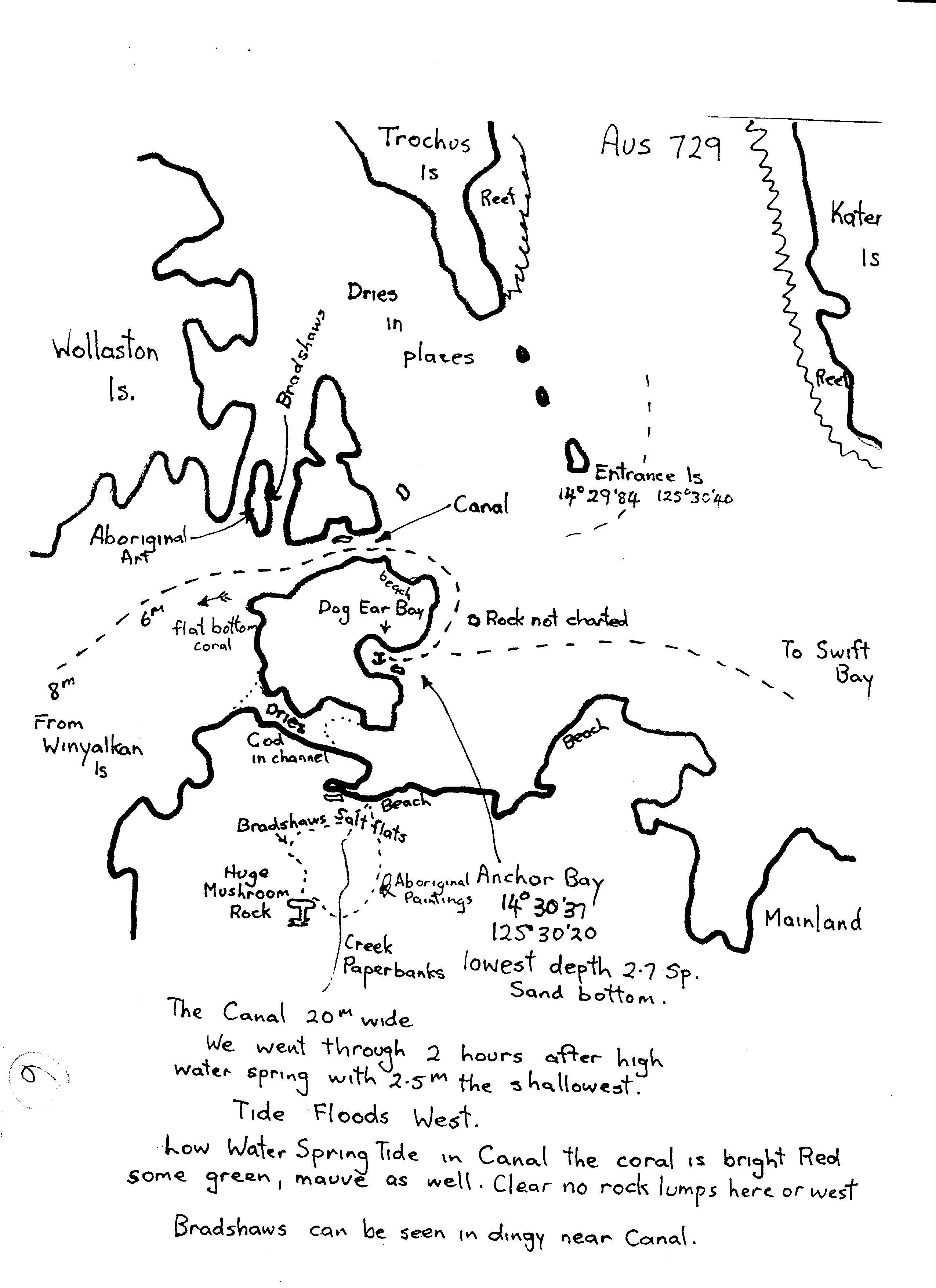
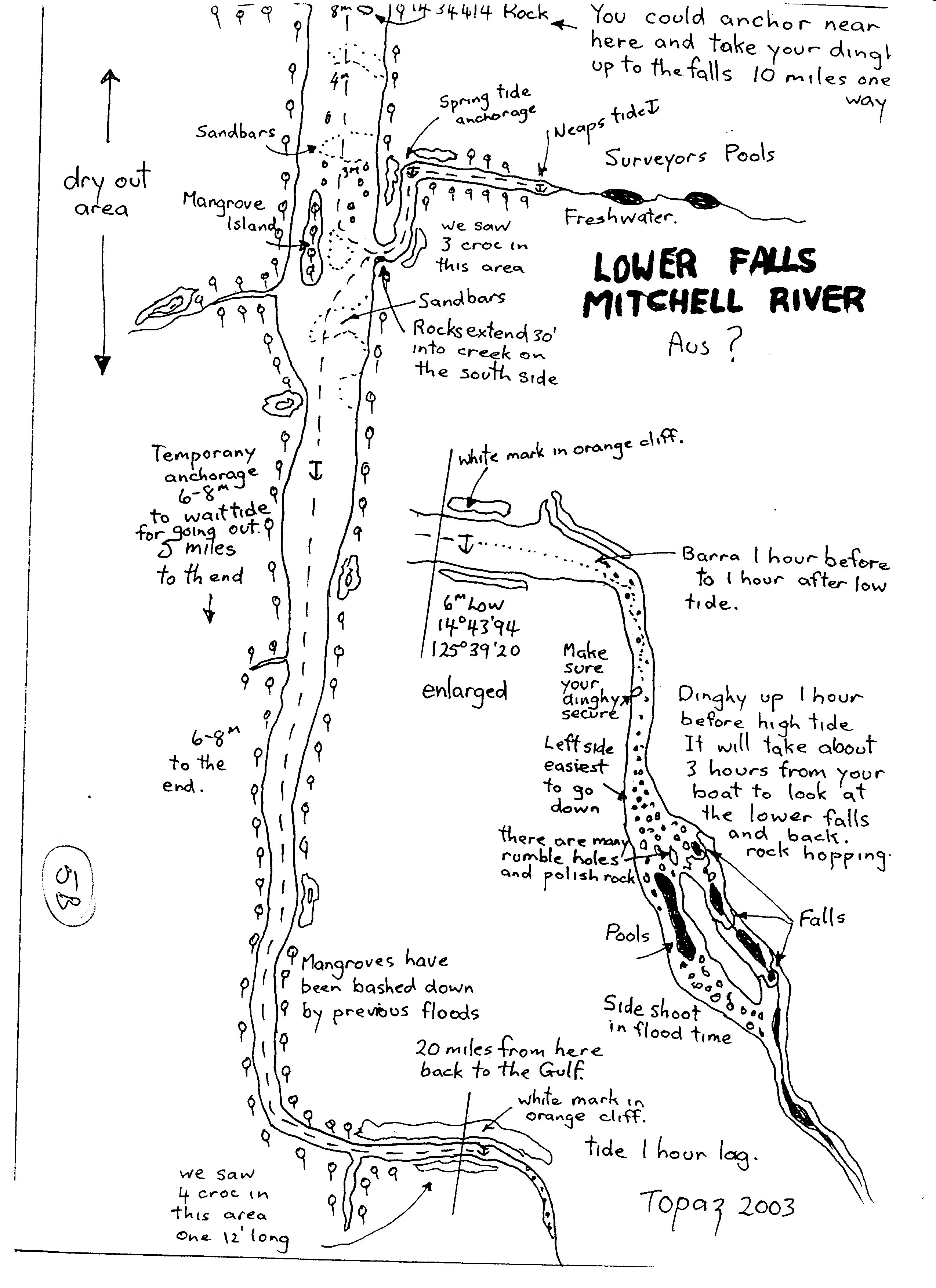
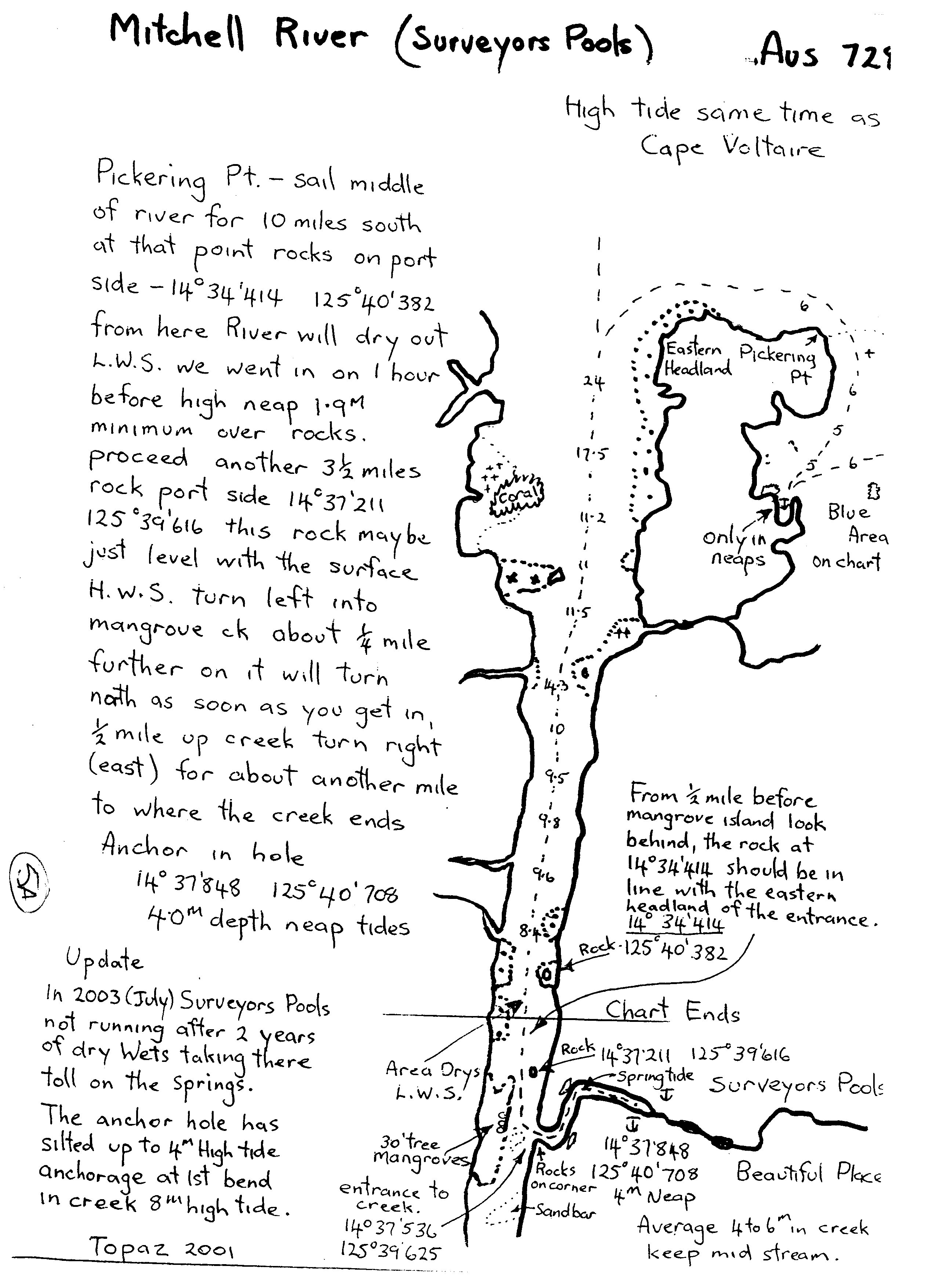
“Mud Maps” – A map drawn on the ground with a stick, or any other roughly drawn map.
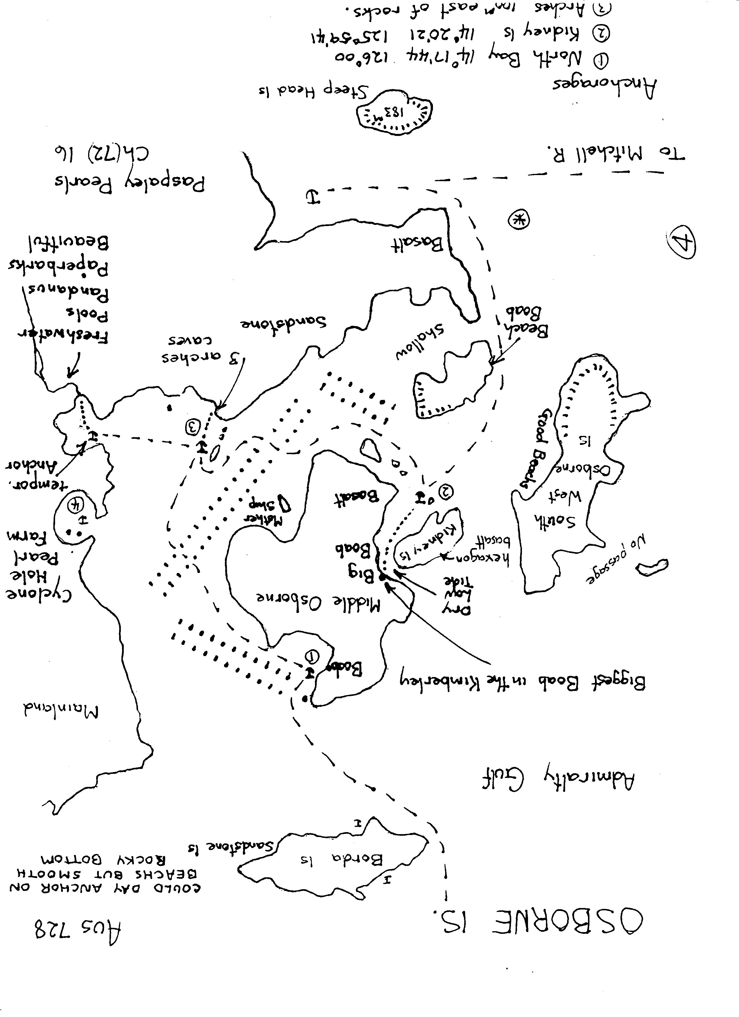
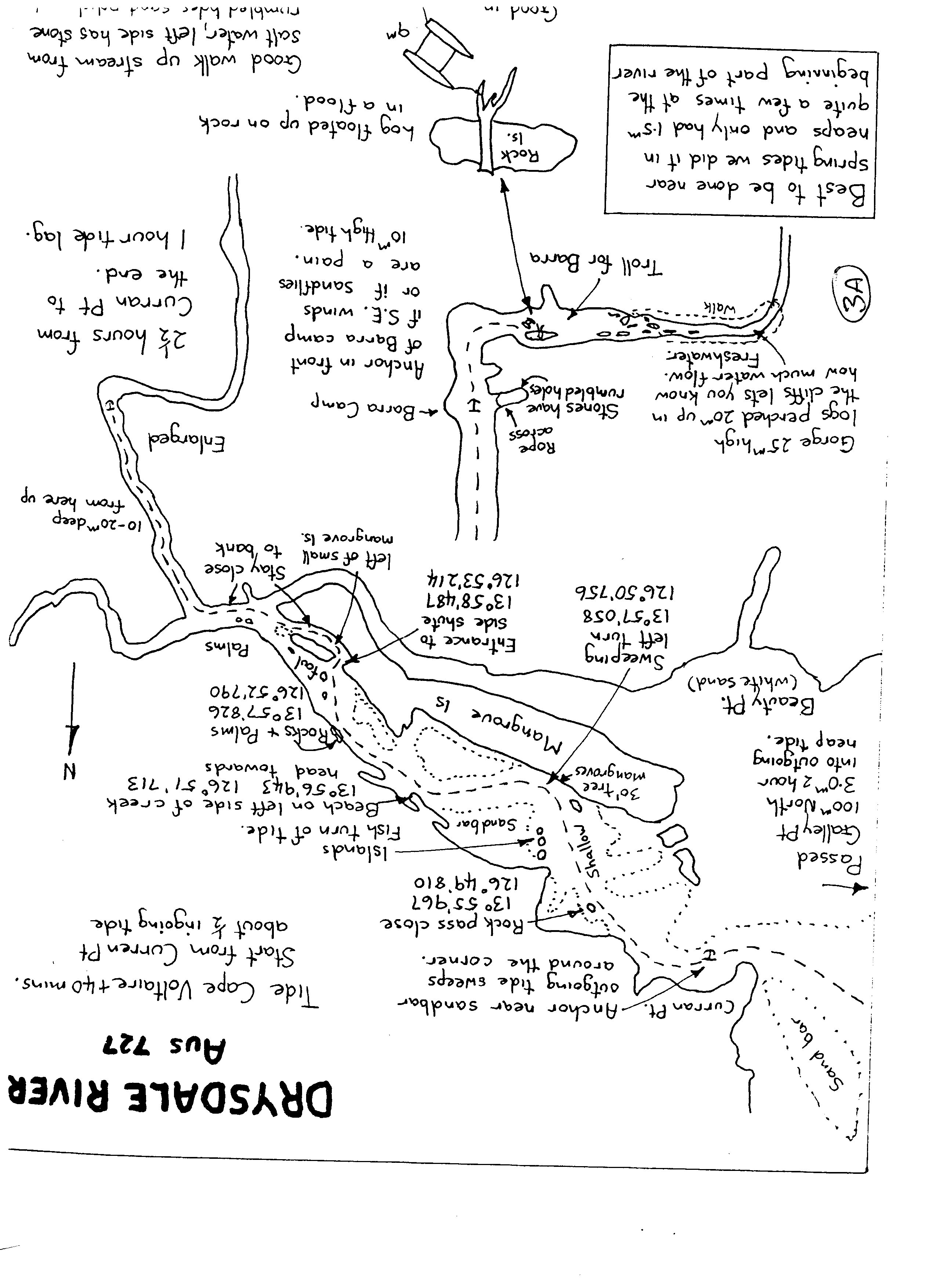
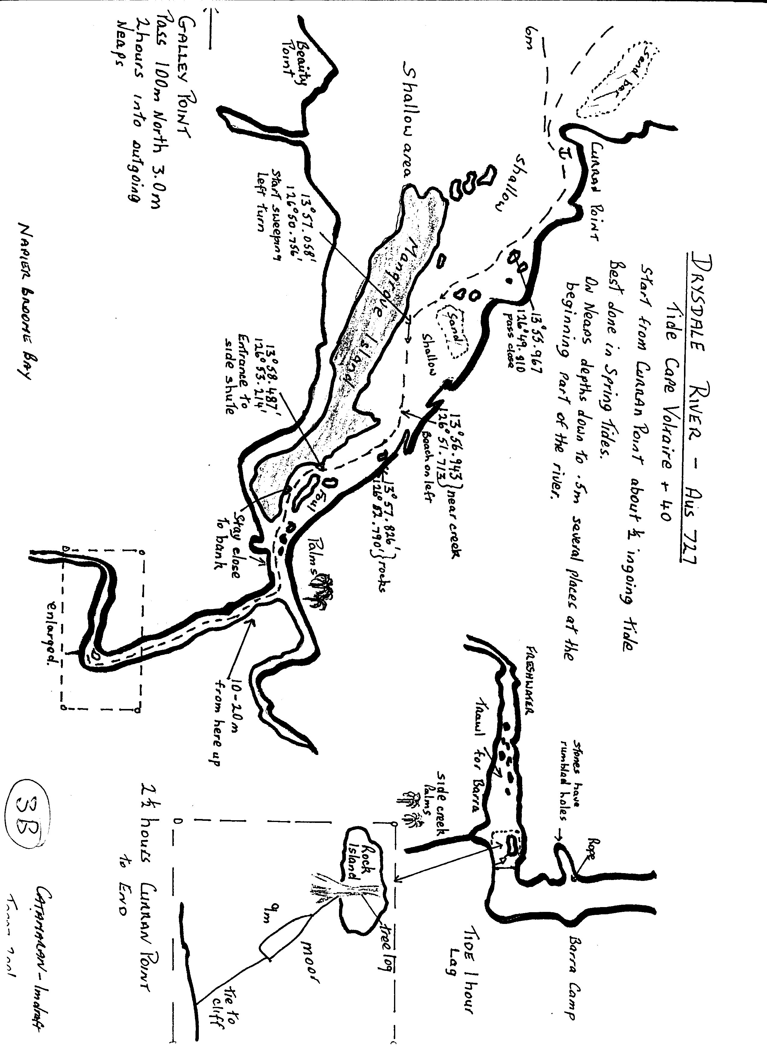
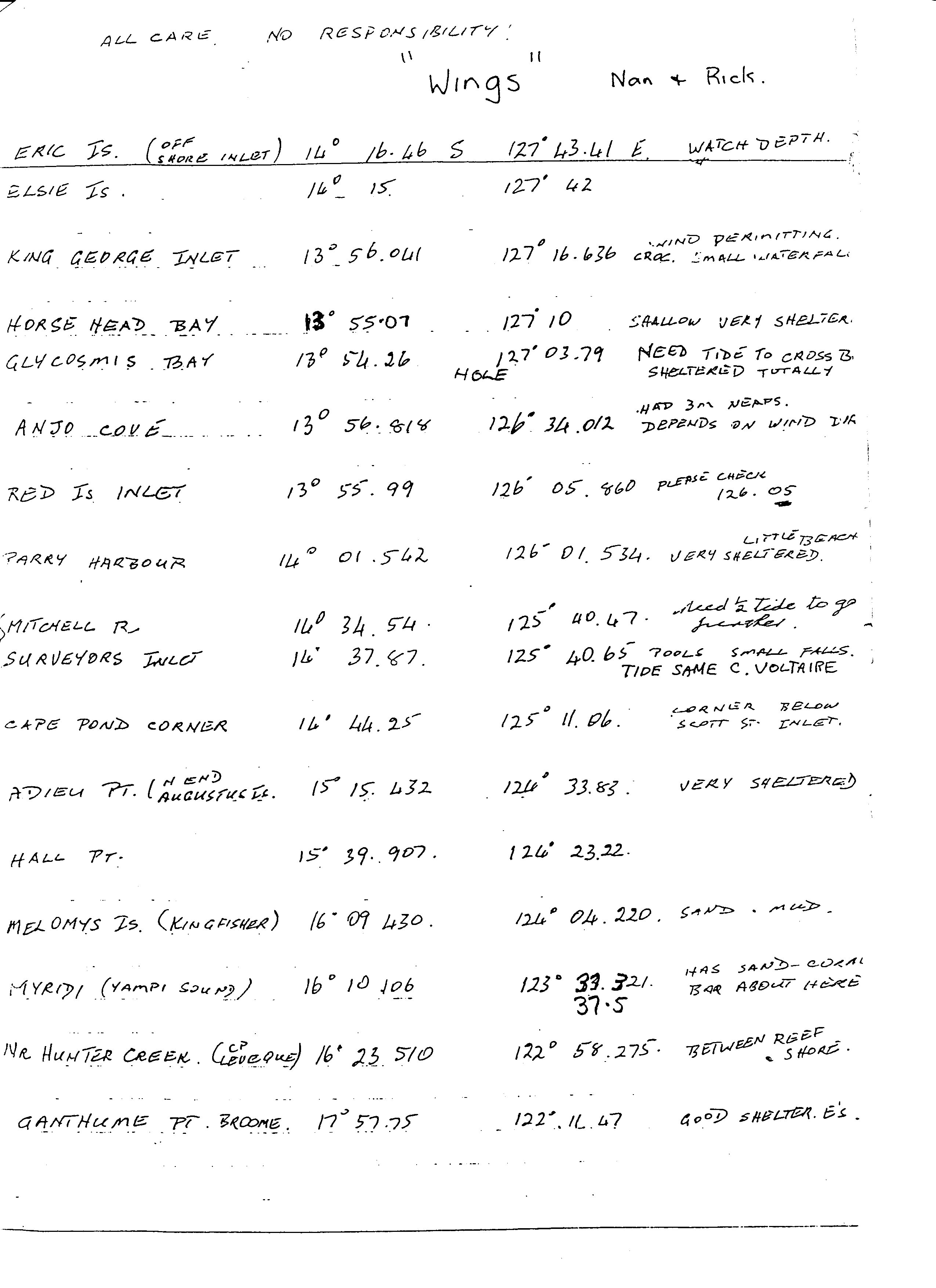
These are jpg images that can be printed on A4 paper, 24 sheets in the set. They show most of the Kimberly river entries based on work completed by the catamaran Topaz with 1 M draft, with added notes from Wings with Nan and Rick.
We used some of these in our journey through the Kimberley and found them invaluable.
BUT IT MUST BE NOTED that monsoonal rains in the Top End can alter rivers and their entries, so take these MUD MAPS as advisory only. Ultimately you are responsible for the safety of your ship and crew. These are dangerous waters no matter how many gadgets are on board or how many miles sailed.
There are FOUR LARGE files containing 6 mud maps each
MUD1.zip – MUD2.zip – MUD3.zip – MUD4.zip
OR individual files are available:
And a lover of mud maps, we’ve spent many years walking using these types of maps. Absolutely beautiful, Some of the ideas you’ve given us. I’d love to get in contact with you. Sounds like you’ve done some beautiful adventures. Regards John and Janine Ball Inverell New South Wales (Phone number removed for privacy)
Good morning
My yacht Josida, white Huon pine motor sailer, was sharing slip time with you at Kettering Tassie about 12 months ago.
Presently in Port Douglas waiting to go further north across Kimberley poss. Perth and back to Tas. for the summer.
Your mud maps should come in handy thanks.
Regards,David