Jack’s Birthday in The Washpool Ntl Park
June 12th – 19th 2003
Required topographic maps: Rockadooie, Coombadjha, Cangai, Glen Elgan.
Directions: Drive south Ballina to Grafton (2hrs), Then Gwydir Hwy to Wades Road (1hr)
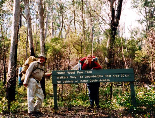
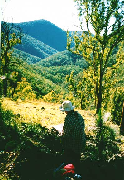
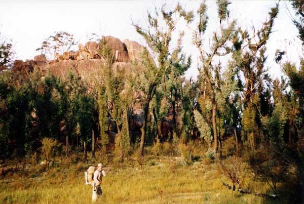
Here we are at the start of our six day walk. Jude looks very weighted down carrying the grub while Jack’s prodigious belly seems to be his greatest burden

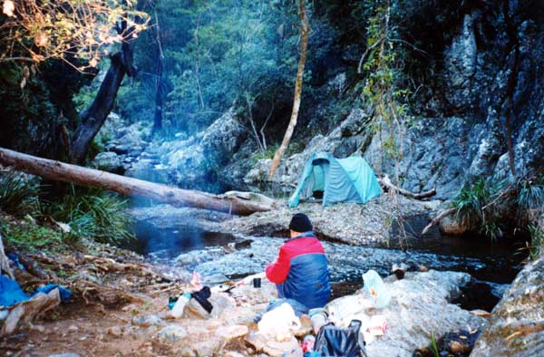
Night Three: Camp at the bottom of The Demon Fault
Pitched tent on sand island with access via fallen tree or a good leap!
Our exit was blocked by rock walls, so we left as we entered – – straight up!
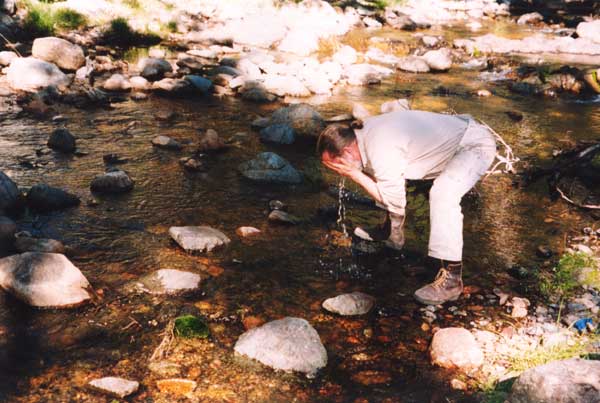
Wash Up ….. Cold & Crystal clear
See the lovely mosses, the photo did not capture their lush vibrant color
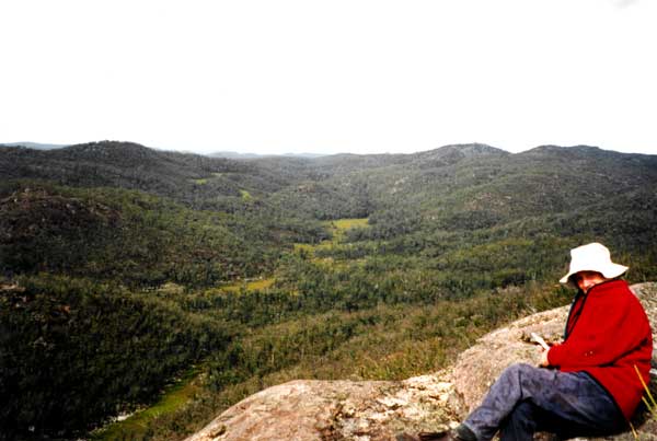
On Top of The Haystack, looking South
This is the headwaters of Boundary Creek.
The light green are swamps;
Eons of collected peat over a hard granite base.

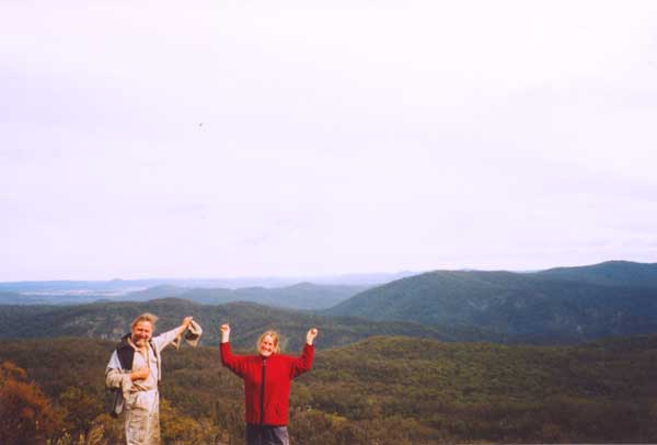
A last Hurrah looking over the wilderness we had experienced for a week
We trek the Washpool Wilderness because it contains an outstanding variety of topographic features, including: a section of the Great Escarpment and part of the Gibraltar Range with the deeply incised valley of the Rocky (Timbarra) River; and part of the New England Tableland.
Within this area, The Demon Fault Line scars a great expanse of forested ridges in a north-south direction from Ebor to Tenterfield, nearly 200 km in length bisecting the wilderness with descents generally between 400 and 1,500 metres.
Click here for more
information on the geology, vegetation and animals.
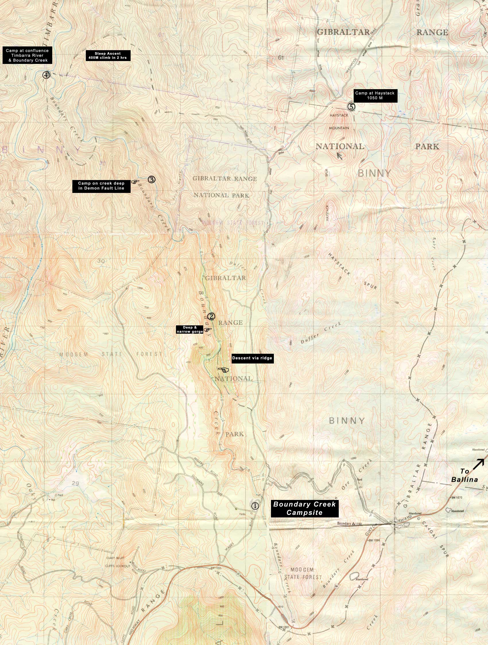
Locate Demon Ridge on Map:
“Descent via Ridge” near Campsite 2
Jude identifies the ridge descending into Boundary Creek and the Demon Fault. Trees in “clothes” after recent forest fire ( coppice)

Duffer Falls
The purest water on the planet. Collected straight from high
altitude wetlands, it then tumbles down a 400 metre cascade.

Locate on Map:
“Duffer Falls” One km north of Campsite 2
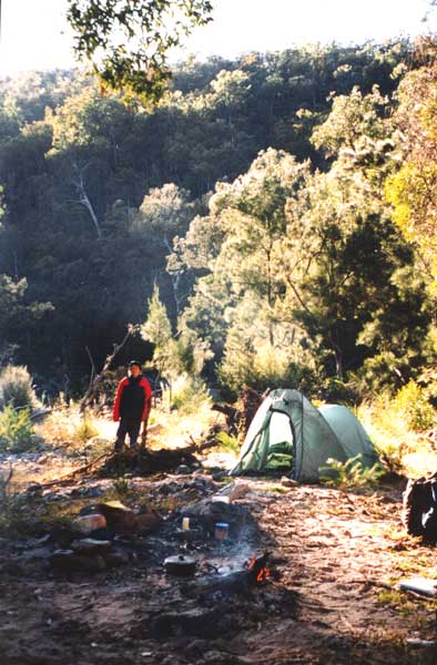
Nights Four & Five Camp at the confluence of Timbarra River & Boundary Creek.
We had a bitter white frost the first night and had to be terribly brave when we went out for a midnight wee!
But each dawn we were serenaded in our sacks by a multitude of bird song.
Locate camp on Map:
Campsite 4
“The Haystack”
A granite formation in the high altitude wetlands, 1150 metres at the top.
The day before, we had to climb 400 metres up from the confluence.
On top of The Haystack, looking North
In the distance is the Timbarra River Valley
reached via tramping down the ridge mid picture.