 The year is 1803 and we are on the newly settled island of Tasmania surrounded by a wild sea half a world away from law and order, and we have few soldiers and fewer free men. Sailing along our shores are the red, white, and blue ensigns of a French expedition, snooping for raw materials. In command, Captain Baudin has secret orders to locate a foothold in this new world. Miles away across a sometimes stormy strait, Governor King in Sydney hears a rumour and reacts boldly, ordering the establishment of another settlement, a precarious one with even fewer resources in a little explored part of this hostile island. Early in 1804, an aging Colonel, eager to add more credits to his illustrious name, steps ashore on the broad shores of a fast flowing river that has rich forestland rising each side. Thus begins the occupation of Tasmania’s North Coast.
 Tasmania has a cool temperate climate with four distinct seasons. Summer lasts from December to February when the average maximum sea temperature is 21°C (70°F) and inland areas around Launceston reach 24°C (75°F). Autumn; March to May experiences changeable weather. The winter months between June and August and are generally the wettest, coolest months. Tasmania’s more densely populated north coast is much drier than the western side, with annual rainfall ranging from 666 millimetres (26.2 in) in Launceston to 955 millimetres (37.6 in) in Burnie. Most rain falls in winter. In summer, the average rainfall can be as low as 31 millimetres (1.2 in) per month in Launceston.

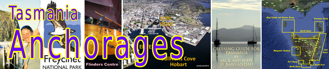
The Banyandah has sailed the north coast of Tasmania several times. We find the calm water a delightful respite from the Southern Ocean swell found further north, and the abundance of well-serviced protected harbours means day hopping is a treat. Let’s begin our exploration at the island’s far northeast corner closest to the Furneaux Group
All GPS positions are Approximate. Swan Island, Jetty Bay
40°44.13’S ~ 148°07.23’E
Shelter from NW through N to NE in 7 – 10 m sand with kelp.
A submerged rock in centre of bay ½ cable off beach.
Foster Inlet,
40°45.47’S ~ 147°57.19’E
Shelter NNW through N to S Weed with patches of sand in 3 – 7 m
Note: tidal streams attain 5 knots with overfalls in area.
Ruins on shore.
Waterhouse Island,
1/ Off Lighthouse
40°47.14’S ~ 147°38.66’E
Shelter SSW through W to NNW in 3 – 6 m sand

2/ Near houses
40°48.35’S ~ 147°38.24’E
Shelter SW through W to NNW in 3 – 6 m sand

Tamar River,
Slightly torturous, well marked channel, sometimes with fast currents, as well as encounters with large ships at anytime. Leads 127.7° T to first Port and Stbd buoys, then east cardinal mark on lattice beacons. Study chart, knowing what’s ahead will make it fun. We sailed all the way to George Town the last time.

1/ George Town
George Town, population approx 5000, is Australia’s third oldest settlement after Sydney and Hobart. European settlement can be traced back to 1804 when Lt Colonel William Paterson camped there after running his ship, ‘HMS Buffalo’ aground at York Cove. Ignoring the disaster, he ran up the flag, fired three shots in the air, and played the national anthem. A memorial stands at Windmill Point to honour his optimism.

Historic Low Head Lighthouse
The Maritime Museum at Low Head marks Australia’s oldest continuously used pilot station, founded 1804. Low Head Lighthouse was a simple flagstaff and fire in 1804, then the first structure was erected in 1833, which used sperm whale oil lamps. The present structure, built in 1888, is now completely automated with super bright LED lights, flashing 3 times every 30 seconds. It also has a type “G” diaphone foghorn that is fired up every Sunday at noon. It’s a terrific sound. Don’t miss it. Of interest in George Town is the Bass & Flinders Centre with a replica of the Norfolk and Tom Thumb. Numerous eateries, two pubs, Woolies, Super Cheep, and a library are nearby.

Private moorings lie in front of the George Town Yacht Club. Anchoring outside of them is in quite deep water with swirling currents round the cove.
The GTYC will rent their jetty short term. Contact the Commodore on (03) 63822827
York Cove Marina lies opposite the town where visitor berths can be hired.
Contact Callum (03) 63453333

2/ Beauty Point,
We found this a beautiful area, but with limited facilities in the town. The TYC marina is exposed to east winds that, if severe, can create damaging swell. Modifications were underway.
Free anchoring outside the established moorings is fine all the way south until slightly beyond Shag Head.

Tamar Yacht Club
Visiting yachts please phone ahead on 0418 321 339 to make a booking or if you arrive late, tie up to the public pontoon, adjacent to the marina. Distillate is available at near-by fuel berth for purchasing during working hours. Club Manager – Janette Elmore 0417 037 050
Port Dalrymple Yacht Club may be able to accommodate visiting yachts. (03) 6383 4110
3/ West Arm,
41°08.48’S ~ 146°47.72’E
Shelter from all winds, anchor in 3 – 6 m mud.
Follow leads into shallow bay then around Redbill Point. It’s a long row to Beauty Point.
Locals go in much further following north shore.
Port Sorell,
41°09.80’S ~ 146°33.66’E
Shelter from all winds. Anchor in 4 – 8 m sand.
Approach using white leads behind jetty on approx 185° T until abeam Penguin Island then follow Port and Stbd markers. Tidal range 3 m. Enter on rising tide, half tide or better depending on your draught. Local knowledge recommended.

Port Sorell, a quiet getaway close to some of the best natural wildlife viewing, was established in 1822 by Lieutenant-Governor William Sorell and was once the largest town on Tasmania’s north coast. The port traded in wattle bark, and thrived until it was outgrown by Devonport.
Devonport,
Mersey Yacht Club 41°11.41’S ~ 146°22.14’E
From sea, leads bear 204° T to enter break walls, proceed past city on west, ferry terminal on east, then find leads near highway bridge bearing 176° T. Just after the ferry terminal, red buoys mark a shoal, then a green buoy beyond marks middle shoal area. Many boats moor in this area. Take care as some are shallow draught. Proceed to Mersey Yacht Club on east bank.
 Cruising yachts are welcome at the Mersey Yacht Club. Either a berth or mooring can usually be arranged for a fee. Fuel and Fresh water are available. Slipping available. Bar facilities open everyday from 4pm.
Visitors berth up to 15m / $20.00 per night.
Moorings, if available, are cheaper.
Contact: Tel 0407 871 541 Email: myc1@iinet.net.au
FREE ANCHORING: Is difficult, near the bridge with tidal streams and poor shore access.
The city of Devonport, with a population of 25,000, is the homeport for the Spirit of Tasmania and the largest port on the north coast. All facilities are available. The main CBD is on the west side of the Mersey River and includes a pedestrian mall, cinema, speciality stores, chain stores, and Gateway Hotel plus a plethora of restaurants catering for all tastes. Quite near the yacht club is a hotel offering cheap tasty lunches. We recommend the Maritime Museum located in parkland near the mouth of the Mersey River, great walk to it. Contains an interesting collection of models, photographs, artefacts, paintings, and a local history collection.
Burnie,
There are no specific facilities for small craft at Burnie, and Banyandah has always sailed past. But cruising yachts may use the port for shelter, or for provisioning. Port Control should be contacted on Ch 16.
There is a Yacht Club. For more info. (03) 64315353 or burnie@tco.asn.au
Rocky Cape, Burgess Cove
40°51.81’S ~ 145°30.79’E
Shelter from S through W to NNW anchor in 5 – 8 m sand.
Pretty anchorage with bold rocky foreshore. No facilities.
Note: Rock awash 1 mile NE of cape
Stanley,
Harbour entrance 40°46.13’S ~ 145°18.09’E
Stanley is the last major township on the north-west coast of Tasmania. Located 127 km from Devonport and 231 km from Launceston, it is a historic town full of beautifully preserved buildings. As you approach, you see The Nut rising like a strange box above the bay. At the lookout, a plaque reads: “The Nut, discovered by Bass and Flinders in 1798, rises abruptly 143 m from the sea to a flattish top.” A geological survey has confirmed that The Nut is the stump of an old volcano.
 Stanley is the main fishing port on the north-west coast of Tasmania. In 1823, the English parliament granted 50,000 acres of land to the newly formed Van Diemen’s Land Company, to open up the unexplored lands of the north-west. The company made its headquarters at Stanley and today still farms large holdings at Woolnorth.
 Stanley Boat Harbour entrance, although short, is quite narrow and can be difficult to enter in strong east or southeast conditions. Be aware of a possible tidal cross current. Once inside, tie alongside the main jetty or better still, seek permission to tie alongside another vessel as Stanley has a very large tidal range, reaching up to 4 m. A fishing boat berth may be available, best to enquire with the Harbour Master. Water is available along the main jetty and fuel available from Fishing Co-op.
Climb the Nut:
Don’t be fooled, it is steep, but not a difficult walk for the fit. Another option is to take the Stanley Chairlift. Pack a picnic, the views are extraordinary. The walk is free.

Jude loving the view of the Nut
Explore the town:
St James Presbyterian Church; An early example of a prefabricated church imported from England. Plough Inn; a pub until 1876 when the license lapsed, later it became a dispensary then a branch of the National Bank of Tasmania. Laughton House; is a fully restored Edwardian house in Alexander Street built in 1906. Lyons Cottage; Church Street, is where the honourable J. A. Lyons was born in 1879, the first Taswegian Prime Minister of Australia (1932-39). The Stanley Cemetery commands a picturesque view to the Hunter Group. Great fish ‘n chip shop on walk to town.
 Smithton,
Yellow Pillar Buoy 40°47.05’S ~ 145°07.13’E
Entrance to Duck Bay; Yellow Pillar Buoy marks inside of bar and should be passed on a half tide or better, rising. Leads passed Eagle Point 195° T – shifted to suit sand banks. Local knowledge recommended.
Anchor just inside bar opposite Eagle Point, 40°47.87’S ~ 145°06.21’E Good in all winds.
The channel up to Smithton is well marked, but dries in places. A high tide will be required to reach the town. Berth alongside, usual town facilities within walking distance. Active fishing port. Smithton radio Ch 16; 0600 – 1830 -7 days
© 2018 JACKandJUDE.com