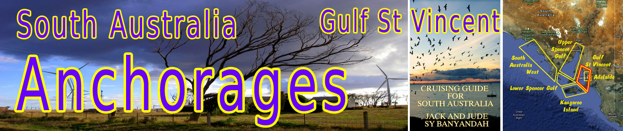

The Gulf St Vincent is a large inlet in South Australia bordered by Yorke Peninsula to its west and the Fleurieu Peninsula on its east side, with Adelaide, the South Australian capital, midway along the gulf’s east coast.

When explored by Matthew Flinders in March 1802, he named it, “In honour of the noble admiral who presided at the Board of Admiralty when I sailed from England … I named this new inlet, the Gulf of St Vincent. To the peninsula which separates it from Spencer’s Gulf, I have affixed the name of Yorke’s Peninsula, in honour of the Right Honourable Charles Philip Yorke.”
Other towns on the gulf’s shores include Edithburgh, Stansbury, Port Vincent, Ardrossan, Port Wakefield, and Normanville. Straddling its opening to the Southern Ocean lies Kangaroo Island.
The east coast of Gulf St Vincent
Regard all GPS locations as approximate.
South of Adelaide, it is open roadstead, which in summer may be fine overnight. Adelaide yachts often take the off-the-land night breeze to sail to Kangaroo Island, a distance of about 70 nm. Or they may choose to spend the night at Second Valley or Marina St Vincent at Wirrina.

Marina St Vincent at Wirrina
Marina St Vincent at Wirrina
35°29.90’S ~ 138°14.36’E
Shelter from all winds in a man-made harbour just a day sail south of Adelaide. Strong SW gales can set up a surge, but in all other conditions, it is perfectly safe. There are NO facilities nearby. A bus to Adelaide passes once a day, takes an hour and half, costs $20, and can be boarded after very long walk up to the highway. Weekly rates in a modern floating marina with security gates vary from $100 for a 10m berth to $140 for a 14m. Overnight is something like $50.
Contact Mark Richards 0488 154 540 or info@marinastvincent.com.au
Second Valley
35°30.57’S ~ 138°13.12’E
Shelter from NE through E to S in 6 m sand
Very pleasant roadstead anchorage just south of Wirrina. Probably no good in winter (swell).
There are NO Facilities.
Rapid Bay – south from Second Valley, can experience strong offshore gusts down the valley.
The west coast of Gulf St Vincent
Prior to European settlement, the whole of the Yorke Peninsula (which was always marginal land) was inhabited by the Naranga Aborigines. It is estimated there were about 500 in the 1840s, but their numbers had been reduced to a mere 40 by 1880. They lived on a diet of oysters and fish supplemented by the kangaroos, which abounded on the peninsula.
The first settler in the district was Alfred Weaver who brought 7,000 sheep with him. He was constantly confronted with problems in terms of disease, reliability of water and the penchant of the Aborigines to kill the sheep whenever they needed meat. Alfred Weaver built a shearing shed where Stansbury now stands.
Black Point (Port Alfred on some charts)
34°36.47’S ~ 137°53.82’E
Shelter from ESE through S to WNW in a bay open to the north.
Poor holding, thin sand over limestone with weed.
Black Point has a crescent shaped sandy beach lined with shacks and holiday homes. Care needed when landing in an inflatable as the beach has many razor clams around the low water mark. There is a sand spit running NE from the point, the extremity of which is marked with an unlit black pole at approximate position 34°36.09’S ~ 137°55.56’E. It needs to given a wide berth as it can prove difficult to see from a distance when approaching in sunny afternoon conditions.
Facilities: None, just a peaceful sandy beach.
 Port Vincent
34°46.25’S ~ 137°51.78’E
Shelter from ESE through S to NW in about 3 m, poor holding in thin sand over limestone with weed.
There are many moorings available. The RSAYS has two moorings marked by red and yellow buoys at approx:
34°46.43’S ~ 137°51.74’E
34°46.38’S ~ 137°51.75’E
Marina:
Entrance at: 34°45.97’S ~ 137°51.93’E
Facilities: New modern facility. Excellent shelter from all directions. Popular destination for Adelaide vessels. Visitors welcome. Amenities building, fully equipped laundry, secure berths, picnic and bbq facilities. 15 minute walk to the town. The supermarket will deliver supplies and the Ventnor Hotel will pick you up and drop you back (Tel 08 885 37036). Both Optus and Telstra mobiles work in the basin.
For more info and bookings call Rob Marner: 0414 611 110
Attractions: Port Vincent looks similar to Stansbury with a 2 nm long sand spit heading NE from the town. Unlit beacon marks its outer end, hard to see in afternoon sun. Our mate Bosun John says you can stroll in the shallows to rake for blue swimmer crabs, dive for scallops just off-shore, or throw out a line for mullet, salmon, flathead, bream, garfish, whiting or squid.

Stansbury
Stansbury
Moorings at 34°54.00’S ~ 137°47.97’E
Shelter from ESE through S to NW in 3 m sand covered limestone with extensive ribbon weed patches.
About 35 nm west across the gulf opposite Adelaide is a quiet place fronting Oyster Bay that has a 3 nm long sand spit ensuring calm water. Anchor north of the jetty. Holding however, is mostly poor. There are quite a few private moorings in this area and three new RSAYS moorings, marked with red and yellow. We used one of these overnight.
NOTE: Be sure to find the lit mark at the tip of the sand spit, somewhere near, 34°52.72’S ~ 137°50.88’E and give it a wide berth to the north.
Facilities and Things to see:
Majestic stands of Norfolk Pines are one of the defining characteristics of Stansbury (population 550). Stansbury has a caravan park, fuel (petrol and diesel), groceries, and the Dalrymple Hotel, established in 1875.
Stansbury Museum in Dalrymple House, which was completed in 1878, was originally the old school house, but is now a folk museum with the original schoolrooms containing lots of interesting educational memorabilia. Opens Wed & Sun 2pm to 4pm or by appointment Tel: (08) 8852 4231 – 0408 142 875
Admission $2
The original Stansbury jetty was built in 1877. Its replacement, sited in deeper water, was built in 1905, when the port was alive with workers moving grain from the surrounding farms onto clipper ships.
Edithburgh
Mooring at 35°05.80’S ~ 137°44.93’E
Shelter from SSE through S to NW in 3 m soft mud with extensive ribbon weed patches. Poor holding.

Careful – No teeth – But plenty of INK!
Edithburgh, near the southern tip of the Yorke Peninsula, has about the same population as Stansbury, 20 nm north. It is 233 km west of Adelaide via the Princes Highway and 255 km south of Port Pirie, and is one of the major holiday destinations on the Yorke Peninsula. Popular belief is that wind is made there and a huge wind farm announces Edithburgh’s position from 10 miles out.
History: Matthew Flinders, the first European to explore the area, named Troubridge Shoal. The area was later surveyed in 1869, and named after Lady Edith Fergusson, the daughter of the Governor-General of India and wife of the South Australian governor at that time. After that survey, people began to buy farming land in the area and Edithburgh started to prosper as a major supplier of salt from saltpans that lay inland from the town. This industry peaked in the late 1920s when up to 24,000 tonnes of salt was exported every year and the town’s population peaked at around 1,000.
Anchorage: To find the anchorage, head south past the town and its main jetty, then pass the boat ramp and its breakwater, and into a blind channel taking care to avoid the eastern shoals. Watch your depth. It shoals the further south, closer to Sultana Point, which is better shelter from SE winds. The holding, soft mud and weed, is not good. But there are a number of moorings on the shore side of the blind channel, laid for RSAYS members and others by the CYCSA. On several separate occasions we have borrowed one for a few nights midweek at 35°05.80’S ~ 137°44.93’E. Almost every time withstanding a feisty westerly gale with no problems. We were polite and posted our mobile number conspicuously whenever we left our vessel.

Facilities/Attractions: Reasonable range of facilities – hotel, fuel, supermarket, restaurants, although these are quite a walk from the fisherman’s jetty or boat ramp. We often enjoy a 3-course hot lunch for under $10 in the town’s pubs. Substantial number of impressive historic buildings and the wind farm provide plenty of photo opportunities in Edithburgh.
Fishing: We enjoyed great fishing from the wharf where we joked and caroused with the regulars before finding that squid loved chasing our jig in the tape weed around our anchorage. The snorkeling in the Troubridge Shoals proved exciting although we spent a fair time looking over our shoulders for white pointers.

Storm approaching Wind Farm

Troubridge Lighthouse
The Troubridge Island Lighthouse, about 5 nm from the Edithburgh anchorage, was the second lighthouse built in South Australia, the first being Cape Willoughby on Kangaroo Island. Opened in 1856, the Troubridge lighthouse still did not prevent shipping accidents in the area. Over the years, the town has experienced a number of shipwrecks. None more devastating than the Clan Ranald that sank off Troubridge Hill with the loss of 40 lives, some buried in the town’s cemetery. In the late 1970s, it was decided to build a new lighthouse on Troubridge Hill, which was completed in 1980. Two years later the island and lighthouse was sold to the South Australian Government who wished to create a bird sanctuary, and the light was extinguished in March 2002, replaced by a beacon on Marion Reef. Ironically, this was the very same month that Australia Post honoured the light with a postage stamp. Troubridge lighthouse is very much under threat. Erosion has now reached the base of the lighthouse, and winter seas threaten its foundations.

Anchorage:
35°07.01’S ~ 137°50.05’E on the eastern side directly off the lighthouse, good only in calms or westerly winds.
35°07.23’S ~ 137°49.13’E Inside the shoals further from the lighthouse, The Cutter Patch provides protection from N through E to SE in 3 m over sand.
Sultana Passage – west from Edithburgh
It is a long 11 nm diversion around Troubridge Shoals, and unless a visit to the lighthouse is planned, there is a passage through the shoals only 4 nm long, called Sultana Passage. The falling tide generally sets south through the well-marked channel, but beware of a set across the channel. Strong south winds can make the southern exit a bit dangerous and scary amongst the shallow patches.
 If approaching from the west, finding the southern entrance requires good eyes and an accurate GPS. This southern entrance is marked by a green lateral mark, cone point up, which is right amongst the shoals. Having said this, we have safely used this passage many times and found it once in pea soup mist, albeit motoring with no wind.
Next >> Spencer Gulf
What keel depth woud you recommend for a 36 or 42 ft Irwin Ketch we plan to buy for easy anchoring in the St. Vincent Gulf. We like secluded (private) overnight anchorages. Irwin builds 4ft deep keels but with 3 ft extensions. Problem is that barnicles grow in between when not used. A six ft keel is an option (better sailing, closer to wind) but more difficut to get near land and/or anchorage. How do the tides here effect these different sizes of keels? What would you recommend. Thank you. Gerrit
Hello Gerrit
If you’re talking about a vessel primarily for the Gulfs of South Australia and you like seclusion then you have no choice but to take the shallower draft and control the fouling problem. There are too many shallow waterways in the gulfs, where dragging around six foot limits where you’re comfortable. Trailer sailers are popular. Tow them to your favorite spot and launch. Nevertheless, we drag our lovely six foot through those waters and do heaps, but being shallower would let us do more. So unless there’s a longer term plan that would benifit from a six foot depth. Hope that helps
Hi
We’ve got a Catalina 42 with the deep keel (design says 6 ft 8″) but fully laden with fuel & water & anchor/chain etc) she’s closer to 7ft that we sail in the Gulfs here
Just means we have to anchor a little further out and can’t go up the creeks etc but that’s what dinghys & tinnies & possibly trailer sailed are for.
Depends what you want to do though … ours is Ocean going … has been across the Pacific (original owners) but I bought and sailed her back from New Zealand which she handled with ease)
Cheers
Hi Jeff, always a good to have a good grip of the seas, especially high latitude sailing – And it can get pretty ferocious around South Australia as I’m sure you’ve found. Cheers, Jack