
Busy as Wombats Preparing for Winter
In this issue:
Fish Farm Trash – Gordon River – Sir John Falls – Strahan for Victuals – Brisbane Bay
Micro-plastic Pollution – Back to The Office – Sir John Falls Hut Restoration – HELP NEEDED
Since last report, Jack and Jude have travelled around Macquarie Harbour and to the far reaches of the lower Gordon River on fact finding missions, as well as a bit of track maintenance and to search for new destinations. In all we’ve been out of touch for most of the last thirty days.

Our Office
Both Well
Both of us are well with no complaints, and no injuries sustained even though a lot of our time has been pushing through the deep thick stuff and tramping through wet wilderness on rugged tracks.
Leaving Strahan directly after posting our last blog, we romped down harbour on a perfect Northerly wind, pulling in for a stint at our office in Farm Cove where we got busy editing our next book, “Around the World in Every Increasing Circles“,a whopper now nearly 500 pages long.
Fish Farm Trash
Disturbing news was found on 28 March upon crossing the narrow neck to inspect the harbour-side beach for trash, and even though the companies have assured us that they would smarten up their “culture”, we still found trash strewn along the shore and in amongst the vegetation. Bits of plastic farm ropes, many if not all in a state of disintegration, are turning into millions of tiny filaments that will quickly sun rot to become micro-plastics. We have made another video of our findings voicing our concern that these micro-plastics are re-entering the pristine waterway where the fish are raised, and thus, quite possibly they might be polluting the fish with plastic. It’s got to be stopped. Pollution for profit is an unconscionable way to make a buck.


Gordon River
By Saturday March 30, our writer’s cap had withered, and it was time for an adventure instead of writing about them. So we moseyed up river to great views of distant ranges and anchored next to the Sulphide Pool near Snag Point where galaxies of stars bounced off the still water of the Gordon River. Both the Sulphide Pool and Lake Fidler a little further downstream are rare examples of meromictic bodies of water stratified into narrow layers of fresh overlying an anoxic salt water layer that do not intermix.
 Great views of distant ranges, anchored next to the Sulphide Pool


Sir John Falls

Sir John Falls
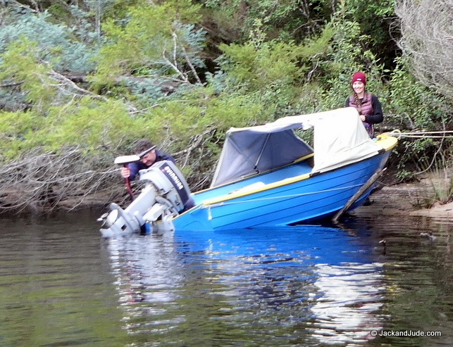
We reached the jetty at Sir John Falls late the next day, the weather gusty and drizzling. Our look at the falls bursting into the tight pool surrounded by lush green laurels and moss covered rocks indicated just how much rain had recently fallen. No worry for us, Banyandah sports a massive rain awning that nicely handles Tasmania’s west coast wet weather. But not so for the pair that called out to us late that night, for them the inclement weather had been challenging, if not downright dangerous.
A father and daughter, on a tight time schedule, had braved the open waters of Macquarie Harbour in an open 12-foot tinny, and unfortunately but understandably swamped before getting halfway down its twenty mile length. Quick life or death action saved their lives, but instead of turning back, they baled the tinny next to an island then came on, all the way to Sir John Falls, where soaking wet they knocked on our hull in search of the hut.
While we admire gutsy action, we’re more inclined to encourage well thought out challenges rather than events that can result in a rescue by third parties. These two were ever so grateful for our assistance, and returned next morning for more advice, and a few spares to take with them on their quest to visit the Franklin River that requires negotiating several rocky sets of rapids.
Not appropriate for Macquarie Harbour
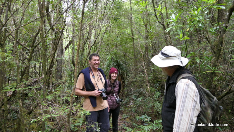
They departed promising to take extra care, and we too went on our quest to examine the partially cleared Goulds track. Documented by Parks as the Sir John Falls to Angles Cliff track, historically it was the way to the west from the developed east from 1862, and still in daily use until the area was declared World Heritage in December 1982. Tree fall had blocked the first kilometre and a half through what is a spectacular wet rainforest of many rare species that make Tasmania renown for natural beauty. These last five summers, Jack and Jude, using only their hands, have cleared this track so that today grammar school children kayaking with their guides, as well as yachties and other visitors can safely behold the natural wonder of this unique part of planet Earth. We had planned spending the next two days walking along the once timber-getters shoe-road, where we move aside small fallen branches to ensure visitors would feel safe and comfortable in such a hostile environment. It is our hope to win Parks’ approval to establish signage near notable specie, as the most common questions asked are, where’s a “Huon Pine” or what tree is that?
Goulds Track, Documented by Parks as Sir John Falls to Angles Cliff track, from 1862, the way west from developed east
On our way back home that first day, we met the father and daughter who had followed our instructions to the letter and who’d had a marvellous adventure that took them safely around Big Eddy rapids, up Franklin Reach then into the Franklin River to Veranda Cliffs. On their return, they even managed to follow our guidance to find the start of the Goulds Track where their loud exclamations first alerted us to their nearby presence. First Question: What does a Huon Pine look like was answered by Jude pointing to one growing at their feet.
They had just one day remaining before needing to be heading home, and as the weather was still foul, they took our advice to play it safe, and caught the day ferry back from Heritage Landing.

Lea Tree Two thousand year old Huon Pine nine feet across

copper plaque celebrating saving the forest
While they were safely reaching Strahan, we moved Banyandah across from Sir John Falls to Warners Landing where Hydro had their construction base for the Gordon below Franklin Dam, which was stopped by the Hawk government in 1982. Near what remains of their staging area, now mostly overgrown with saplings and stunted tea tree, is a Perched Lake formed when organic matter such as leaves, bark, and dead plants, gradually builds up and hardens in depressions that are higher than the river. No longer maintained, the drains around the area are becoming clogged and the main access can be boggy. So we tagged a dry access route around that mess with bright red tapes, and then found what remains of the old Parks track through to the lake, marking a way through a mostly open area encumbered by wet spots and small vegetation. Nearby stands the Lea Tree, where dam protestors are known to have held meetings to plan their next activity.
 It took a few hours searching for the Huon Pine tree some 9 feet in diameter, a sufficiently prominent landmark to have acquired the name – Lea Tree. It’s so big, three men, all over six feet tall, found that they were unable to link arms around the trunk, and the tree so old that it had been left by convict cutters of the 1820s as no use for boat building. Given its size, it was quite likely more than 2,000 years old.
After the decision to save this area from flooding by building a new dam, on the night of 5 July, 1983, the tree was chain-sawed and holes were drilled into it, then oil poured into the holes, then the tree was set alight. The fire continued for at least twenty-four hours.
Allegations that Hydro personnel were responsible for the incident are supported by photographs of HEC workers in front of anti-conservationist messages in front of the charred tree.
Back to Strahan for victuals and a cuppa
Away in the wilderness for two weeks, a strong south wind tempted us back to Strahan at breakneck speed, where once back on the mooring we quickly re-provisioned, posted mail and collected a pair of lovely warm Ugg boots for Jude. It’s always nice to see friends and share news over a cuppa, but then a patch of sunny weather came and we high-tailed off for Swan Basin to walk across to Ocean Beach then back through the pine forest. What a battle it was getting back aboard, paddling against a fierce north wind which had come up, but once aboard we used it to advantage and were whisked down harbour for another stint of writing at our office under the might of Mount Sorrel. Our next book, “Around the World in Ever Increasing Circles” is entering its final stage surrounded by peaceful beauty without any interference from the outside world, so that we can completely immerse ourselves in faraway adventures of yesteryear when our sons were coming into manhood aboard a yacht sailing vast oceans around the world.
- Ocean Beach access from Swain Basin 4WD track


Recording these memories, just Jude and I, enclosed within the familiar confines of a vessel we homebuilt and then sailed since the early seventies, is a wonderful treat that is bonding us even tighter as we are replayed in words.our trials and achievements.
Brisbane Bay
 It rained for several days, perfect to stay below, but when that system passed leaving a dead calm on 19 April, we shifted to investigate the shores of Brisbane Bay, where we’d found much “Gunge” a couple of years ago. This bio-fouling, not modelled in the EIS, clogs the fish farm nets, restricting water flow so they clear it by water blasting. Of course, that sends the macro-algae on its way around the harbour where it either reattaches itself in a new colony, or is washed up where it suffocates the shore plants and reeds. Fish farm management says they’ve changed to a suck-off vacuum process, but while they may have, we’ve heard the bio-fouling is still discharged out the back of the pump into Macquarie Harbour. Being late in the season with water temperature getting on the cool side for macro-algae to form, we still found enough on the shore to dismay us in the form of plastic ropes tangled in the undergrowth. After reading alarming reports of microplastic pollution in oceans and on beaches, the global scientific community intensified its focus into this area. Researchers have since found evidence of microplastic contamination everywhere—in our lakes and rivers, beverages and food supplies.
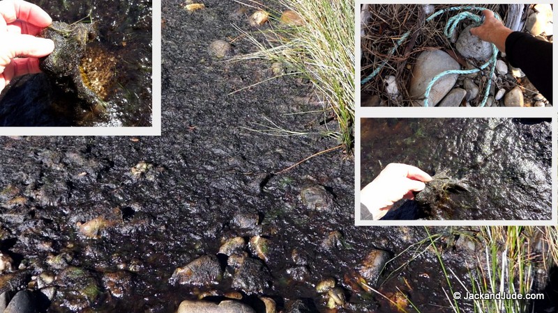
Macro-algae grows on farm nets and is released into Harbour during net cleaning
Microplastic Pollution
 Why do we need to be worried about microplastic pollution? Actually, it’s not yet totally clear just how dangerous microplastics are for living organisms. What is known: aquatic organisms and other species, including humans, can absorb microplastic particles. But that alone doesn’t prove toxicity. However, it has also been ascertained that smaller-sized particles might have the ability to be absorbed in certain types of body tissue in aquatic organisms.
Each year, humans produce around four hundred million tons of plastic worldwide. A significant proportion of this plastic ends up in the environment as litter. Plastic waste that makes its way into the environment can break down due to the photodegradative effect, where UV light from the sun provides the energy for oxygen atoms to incorporate into the polymer of the plastic, and from wind and waves. The plastic then becomes brittle and breaks into smaller pieces. Animals often ingest the tiny pieces of plastic and it can build up in their stomachs. Tiny pieces of plastic have been detected in sea creatures that humans like to eat such as fish, shrimp, mussels, and oysters. (Smithsonian)
The result? Over the next few decades, we will probably be facing a massive increase in the amount of microplastic pollution in the environment. We all know that even inert and non-toxic substances can have unforeseen effects once they reach a certain level of concentration in the environment and our bodies.
Back to the office
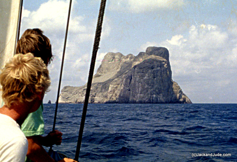
Malpelo rising from great depths
We drifted away to the Caribbean, and then to climbing Malpelo, the monolith rising out deep ocean, two hundred miles into the Pacific off Colombia. We were busy until the next run of sunshine when we took to the bush on the route to the great mountain itself. There are no established tracks to the peaks of Mount Sorell, not even to the easier plateau lying directly south. Most of the ground between Farm Cove and those destinations crosses open button grass plains that are interspersed with tea-tree that is especially tall where lining the numerous small waterways. This is time consuming and tiring to negotiate, but not as difficult as the growth along the shore, which is thick, tall, boggy, and infested with cutting grass that’s a menace to the unwary.

Red tag leads to one day walk up plateau or overnight to Mount Sorrel peaks
Both offer exquisite views over Macquarie and Southern Ocean

View near track start
A good friend, and excellent bushman, once cleared a narrow way through this to the first bit of high ground that leads to the button grass plains, and we spent a lovely day in the sunshine re-finding and retaping his route. Yes, we removed all the old faded tapes found. It’s our hope that others will be encouraged by this to make the day trip up to the summit of the plateau lying four hundred metres above sea level and witness the outstanding views over the Harbour and far away across the wide Southern Ocean. For the more adventurous and capable, this is also the access route to the peaks, best done taking an overnight camp. sorell plateau_190501 GPS
Ferocious Weather
Another bout of ferocious weather struck the day after, forcing us back into our lair behind the narrow neck sheltered by it high band of eucalyptus. With a good grip of Farm Cove’s gooey mud, Banyandah endured herculean blasts and torrential lashings of rain and hail while Jude and I lost ourselves in high drama transiting the Panama Canal then heading across the Pacific to Easter Island and onward to home.
Each day we finessed a new episode in the development of our youngsters. The task bringing our achievements home, not with narcissistic pride, but rather immeasurable thankfulness that we survived a life worthy of a book that will inspire our ten grandchildren, as well as the young at heart, that anything is possible if you give it a go and don’t give up.
Winter is upon us down here below forty-two south. Snow whitens the peaks, wet saturates the air, and the excited calls of our grandchildren can be heard upon those icy winds. Time to change hats is close upon us.
Sir John Falls HUT RESTORATION
FUNDING AND VOLUNTEERS REQUIRED
 The Visitor and Refuge Hut located at Sir John Falls on the upper reaches of the Lower Gordon River is in dire straits after being neglected for many many years..
Jack Binder, Secretary of Wildcare Friends of Macquarie Harbour and Waterways, is seeking expressions of interest from interested parties to fund and work to restore this useful and valuable asset. Built for a limited life decades ago by Hydro Tasmania, the hut presently is almost uninhabitable due to wet, and rats that attract snakes. It is the only place of refuge for many miles, the closest refuge being 15 NM downstream. When restored, it will be able to house visitors and students from various schools that want to visit this fascinating area of the SW. Presently, visitors choose to sleep outside rather than endure the smell and rustling of rodents and nearness of their predators.
Interested Parties should contact Jack Binder for more information
- Approx 20 NM from river mouth and furthest access possible by vessels
")
")
")
")
")
")
")
")
")
")
")

ENVIRONMENT VIDEOS:
Macquarie Harbour Scary Gunge – High Nutrient levels causing major disaster – 2:35 min
Macquarie Harbour Farm Cove Fish Farm Trash – Disappointing to find trash in such beautiful area – 4:45 min
Macquarie Harbour Scary Gunge – REVISITED one year later – hardened & suffocating shore reeds – 7:42 min
Macquarie Harbour Farm Cove Trash – REVISITED one year later – Are farms maintaining cleanliness – 5:06 min


Always love reading the latest blog, even if it is at 5am. How appropriate that today here in Costa Rica it is Labor Day and I’m reading your labour of love. Happy trails.
Hello Dear Suzie – As you read we’ve been scribbling stories while hail and rain gave us a good reason to stay below. Reminded us of Jim’s arrival in Mahe Seychelles, making for great story telling. Hope ol’Joe is safely locked away cause he’s going public! Hugs, J&J