June 2023 April 2023 >>
Blog of Jack and Jude
explorers, authors, photographers & videographers
Afloat and On Land

Love for Wilderness Afloat and on Land –
When we were a young family sailing around the planet enjoying a truly wonderful experience that everyone should have, there came the time for us to swallow the anchor to secure our future. And, after doing that, we sorely missed Nature’s majesty and the challenge of finding our way unassisted. So, we took up trekking the wilderness to fill the void.
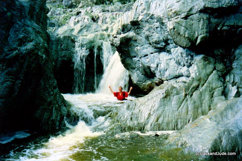
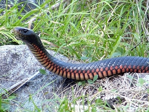
Wollomombi NP 1994
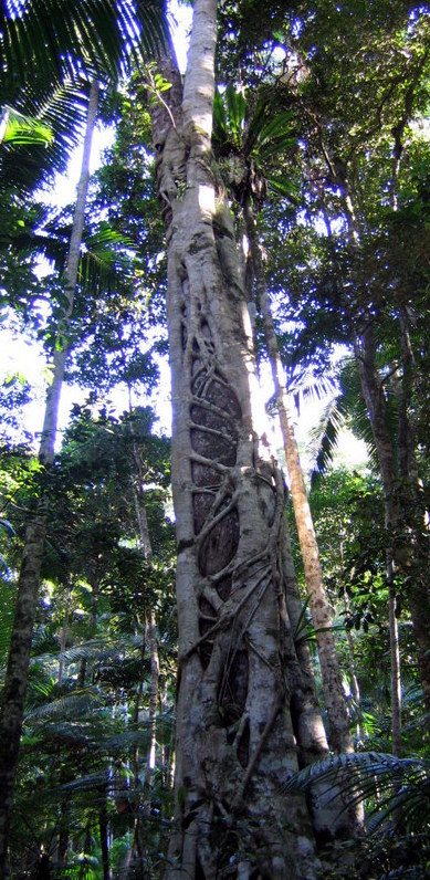
A strangling fig wrapping around a host tree that it will eventually devour
This website mainly focuses on our adventures since re-launching the good ship Banyandah in 2007. However, we also want to take a moment to reminisce and share some photos of the walks we took while we were stuck on land, working to earn enough for future adventures.
Here’s a wise word for our younger readers. One of the greatest joys of taking on hard, physically challenging adventures is you’ll have plenty of memories. Both good ones and the not so good that will amaze you as your fine bodies start to fail.
So, sit back and look at our photos and imagine conquering mountains and crossing seas. Both are possible. We believe good karma helps, and that’s easily gotten by always being kind to Earth and her creatures. But you must be aware and prepared to look after yourself. Really prepared. Otherwise, Nature will find you lacking.
Nearly Two Decades Land Bound –
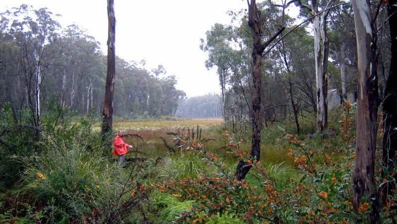
Through that nearly two decades of being land-bound, Jack and Jude extensively tramped through much of the Forestry lands and National Park lands of northern NSW and SE Queensland. It’s something we still do in our time away from Banyandah. The Great Dividing Range occupies much of that territory. That’s where the largest continuous expanse of subtropical rainforest, “The Big Scrub,” once flourished across 75,000 hectares.
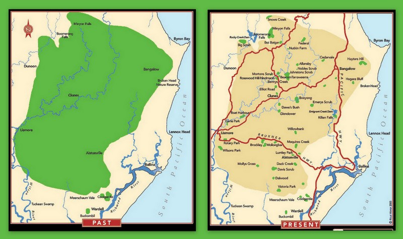
The Big Scrub almost all gone in 100 years
Always something to discover
The Big Scrub stretched from Ballina to Lismore in the east, Meerschaum Vale in the south, and the Nightcap, Goonengerry, and Byron Bay to the north. But, after broad scale land clearing by cedar getters and settlers began in the 1840’s, only about 300 hectares exist today as tiny remnants. That’s less than 1% of the original forested land before white man arrived where the Bundjalung Nation hunted and collected rainforest bush food.
How Our Bush Adventures Began –
After we settled on land, we attended a party at a farming commune near Mullumbimby. While admiring the lush forested hills, we inquired about the feasibility of hiking through the forest to reach the quaint village of Nimbin.
“Of course you can,” came an immediate response. “There once was a well-used track along the ridgeline. Interested?”

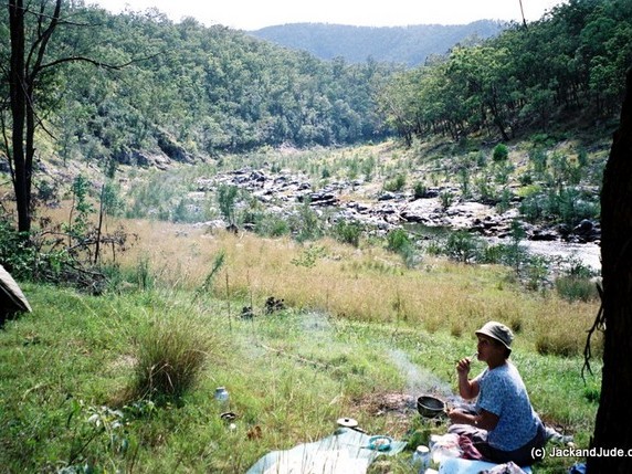
Sublime moment – Namoi River 1999

Well, we’re always interested in Earth adventures. And so, before another hour had passed, we found ourselves on a new friend’s veranda with a large cardboard box on the table before us, filled with rather worn topographical maps.
When the one for that area was spread before us, we became entranced by the many faint contour lines showing ridges and valleys, streams and ponds. In a few minutes under this man’s tutelage, we learned the basics of how to read a topographical map and the meanings of the various symbols. And because we were sailors with wide practical experience, like a sea chart, that topographical map immediately presented a picture of adventure.
On that porch, we noticed an array of touring bikes, a few well-used kayaks, with climbing ropes hanging on hooks that showed this man took his adventures seriously. Good, I thought. He’ll know his stuff.
Naturally, one of my first questions was, “Where’s the most exquisite location you’ve explored?”
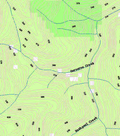
Washpool and Oorooroo creeks
He didn’t need to think twice before answering. “Inland from Grafton, there’s a valley so steep and so hard to access that machinery has never entered it. The old growth forest found there is pretty much as it has been since the Mt Warning volcano cooled and eroded millions of years ago.”
Reaching into the box, his fingers easily found a tattered map. When opened on the table, we noticed that tape held the folds together and that the margins were scribbled with notes.
“The Washpool Creek flows through this valley with several feeder streams coursing down both of its flanks. This one,” and here his fingers followed a tiny blue line, “is the Oorooroo Creek. It’s exquisite. There are waterfalls and shear rock faces covered in orchids, mammoth White Booyongs, Australian Red Cedar, Black Bean, thick vines and giant palms.”

Richly fragrant wet forest
Smiling broadly at the vision, Jude yelped, “Yeah… I like it. Where do we start?”
Sagely shaking his head, he said, “Look, maybe it’s best you leave that one till you have more experience.”
Meanwhile, I had noticed a few notes on the map showing a route and starting point, so I charged straight into something essential. “Tell me, how do you navigate in a thick forest? Do you count ridges and valleys or only follow creeks?”
Alarmed at my question, our host immediately began folding the map, saying, “Do not go into the Washpool. You’ll only get into trouble.”
Now, those were the days before GPS navigation, back when navigators used compass bearings on headlands and peaks. Just like our travels on the sea, where we used dead reckoning to keep kept track of direction and distance travelled from the last known point.

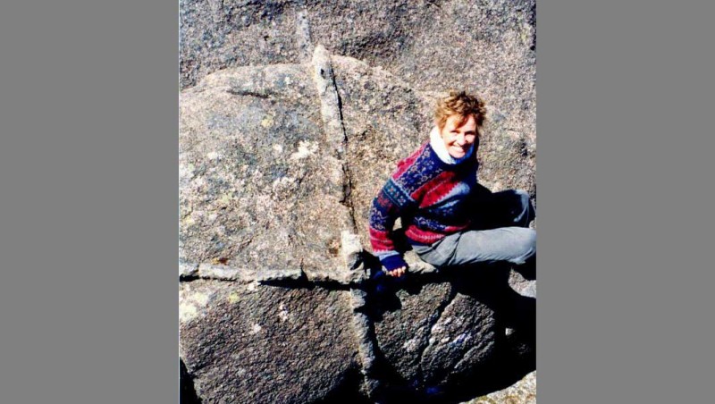
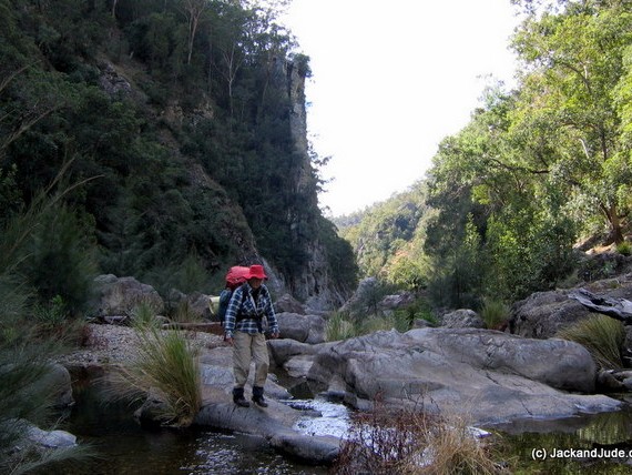
Young and fit, carrying heaps at Cathedral Rocks NP
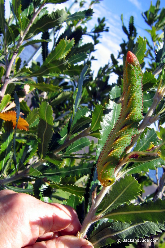
Do you see the monster caterpillar?
After purchasing a local topographical map on our way back to the commune, the following day, Jude and I embarked on our journey to Nimbin. We followed the now overgrown path once used by early postmen on horseback, and it proved to be a magnificent experience. As we ventured deeper into the lush forest, the hustle and bustle of the developed world faded away, letting us embrace the peace and serenity. Like curious children, new wonders stopped us every few feet. That night, we discovered a small clearing near a gentle stream. Gathered around a crackling fire, after the physical work, we felt exhausted but with a sense of accomplishment as we laid back to immerse ourselves in the awe-inspiring night sky adorned with countless stars. The intense silence occasionally interrupted by peculiar sounds, added to the enchantment of the experience.
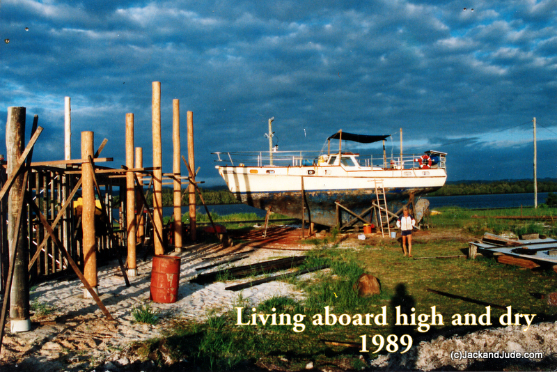
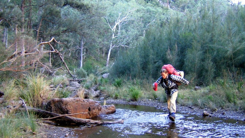
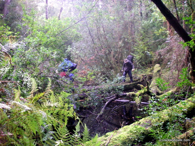
On our way home to Banyandah, which at that time was standing high and dry on bare land, we bought a topo map of the Washpool Valley and studied it for the next two weeks while the moon waxed to half full. Then we drove off to find the starting point I’d noted on the fellow’s Washpool map. Of course, that first trek was arduous, horribly so. But we found trekking wilderness to be very much like cruising in a vessel. Carrying our house with us, no matter what happened during daylight, we had a place to rest at night, and it fulfilled our need to be self reliant while also filling our memory banks with achievement and glorious Nature. That said, we also discovered Lawyer Vine, commonly know as Wait-a-While that tied us up like razor sharp spider webs. Lawyer Vine sends out lots of slender barbed tendrils that seem to reach out to grab arms and faces and clothes, stopping us lest we slash our skin. The patience we had developed while sailing oceans proved mighty helpful here.
Twenty Five Years of Trekking –
After the three arduous years of building our house and work shed, we earned a living by fitting out a few boats in the dying days of local shipbuilding.

Jude finishing one of our Country style kitchens
Then after that collapsed, we evolved into making timber kitchens, stairs, and libraries in a man and wife business where Jack made the pieces and Jude did the finishing. At the same time, we were rebuilding Banyandah in our workshop next to the house, which meant we worked long hours, often seven days a week, except for family gatherings or equally important events. To sort of recharge and clear our lungs before starting another contract, we developed the habit of going bush upon completing a job. In that way, after exploring all the Washpool Valley in many visits, we tackled the subtropical forest of SE Queensland.
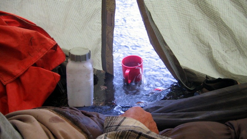
 Sometimes it rained and then poured all night
Creating a Reason to go Bush –
Being in the timber business, we naturally loved wood. Recognizing the rapidly dwindling supply of good cabinet timbers, we joined with a hundred others to form a group called the Subtropical Farm Forestry Association, with the goal of encouraging Big Scrub land owners to plant subtropical timbers. I became its first Secretary and that meant I needed a greater knowledge of the many varieties of cabinet timbers native to our area, which created another reason to go bush.
But, after a decade of pushing through thick, wet, subtropical rainforests identifying tree species, we sort of got worn out. It was damn hard work that often left us bleeding on our arms and faces. About that time, the endeavours of our farm forestry association to find farmers willing to plant cabinet timbers found opposition from State Forests, who needed more land for eucalypt plantations. They were offering joint ventures that paid land owners maintenance fees and an earlier harvest income. You see, eucalypt trees mature in about ten years while rainforest species take at least thirty.
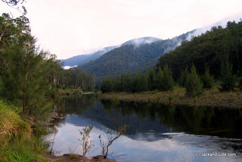
Mann River near Grafton NSW
And so, we began walking through open, dry eucalypt forests. They are much easier to get about in and much more fun because we could cover heaps more distance under an open sky and have starry nights. But, we lacked a mission to motivate us like we had before.
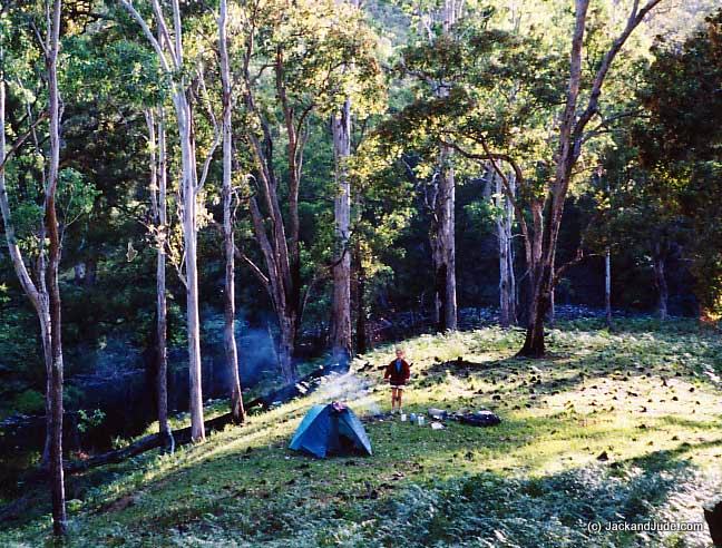
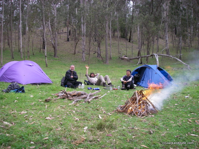
Camp alongside the Cooradoral
Aussie Bush History to the Rescue –
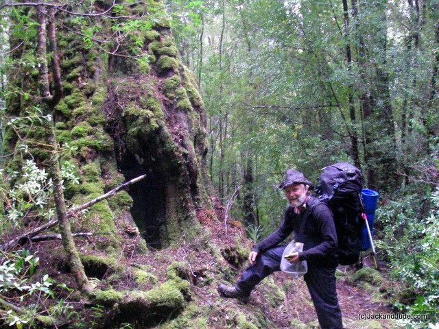
In the late 1800s through to around 1950, the mountainous area inland of Grafton had seen considerable mining activity. In the ten years of walking rainforests, we never saw another soul, but in the first year trekking the easier dry forests, we met a man and his son, and a local rancher on horseback. That happened when we were down in the Cooradoral, a small creek that flows to the Mann River just south of the Gwydir Highway connecting Grafton to Armadale. There’d been a fire in that forest a few weeks earlier, a hot one. But where we were camped was rich and green when this lanky fellow rode up with his three dogs sniffing all our stuff. In our conversation, he mentioned that the fire had burnt away all the weeds from Cherry Tree Creek, exposing the long-lost gold mine. Hearing that, our ears perked up. Three days of walking later, we reached that creek and were astonished to see a large boiler sitting atop a pile of river stones. Our closer inspection revealed bits of a Huntington Mill and ore stamper. And after exploring further up that creek, we discovered a brick smelter and footings of a house along with rails and trolley wheels.
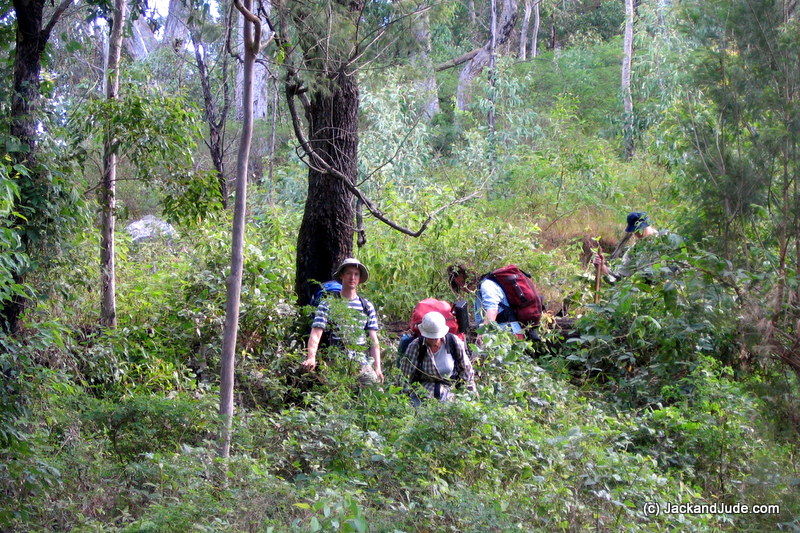
Jack and Jude leading a research team into the long lost gold mine
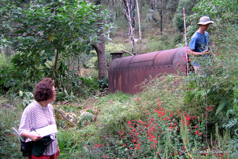
The boiler, made in England, brought by bullock cart then lost to forest growth
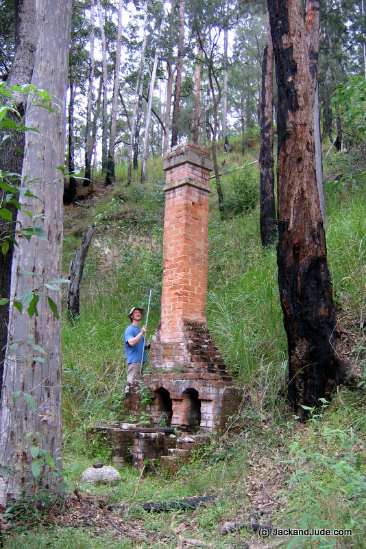
The smelter chimney lost in this forest for a century
All of a sudden we’d found a new reason to go bush and that began a five-year search to not only document the remnants, but what we also wanted to learn was how those early settlers got that big, heavy boiler into that river valley. It didn’t get there on a barge. There’s not enough water in the river that tumbles over several falls. In a dozen searches, we trekked up and down every ridge and skirted the valleys looking for scars that would have been made when hauling in such a heavy load. Naturally, we passed our discoveries onto National Park, who eventually asked us to lead a scientific team in to catalogue and record the site. After doing that, they asked if we could locate some of the abandoned mines. They’d supplied an approximate location based on the claim, and we’d go off for a week to scramble up and down slopes, finding quite a few old mines. Most were dangerous holes covered by regrowth, a trap for the unwary. In one we found a dead brumby; another had the remains of a cow. While doing this, we also found and documented a shed containing a crosscut saw, an axe, and other historical paraphernalia. In another location, we found the remains of a homestead with piles of fencing and a rotted water tank.

Huge stick creature walking on Jude’s shirt
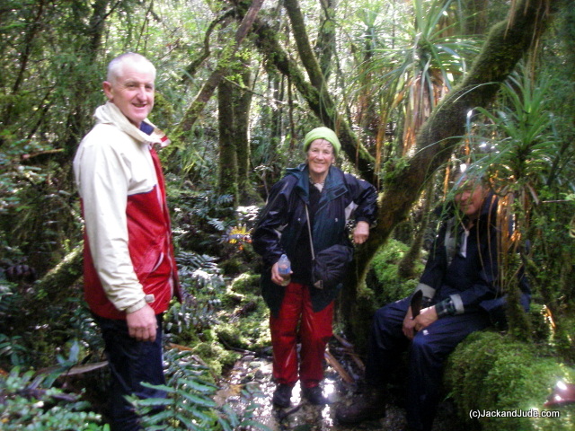
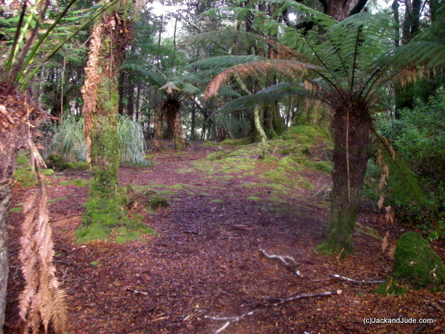
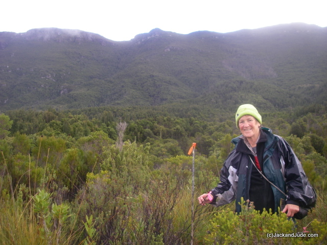
All of this kept us occupied until we’d finished rebuilding our boat and had earned enough freedom chips to close down our shop so that we could go sailing again. Our plan; to sail to unique locations, then trek inland. This blog records several of our excursions in northern and western Australia and now we’re heavily into the challenging forests of Southwest Tasmania.
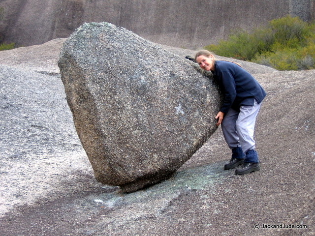
- She's stronger than you think

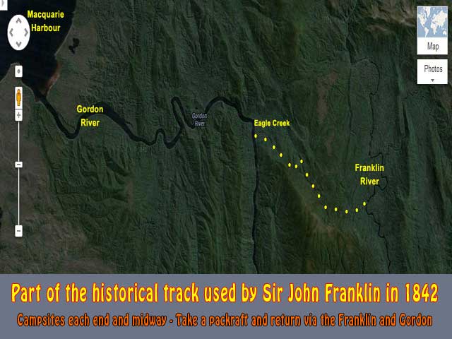
For those seeking a fabulous challenge that is doable for experienced wilderness walkers, we suggest hiking the Eagle Creek track connecting the Gordon River to the Franklin River. A group of us cleared it several years ago. Originally cut in 1842 to take Governor Sir John Franklin and his wife Lady Jane to the west coast (details here), it is the most intense rainforest we’ve ever encountered, and it’s mixed with open button grass plains that command grand views of the stark South West mountain ranges. To add more adventure, take along a pack raft to complete the circuit by paddling down the Franklin to the pickup point at Sir John Falls on the Gordon. But, please remember, this is challenging, requiring being prepared for wet thick stuff without assistance.
How to organize? The man to talk to is Trevor Norton (tmnorton7468@gmail.com), ex-master of the Stormbreaker, which does upwards of seventy trips up the Gordon River a season, right past your departure point. Trevor knows this track better than anyone and he’s a gracious person. He will tell you everything about your challenge, how to get to Eagle Creek and be picked up. Trust him, we do.
An easier challenge lies next to Sir John Falls. The Goulds track was first established in 1862 by a team led by Tasmania’s first Geological Surveyor, Charles Gould (1834-1893) during their search specifically for gold. Jim Morrison later enhanced it when he established a pack track from Goulds Landing, near Sir John Falls, to his Sandstone Camp near the Rocky Sprent. If interested, Go Here to learn about Jack and Jude’s five-year explorations in finding the lost Gould Track as far as the Rocky Sprent River, some 15 kilometres upstream.
Walks/Treks:
NSW: Mann River – Gibraltar Range NP – Washpool NP
Guy Fawkes National Park – OFFTRACK 5 Days in fairly open riverbank walking to Sara River
Birthday walk to Demons Fault – OFFTRACK – Washpool NP from Boundary Creek Campground
Mann River and Barool River – OFFTRACK – 7 day trek return from Raspberry Lookout.
Jackadgery to Cherry Tree Creek – OFFTRACK – 9 day trek return to an abandoned gold mine
Boundary Campground to Pheasant Creek via Demon Fault – PART OFFTRACK 6 day walk
Gibralter Range NP to the Cherry Tree Gold Mine – OFFTRACK 8 Day Trek
Boot Camp – OFFTRACK 8 day walk from Gibraltar NP to escarpment.
Duffer Falls, Haystacks, Duffer Creek – Part OFFTRACK 5 day walk from Boundary Creek Campground, NSW
The Valley of Tranquility – OFFTRACK – 5 Days Cooradooral Valley, Gibraltar NP from Boundary Creek Campground
Four days of Dhyana – OFFTRACK – near Jackadgery, NSW – Pleasant camp – access to Mann River
Tasmania –
Betsys Bay WALKS – On track, Day Walk to West Coast plus Several offtrack outings to great views.
Mt.Sorell Plateau – Day walk from Farm Cove
Mt.Sorell Peak – Three days return from Farm Cove – no track – requires bush skills and camp gear.
Eagle Creek – West Coast Tasmania superb wet rain forest – challenging.
Goulds Track – Historical track from Sir John Falls to Upper Gordon River, first 2 km marked.
Files update:

Till next time, be happy and safe.


