
April 2017 March 2017 >>
Blog of Jack and Jude
explorers, authors, photographers & videographers
It’s been a busy month here on the west coast of Tasmania. We’ve been around the Harbour inspecting several tracks that our newly formed group is hoping to maintain, got rain drenched in the upper Gordon, returned to civilization in time to go on an organized Harbour cleanup. And when just catching our breaths, a fabulous weather window opened, promising a week or more of balmy conditions. So again we took flight on what became one of our greatest adventures, Trekking to the Past.
There’s a fair bit in this blog, so here are links to the contents.
Harbour Tour
![]() Immediately after Wildcare Friends of Macquarie Harbour was formed, we set off for an around the harbour meander to inspect the several tracks that we’re hoping to maintain under a newly signed Parks and Wildlife agreement. That delightful week walking those tracks took us as far as Sir John Falls where we’d hoped to set off overland, trekking well away from all humanity to the Sandstone Creek that runs under the King Billy Range. Unfortunately our beautiful sunshine vanished behind black rain clouds that kept us below editing video and chatting with the few other adventurous folk who had come to walk and kayak, but instead, were sharing the gloomy anchorage – until we all threw in the towel and returned to Strahan. Just as the sun returned! In time for the first ever Macquarie Harbour clean up.
Immediately after Wildcare Friends of Macquarie Harbour was formed, we set off for an around the harbour meander to inspect the several tracks that we’re hoping to maintain under a newly signed Parks and Wildlife agreement. That delightful week walking those tracks took us as far as Sir John Falls where we’d hoped to set off overland, trekking well away from all humanity to the Sandstone Creek that runs under the King Billy Range. Unfortunately our beautiful sunshine vanished behind black rain clouds that kept us below editing video and chatting with the few other adventurous folk who had come to walk and kayak, but instead, were sharing the gloomy anchorage – until we all threw in the towel and returned to Strahan. Just as the sun returned! In time for the first ever Macquarie Harbour clean up.
Farm Cove Anchorage under Mount Sorell from JACKandJUDE
Macquarie Harbour Clean Up
This unpleasant task is in fact a part of the licensing agreement of the three fish farms; Tassal, Huon Aquaculture and Petuna. But they’ve had so much bad publicity recently over the health of the harbour and its once pristine waters, that a considerable community concern has arisen and therefore a special taskforce was set up to inspect and tabulate the trash found on the foreshores in order to find out how polluted the harbour is becoming. Numerous teams were established to work around the harbour in one big cleanup effort.
Kelly Basin anchorage the night before the Harbour Clean
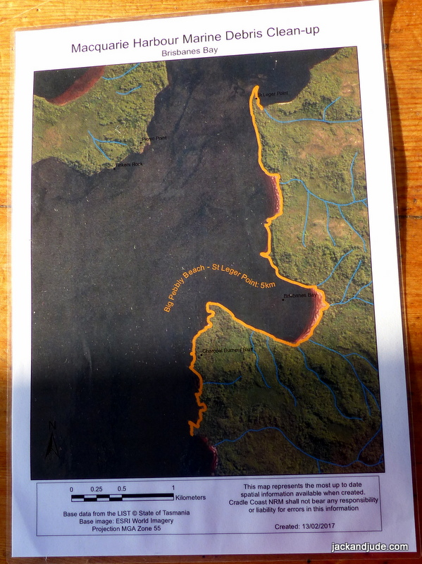
Our zone to clean
In our wanderings, we’ve seen a fair bit of trash and thought it a good idea to know more, and signed up to go with the team on Stormbreaker. The zone assigned to us to clean ran 5 km south from the entrance of Kelly Basin, and included Clerks Bay and Charcoal Burners Bluff to North Pebbly Beach. Trevor Norton, who volunteered the use of his charter vessel, supplied all the food and a few drinks, and so our merry band of eight set off on a balmy Sunday afternoon just days after we’d returned from up river. The following morning, which was a wowser, we were issued with protective gloves and big rolls of bright orange plastic garbage bags, along with rolls of pink marking tape for the stuff we couldn’t carry away.
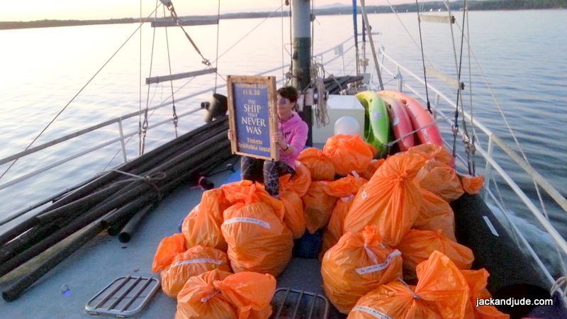
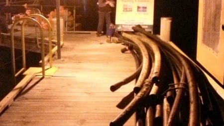
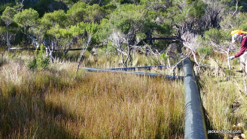
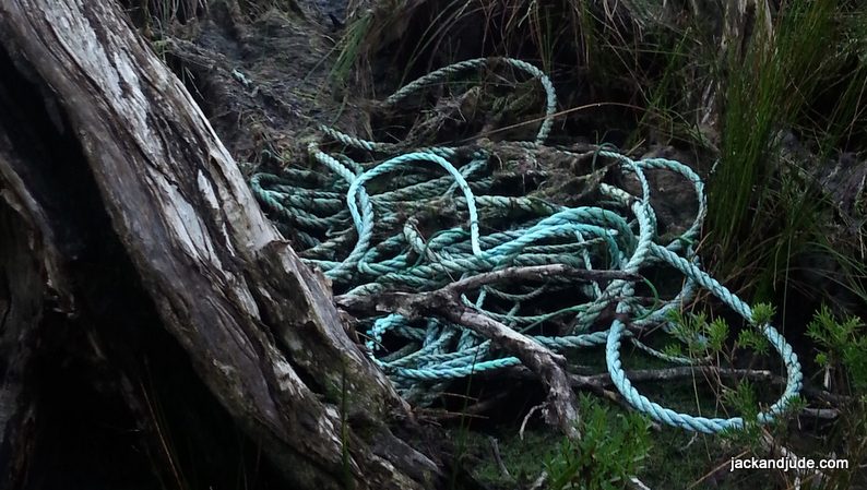
Having seen plenty of junk scattered here and there on our wanderings didn’t actually prepare us for the magnitude of refuse polluting these foreshores. We split into two groups of three, each covering half the territory, while Trevor and a helper, using the dinghy, carted our full bags back to Stormbreaker, in between pulling out bigger stuff stuck in shallow water. Our team collected literally a kilometre of large diameter black plastic pipe, half a fish pen, two mooring buoys each bigger than the fattest man, plus thousands of lengths and bits of rope amounting to hundreds of metres, much of it caught around vegetation or naturally trapped by wave action. It wasn’t hard to imagine plenty buried out of sight, waiting to be unearthed by the next storm. Heaven forbid! Synthetic rope is made up of thousands of fine strands which, when caught by the sun and thrashed by wind and sea, breaks up into millions of little short bits that eventually becomes invisible bits caught up in the food chain. Also there were Styrofoam white floats, those used for moorings and markers, many broken into pieces, that when manufactured were made from hundreds of tiny beads of foam, which when breaking up scattered thousands of tiny white beads. It’s no wonder we hear that a great percentage of marine animals ingest such material. We noted how little non-fish farm trash we found in our sector.
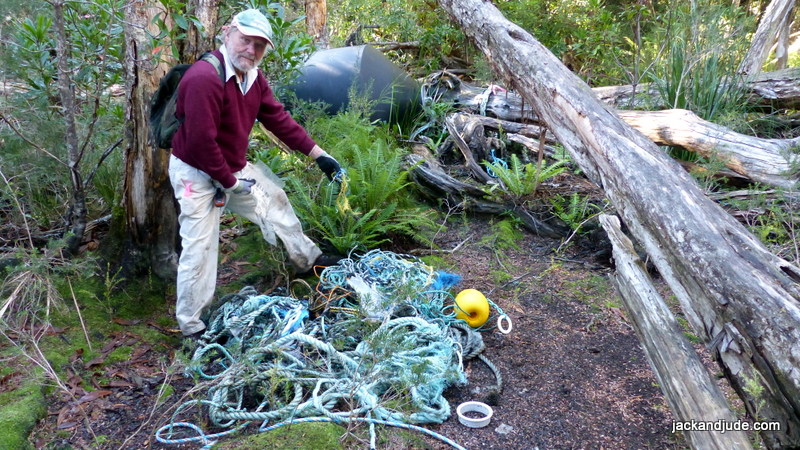
Just a tiny sample of what we collected, including two large buoys
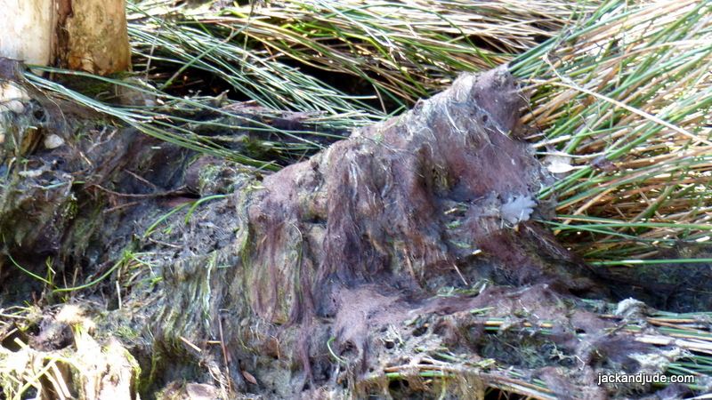
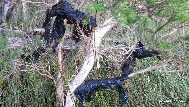
Gunge swamping the native growth.
Scandalous! Outrageous! We are shocked by the wanton disregard shown for the environment by the fish farms. Far worse, compounding the magnitude of trash, we found hairy mossy gunge washed over and suffocating the foreshore reeds and buttongrass. We’ve not seen this before and can only think that the extreme nutrient levels now in the harbour are causing this. Jobs and growth over protecting the environment will depreciate Earth life until our children accept a degraded Earth as the norm. How sad that is!
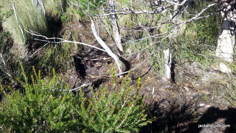
Gunge swamping Native Growth – Never seen this before the farms tripled in size
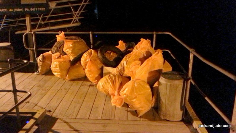
Bags of trash collected with Black poly pipe on left
This article has proved so interesting to our followers that we’re going to post more photos so that you can better judge whether these commercial ventures are treating the surroundings with due respect. Our thoughts, if this were anywhere else, an industrial zone or city, they would be in front of a court on charges of littering, if not something far greater. It is even more scandalous that this is a World Heritage area, supposedly to be kept pristine.
 Our collection from a very tiny part of the Harbour


Bold New Adventure- Trekking to the Past
No sooner were we back from this outing when a new weather system began forming promising fine conditions over Tasmania for at least a week, maybe even as long as ten days. Oh my! We couldn’t let the opportunity escape and quickly arranged for a fast ride up the river with a friend.
Jude and I rushed to provision and pack our backpacks, and then, after barely a night in our own bed, we were heading deep into the Southwest forests, embarking on one of our greatest adventures to continue our search for lost historical remains.
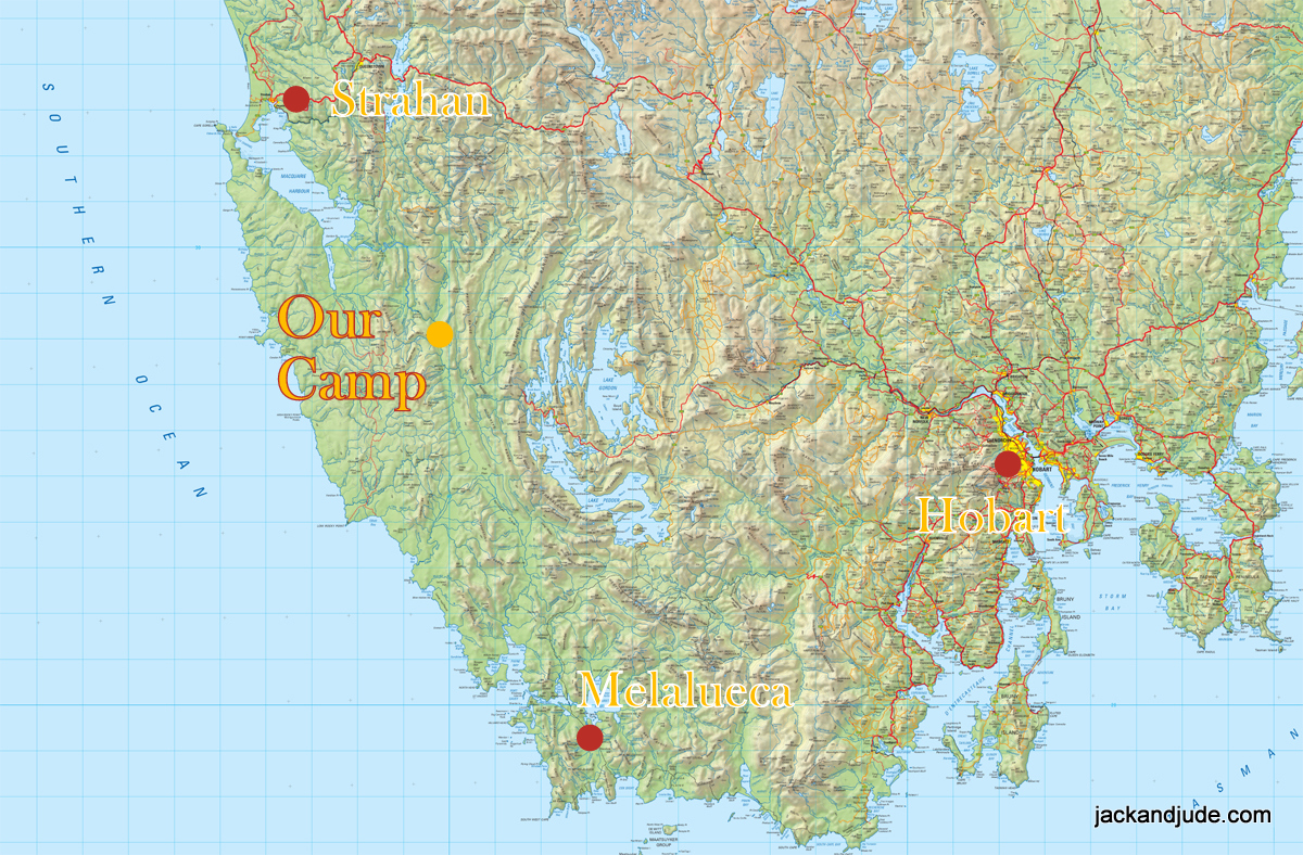
Location Map
Bumper Sticker from Dam Blockcade
By going deep into World Heritage territory we had two objectives – three really if having a grand time is added to finding remnants and evidence left by the piners who harvested exotic logs in this area back in the early 1930s, in addition to looking for and recording evidence of the track cut by the first Geological Surveyor of Tasmania Charles Gould in 1862. Gould’s track opened up the west coast to the populated east of Tasmania giving access for other geologists and miners who searched for much needed resources. About 1900, this same track was then used by piners to access the upper reaches of the Gordon and its tributaries. Then after WWII, it was used four times every year by Tasmanian Hydro to reach their research camp on the upper Gordon, where they measured river flow and heights so that they could design the dam that never was – the dam that changed Australia by NOT being built when the Green Movement was created with the citizens blockade of 1982-3.
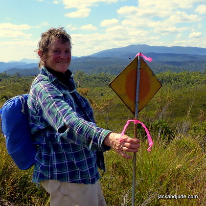
Hydro Sign
Hydro marked the Goulds Track with their unique orange painted diamond shaped signs that have a bright yellow dot in the centre, and which are held aloft about shoulder height on a galvanised pitchfork stalk planted in the ground. Jude and I have been tracking these signs for the past three years because this historical route that opened up the west was left to be swallowed by the ever consuming growth of Nature after the area was declared a National Park – which ended the construction of the dam that never was.
So we’ve been going camping these last three years, into the National Park on long hard slogs pushing through thick stuff that’s sometimes wet and leechy, finding those famous diamond shaped signs with a yellow dot.
This year we explored the far south of the plateau lying under the brooding dark green King Billy Range that yielded so much high quality timber used to build many of the ships that helped this state survive.
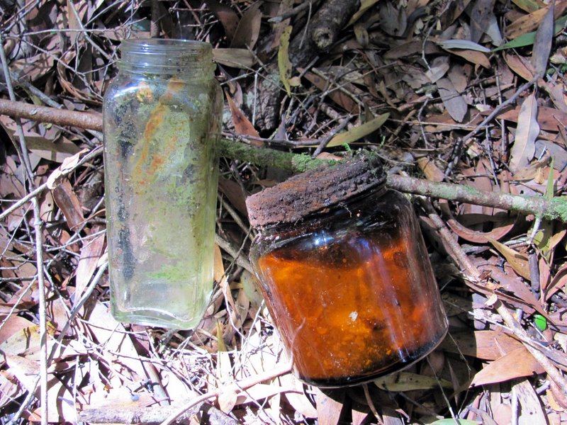
Jars found at Hydro Camp
Near to where Hydro established their Gordon River camp, the Morrison family had many years earlier built a hut and some stables for the horses they used to haul the quality logs out the King Billy Range to the Gordon River, where they were floated downstream. A few years ago, Jude and I visited what remains of their camp when filming “Two Men in a Punt” and found not only a meat safe and forge, but the remains of the stables with its collapsed roof and rusty nails. Our group also found an old leather hobnail boot – gloriously moss covered from lying on the ground for perhaps up to 80 years, just where the last occupant had left it. Downstream a few hundred metres, the Hydro camp had left behind a bit more, probably because that camp was last used in the 1980s. There we found jars and metal gratings bolted to log bridges, and plenty of galvanised wire rope from the Flying Fox that once spanned the river.
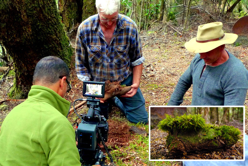
Filming ‘Two Men in a Punt’
This time we were keen to find the track cut by the Morrisons to haul out the logs – called a shoe road after the metal shoe attached to the front of the logs that prevents them from digging into the Earth and carving out a furrow. How hard and long these pioneers had laboured to cut a benched road up the side of the ridge rising out the Sandstone Creek is well remembered by the Morrison family. Amazingly, traces of the road can still be seen using Google Earth. We particularly wanted to find it as it would lead us down through the wet forest fringing the Gordon River to the Morrison Camp. No one has been able to find the camp end of the track as the forest is so thick.
Our Journey Begins
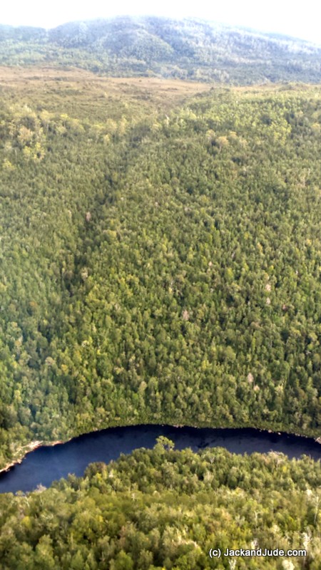
Up the left side of the creek to the button grass
Photo by Seaplane Geoff
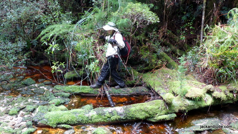
Our journey began on the Gordon River a couple of kilometres above Sir John Falls at a bend encumbered with rocks called Big Eddy for the swirling torrent and whirlpools that can sometimes be all one can see of the obstacles stopping everything but tinnies from travelling further upstream. Big Eddy lies in a gorge just where a stream empties waters off the plateau 300 m above it. In years past, we have gained access to the plateau that way. Steep and thickly clad in dark lush forest it’s remarkably clear of undergrowth, allowing fast, albeit hard travel uphill. Towards the top there’s a nasty horrible bit of Bauera, the interwoven vine like bush that grows over and through all other vegetation, forming a barrier that’s energy sapping to push through, especially if going uphill. That first day, this stretch of Bauera caused us some concern as the sun dropped and had us thinking we might have to spend our first night on the slope. But not to worry. With a bit more perseverance, another litre or two of sweat, and heaps more curses, we got through to the plateau, where after a night’s solid rest, we made a bee-line down the plateau through shoulder height woolly tea-tree, Leptospermum lanigerum, that hid clumps of button grass typical on the plain. It might look flat but it’s not easy peasy. The button grass clumps are rather a pain to step over with a heavy pack and just as bad to push between on the uneven ground that’s often soggy. Crazy to do this you might think. Maybe. But when we stopped to catch our breath, everywhere around us is open to valleys and mountain ranges casting hues of blues by the vast distances, and no trace of humans for nearly a hundred kilometres. So, there’s no roads, no plumes of smoke, no sounds of aircraft; just us and the myriad melody from parrots, wrens, and the squawks of passing cockatoos.
Buggered, shoulder sore and weak in the knees we reached our destination on the second day and could almost hear the sound of rushing water at the foot of the green might of the King Billy Range. Now down to serious business. We had to find a suitable spot for an extended stay, with wind protection, water at hand and a dry flat area, the bigger the better. Tight spots get claustrophobic.

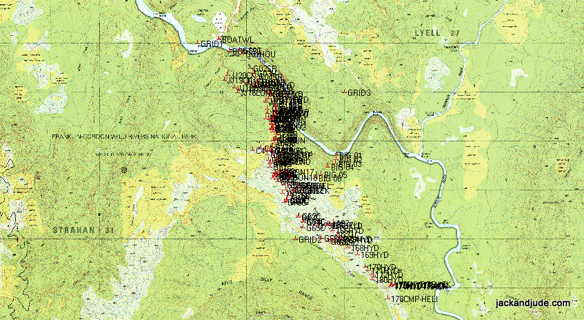
Camp Locations 1:25000 D’Aguilar topographical map
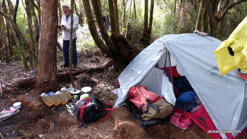
Camp
Admittedly, the first couple of searches were disheartening. Thick Bauera invaded the trees, and the ground was so uneven and tough I was ready to establish our camp on a flattish boggy area exposed to the full force of weather when another copse of trees on a knob caught my eye. Pure magic is what I saw after pushing through the undergrowth.
First, a huge fallen tree that I imagined sitting atop eating my dinner inspired me deeper into the grove. Yes there was Bauera intertwined through all the saplings, but the ground was dry mulch, so I called Judith to come. She liked what she saw, and we began clearing out the Bauera by repeatedly breaking the stems and untangling interwoven runs. As we did, an amazingly large, flat area was revealed. Jude had worked quickly clearing one end, and oblivious to me was continuing a narrow strip down the slope. Worried I called out. I knew the Sandstone Creek lay down that slope as we could hear it gurgling, and when she yelled back that she could actually see water, I was with her in a jiff. Water is the most important thing we needed to live. Confronted by a steep drop off, a tea coloured stream rushed along its base, which although steep, was clear of undergrowth and climbable.
Our Camp on Sandstone Creek from JACKandJUDE
Morrison Shoe Road and Bridge
After establishing our camp and having a restful albeit rather lumpy night’s rest put on the list to fix, we couldn’t wait to set out on our first objective to find the Morrison’s shoe road. The camp sat on a knob that fell 20 m westward into the Sandstone Creek. On our east, ran a level, sometimes mushy strip of mainly short tea-tree and some stunted Banksias, interspersed with patches of cutting grass and thicker areas of Bauera. Rising up on its eastern flank, a long ridge separated us from the plateau and the Gordon River.
We’d seen on Google Earth a faint regular line sloping up this ridge and started off zigzagging, pushing through the low vegetation then going up the side of the ridge, hoping to intersect the road by crossing it, and of course noticing it amongst all the vegetation. Our first find, other than vegetation, was a lovely black Tiger snake, coiled and flattened, enjoying the morning sun in an open spot. Looking at me, he wiggled out his forked tongue as if saying, “Push off, I’m enjoying the warmth.” So we obliged by changing direction for a run back up the ridge. Tiger snakes are quite placid and shy, but have one of the most deadly toxins of all the world’s critters.
Camp Sandstone
In this way we worked south, zigzagging till lunchtime, finding absolutely nothing after covering about three hundred metres. Jude had packed a crib, or picnic, and getting out the noon day sun seemed smart, so we ducked into a stand of Manuka, Melaleuca ericifolia, that paralleled the creek but was steeply well above it. Manuka is also a tea-tree, but grows tall, sheds its bark in strips and doesn’t allow much to grow under it, so we found a lovely open spot with dappled light and plenty of fallen trees to choose for seats – pleased the dry mulch underfoot meant no leeches.
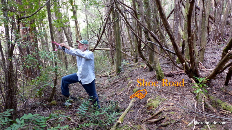
Tagging Shoe Road
It was heaven sent. So much so, that after lunch we walked further under this cover, and within another 20 m, amazingly by providence or good fortune found a shoe road, plain as plain by its furrow running up from the creek. Following it towards the ridge brought us back to the wet flats, where my bushman’s eye locked onto faint disturbances in the thick vegetation, and suddenly I became like a blood hound following them across the flat to where they ran into the ridge. Again by good fortune or providence, while taking a breather I pushed aside the vegetation and right there were the beginnings of a benched road. Called a sideling by the Piners where they cut into the hillside to form a flat track. Well! We were now ecstatic, our feelings exploded and no longer did our joints ache so much. Right in front of us, and immediately discernable, the road rose gently and remained flat under the overhanging scrub, becoming even more open after reaching the larger trees. In fact, when we broke out the low vegetation, we beheld a road leading up the hillside cut nearly shoulder deep on the high side, coated green with superfine moss, the kind that glows in the night. The track itself was flat across several metres before it fell away down the lightly timbered slope. In places along that edge, the builders had laid fenders, small logs laid like a curb to keep the harvested logs on the track, and these must have been Blackwoods or small Huons because after 80 years on the ground, not only were they thickly moss covered, but still solid. I guess we got a bit more than halfway up the ridge, tossing dead branches aside to travel further up, until we struck a particularly bad bit of tee fall and called it a day as it was 3 pm. Our rule is to get safely back to camp well before dark. Good light is gone by half five and we still had to backtrack a fair way and needed to take our time not to get hurt. What a horrible thought, spending a night on wet, creepy crawly ground with a broken leg. Surprise, surprise, we were back in camp after only 70 minutes.
Shoe Road and Bridge across Sandstone Creek from JACKandJUDE
Rain overnight got us off to a late start. The wet morning set me repairing a tear in my pant’s left knee, the bush is so challenging. But the late start allowed some of the wetness to drain away, and going slowly gave us time to straighten some of our route, removing unnecessary pink tapes. Good thing. Won’t bump into Mr Snake anymore! We had brought along thick gloves and went to work clearing fallen saplings thickly intertwined with Bauera. But there was more mess ahead, tree fall thick with Bauera over my height. Cleared that patch to find yet another, and then a run of Bauera so tall I had to trample it by falling backwards into it, letting my weight crush it down enough to back peddle over it. All the while above us, the sky along the ridge line grew larger until, clearing that last hurdle the saddle was revealed. While it might have been open to the heavens, it was filled with head high tea-tree hiding button-grass tussocks in very wet mushy ground, the combination totally hiding the route ahead. To get good photos, shutter bug Jude climbed onto the waist high button grass clumps taking care not to slip off the shiny stalks by using my shoulder as a crutch. Further on we could just see the tops of the lush rainforest that began its descent to the Gordon River and the Morrison Camp. But which way to go? Pushing ahead yielded no clues, and as it was getting late, on a high, but still not satisfied, we turned for our camp.
Bauera – The Bushman’s Curse from JACKandJUDE
Day Off
Day Off
That night a cold front crossed Tasmania, bringing steady rain and strong winds, first from the NW before changing SW. Closeted safely amongst our nest of trees, we hardly felt the wind. We stayed in bed and I read Longitude to Jude, who later cooked up a scrumptious Sunday morning ham and cheese omelette. Her treat in the bush made with the eggs she cocoons inside a plastic container.
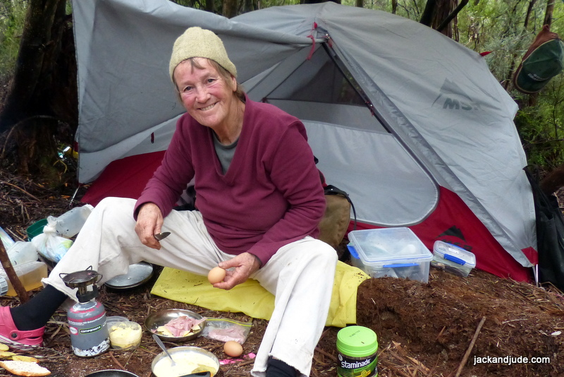
Sunday Breakfast – Bush Tucker – Ham and cheese Omelette
Feeling rather worn out now that we had stopped charging here and there, I was happy to doze in bed as the rain fell while Jude donned wet weather gear to explore the creek below our camp. Every now and again her “okay, okay” came out the creek and she returned an hour later bubbling over with news that she’d seen squared off logs, and possibly a bridge.
The next few days were cloudy and cool, perfect for outdoor work. First we decided to clear our way out because lugging heavy sacks uphill through where we’d come in would be easier after a tidy up. In addition, this would give us a chance to explore where the Hydro track leaves the plateau and enters forest, hopefully finding evidence of it. That went really well and we found Hydro sign 23 near the entrance to the forest, almost completely covered by vegetation.
We also explored the shoe road, going the other direction, down the side of the Manuka ridge, and found the bridge used to haul the logs from the King Billy Range across the Sandstone Creek. Can’t tell you how impressed we were to find that 80 year old bridge lost in deep world heritage forest.
Bridge across Sandstone Creek in use about 1933
Our time ran out before we could explore the saddle and find the shoe road down to the Morrison Camp. But we’ll get back. Either from the river using our kayak, or walking across those plains whose beauty has captivated so many over the years. It’s a connection with the past. Like living in Charles Gould’s time, that same wonderful view of the creation hasn’t changed since those many brave souls challenged the harsh magical land of Tasmania’s Southwest World Heritage Forests.
Trek Out on Historic Goulds Track – Hydro Signs
Our trek out out over three days proved challenging to our aging bodies weighed down again with our packs, but heartened by the early pioneers we accepted the task, stopping as required to steady our breath or pick ourselves up after falling, and by catching sight of many small creatures before again pushing on surrounded by grand vistas. Cherished memories. A once in a lifetime challenge met and conquered while the beauty of Earth and her myriad other creatures took away our pain and uplifted us with the will to succeed. And we did just that.
Hydro Signs and the Dam that NEVER was from JACKandJUDE
Success
We sighted and tagged an additional nine Hydro signs on the route shown on 1:25000 D’Aguilar topographical map. Add those to the six we already had found in the last two seasons brings us to fifteen important relics marking the exact route used by Tasmania Hydro, spanning a distance of six kilometres from Goulds Landing on the Gordon River to where the track enters the forest before descending to their research camp, which is 10 kilometres upstream from Sir John Falls.
Walking out along the Shoe Road to Goulds Landing
We also have now tagged a very basic track from Goulds Landing all the way to the saddle leading down to the historic Morrison’s Camp that was in use harvesting quality exotic timber in the 1930s. All that remains is to find and tag the last little link.
A word of warning
This is seriously dangerous wilderness and a journey through it should not be contemplated unless you are extremely well skilled in bush survival in harsh, isolated conditions. Judith and I have been undertaking off-track wilderness explorations in wet and dry forests since 1990, and prior to that we had nearly twenty years navigating to extraordinarily remote locations around the world on our small vessel. We are a well oiled team and are extremely well equipped.
Experience Tassie’s SW forests yourself
If you want to experience Tassie’s SW forests up close, and are fit, and have enough bush experience so you’ll not endanger the team, then we encourage you to join our Wildcare Group, Friends of Macquarie Harbour and Waterways, and help us maintain the many tracks in this area. Join Wildcare here then select our branch. Those with bush cutting certificates, chainsaw certificates, and those with first aid certificates are greatly needed.
Jude Here –
Jude here talking about the massive amount of equipment and supplies that starts with our new MSR Elixir two person tent, down sleeping bags, kitchen and provisions. Jack says I’m a pro, knowing just what to bring. My menu is simple. Breakfast cereal with an assortment of dried fruit. Lunches are based on a choice of crackers spread with a selection of hard and soft cheese, peanut butter, tiny tins of red salmon or flavoured tuna. We’ll often have a warming soup entrée upon getting back to camp in our sweat soaked walking shirts, sipping the hot drinks while keeping on the move so they dry a bit while we make preparations for the night. Our dinner is basically centred round a packaged pasta meal or couscous with additives like tuna, nuts, or lentils, or for Jack sliced salami. Veggies feature in the evening meal. A few bits of fresh broccoli, sweet potato, zucchini, or carrot go a long way. And I have a way of boiling up minute noodles then frying them with veggies and a fresh egg, carried in a plastic tub, before adding soy or sliced chilli. Simple and yummy. Plus plenty of hot beverages and the inevitable cask of red wine to drown the day’s pains or celebrate our achievements.
We eat well but we also look after our safety with a passion. Why spoil the fun with a medical emergency that might risk our lives, or the lives of others sent to rescue ill prepared explorers. We carry a custom built bush medical kit developed over our time adventuring together. This habit began from a wedding gift, a comprehensive first aid kit put together by doctor friends at the hospital where I trained when we took off overland on our honeymoon through Africa. This mini kit goes with us whenever we leave the boat in isolated places and it saved me when I fell and broke my leg in the Kimberley. There are some very powerful drugs in that small watertight container, as well as sutures, saline, burn ointment, and much more. And a strong crepe bandage is always stuffed somewhere handy. We always carry a personal location beacon and this trip Jack was carrying our Yellow-brick which transmits our position and can send the kids a short message and keep in touch with our support team via the Iridium Satellite network. He also brought along our handheld VHF that very nicely received the Tas Maritime weather on channel 63.
Our mountain of supplies nearly doubles when we add our clobber. The terrain is wet and cold so we took multiple layers of mainly wool jumpers and shirts, a change of clothes for evening and a change out of boots. What’s missing? Oh yes, navigation gear; maps, two GPS, and a compass, and even the iPad to watch a film and check our data base.
Our previous exploration of this area –
Continuing the Hunt
Third Time Lucky
Walk in a Park
Life in a Fridge
 We have just returned from living two weeks in a fridge at Sir John Falls in the upper Gordon. More on that in a moment. But first, Australia’s east coast has just been hit by cyclone Debbie, a massive category four system that gained power and moisture crossing the hot Coral Sea. After its destructive winds nearly levelled the towns of Airlie Beach and Bowen, stranding thousands without food, electricity or a means of escape, the still powerful and very wet rain depression moved south, flooding the capital city of Brisbane before setting its sights on Northern New South Wales. That’s where it dropped 500 mm (20”) overnight near our shack on the Richmond River. Our chief commercial town of Lismore was severely hit when the floodwaters breached the levee built a dozen years ago to prevent future flooding. As a result, the downtown area was engulfed in several metres of water. Further afield, homes and farms were flooded, animals affected, entire communities put to risk. In Queensland, more than a 100,000 homes were left without power, with little food and no refrigeration, no means to cook; little ones traumatized and put in fear of losing life. These massive waters are now flooding downstream, further destroying property and infrastructure, maybe even our little shack. Time will tell.
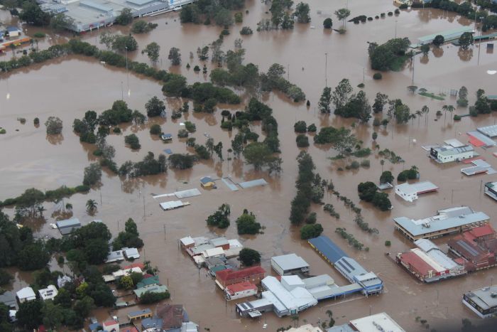
Commercial centre of Lismore Levee breached
It angers us that there is an increasing number of doubters who question that global warming is not a fact, who don’t believe humankind has an effect on the planet. Furthermore, we are dismayed when gazing aloft and see untold jet vapour trails, which might be only water vapour, but mark megatons of burnt fossil fuel, as do the tentacles of highways that encircle the planet emitting CO2 from burnt fossil fuels. All the while President elect of the most powerful and influential country on the planet claims global warming is a Chinese plot to undermine America’s power. Unbelievably the doubters are gaining strength with their mantra of jobs and growth over environment and sustainable living, encouraged by America’s President who had the temerity to appoint a skeptic of climate science as the administrator of the United States Environmental Protection Agency
![]() On the Brighter Side –
On the Brighter Side –
A step forward down here in world heritage Macquarie Harbour, where we have our own troubles with the farming of fish and the environment. The Good News is that a group of concerned locals who do not want to lose the area’s links to its historical past, Jack and Jude included, have formed a Wildcare Group called “Friends of Macquarie Harbour and Waterways.”
WHAT WE DO
Our group works in partnership with the Parks and Wildlife Service (PWS), Forestry Tasmania, and landowners to help maintain the cultural and heritage tracks and infrastructure within Macquarie Harbour and its waterways.
WHERE WE WORK
Macquarie Harbour and waterways are located on Tasmania’s west coast with the hamlet of Strahan at its head. Macquarie Harbour is the second-largest natural harbour in Australia, six times the size of Sydney Harbour. However, its real glory is not its size, but its setting surrounded by rugged mountains, ancient forests, wild rivers, and fascinating histories of convicts, mining, huon piners, and hydro.
Macquarie Harbour is fed by many rivers, not least is the Gordon River within Tasmania’s pristine World Heritage Area. There are many hiking trails amidst rainforests abundant with wildlife, waterfalls and raging rivers. Kayaking is popular within these waterways.
Because of the wet windy nature of this iconic area, the many tracks to spectacular sights must be regularly maintained to allow safe passage. Our group will organise working bees to do this, generally in the summer and autumn months. These will be listed in the group’s calendar.
Over the last three years the group has located, tagged, and cleared the heritage Eagle Creek Track that was used in 1842 to transport Sir John and Lady Jane Franklin from Tasmania’s East to the Gordon River, then used again throughout the piners era and during hydro exploration. Maintaining this important link with the Franklin River is ongoing.

Hut at Sir John Falls
We are currently initiating a project to restore the 1970s hydro hut at Sir John Falls on the Gordon River to a safe comfortable level for ongoing public use. Funds will be required to undertake this work and the group is planning the project in consultation with PWS, funding bodies and other interested groups.
In addition, our group requires tools and protective clothing for which funds are sought. We have our own Wildcare website where you can find information on our planned events, join our group, and/or contribute funds.
OUR CONTACTS
President – Ronnie Morrison
Secretary – Jack Binder
 Longitude
Last night we watched a very good movie close to our hearts based on an excellent book by Dava Sobel called “Longitude.” It tells the story of how John Harrison developed the first really accurate ship’s clock that enabled sailors to determine their East/West position on Earth. You may remember that we were sextant sailors for a couple of decades, and navigated thousands of miles around the world using time to determine our longitude. Doing this not only saved us from countless dangers, it also put us in contact with Earth and the universe. Swinging a sextant, measuring the sun or star’s angle to the horizon countless times during years at sea made the heavens our intimate friend. We can still tell which way we are travelling, and even the time, by simply gazing up to the heavens.
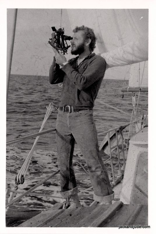
Younger, trim, and dark hair
Jude and I were intrigued to see John Harrison’s genius use layers of compensating devices in his first clock’s mechanisms to correct anomalies and achieve a better result. But, although his first clock was more accurate than other clocks of its time, it failed, being too reliant on those layers upon layers upon layers of fixes. Sound familiar? Like the way we govern ourselves? Harrison did wise up though; starting afresh with what he had learnt, to go on and design three further clocks. The fourth, and smallest, was so accurate that Britain could safely navigate anywhere in the world, and as a result, entered a new age as the greatest maritime nation.
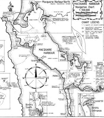
Macquarie Harbour chart by Trevor Norton
Voyage of Inspection
After forming this new Wildcare group, Jack and Jude set off on a voyage around Macquarie Harbour and Gordon River to inspect the many tracks that we might be maintaining. A few weeks ago, when a fine northerly wind was forecast, we stowed our chattels and sailed for the wilderness down harbour, losing contact with the world within the first hours. That night, secluded in Farm Cove under the mighty Mount Sorell, we watched a southerly front clobber the mountain.
Drone flight over Kelly Basin, the most remote ex-bustling-town in the world. Once, for a short time, an export port for West Coast Tasmanian Copper, today succumb to ferns, vines and rare trees of the wet rain forest. A beautiful spectacle of Nature taking back what man tried to achieve.
Then when glorious sunshine returned, we shifted next door to Kelly Basin to walk the fabulous Bird River track with friends Rob and Lou from the good ship Zeehan. The Bird River track is one of Tasmania’s sixty best short walks and is famous because the walk runs upon the bed of a railway, built circa 1900 to bring copper out of the North Mount Lyell mine near present day Queenstown. Two towns graced these shores and many relics remain of once busy East and West Pillinger, which only existed for a rather short time. Today lush forests have reclaimed the land. It was a fabulous sunny day, so we packed a picnic lunch then tramped up that rainforest stream under a thick green canopy, noting that much of the bracken near the start needs a tidy up before someone unknowingly trips over the maze of surface roots.

Bird River Track about 5 km on ex-rail bed along rainforest creek

Bird River – pushing through the bracken
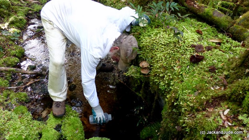
A few days later, we sailed to the Gordon River mouth then continued ten miles upstream to Eagle Creek, where early the next day, Jude and I trekked up the equally famous Eagle Creek track that was used to transport Governor Franklin and his wife from the east coast in 1842. It’s an arduous climb rising 400 metres and easy to lose one’s way through wet forests well decorated by marvellously coloured fungi. The first lower bit, which is the most walked, needs to be cleaned up and remarked. And the climb following this has a few larger trees fallen across the way. Where the track comes out into the open under the Elliot Range, the bauera and razor grass is flourishing, and the many bauera fingers are intertwining through the razor grass, making nasty obstacles. Clearing this back is essential as it’s presently hard to figure out which way to go. Oddly, our pink and red tapes marking the route seem to be fancied by the birds. A lot have been pecked off, their remains lying on the ground. Maybe the birds are trying to tell us they don’t want human interference in their world.
Eagle Creek walk – about 5 km to plateau
We still had marvellous sunny weather, actually too hot out in the open, which made the twenty-mile motor upriver past forested slopes and through gorges filled with reflections a glorious treat. At the furthest reach that a keeled boat can navigate, the Gordon narrows to a very steep gorge that keeps the sun out for most of the day, and, as the waters’ source is nearing the high country, they’re freezing cold. Banyandah soon became a floating refrigerator.
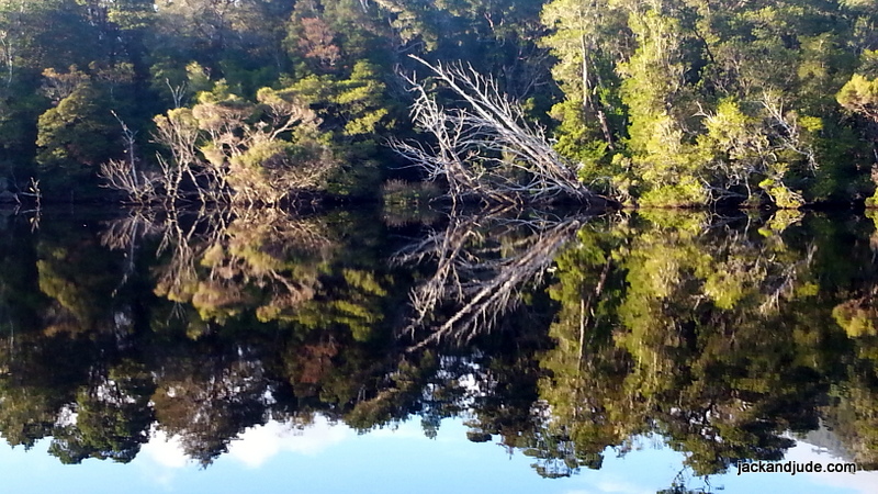
Gordon River reflections
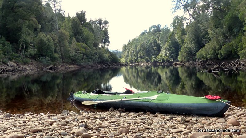
The first day we had the whole Sir Johns Falls area entirely to ourselves and launched the Green Machine to paddle up to the confluence with the Franklin River, paddling right past where the “Gordon below Franklin Dam” was to have been sited. Tasmania Hydro, after last year’s debacle of running out of water in the Gordon Dam at Strathgordon, has been keeping the gates tightly shut this year. Therefore, there was negligible flow, making the paddle easy-peasy through some of the world’s best scenery.
Pyramid Island – Confluence of Franklin and Gordon Rivers
Some of ground we’ve explored
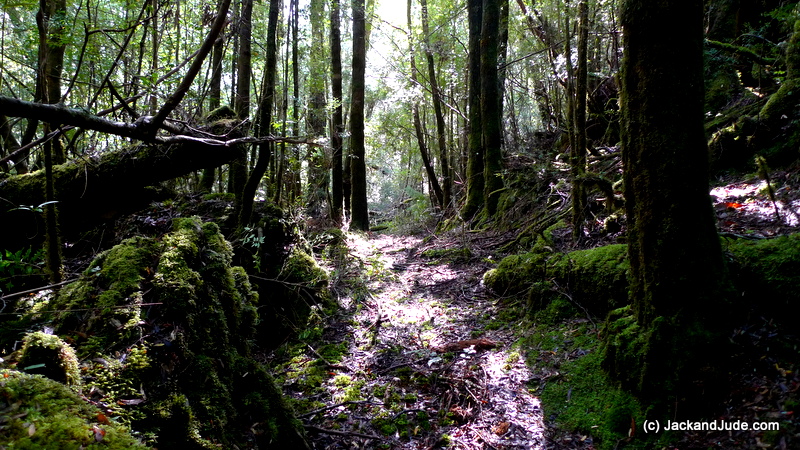
That evening, Trevor arrived with the Stormbreaker to pick up a group of rafters, and he brought along a care package for us containing mail and extra food. It’s great having mates who look after you. When he shoved off next morning at dawn, we slipped into the Sir John Falls wharf and wandered up for a bit of inspiration under the falls. While there, another vessel arrived, one we’d met in Eden, so we hunkered down with them to catch up over a cuppa, then a bite of lunch before heading with them over to the old Forestry house site to walk up the Goulds Track. This historically important route, which is maybe the most important and well used of all the forest tracks, is just so delightful. Cut in 1862 by Charles Gould and his crew, it linked Tasmania’s East Coast with the wild West Coast, so that miners and explorers could find wealth that would sustain the new colony. It was later used by the Huon Piners to get supplies to the upper reaches of the Gordon and then again by Tasmanian Hydro, who established a base camp up river to study water flows. But when this area was declared a national park, the cart wide track was quickly hidden by growth. There simply hasn’t been enough funding for Parks to maintain it. We’d not walked it since last summer and were super pleased to see how clear it had remained.
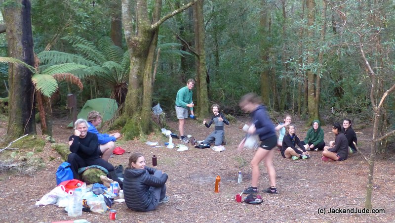
Launceston Grammar School Outing
On the day we’d arrived, the Launceston Grammar School had been there on an outing by kayaks and had walked the first easy kilometres, and when we talked to the kids, they were bubbling with excitement over such a wonderful exposure to the South West World Heritage wet forests. Many variety of trees line the old shoe road that this area is famous for – Huon pine, King Billy, Celery Top and Sassafras to name a few, plus vines, mushrooms, laurels, ferns, with very few demons like razor grass. It’s simply a very lovely walk in a park.
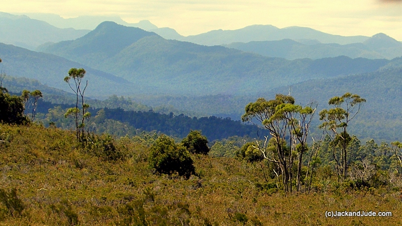
The lovely Franklin Gordon Wild Rivers National Park
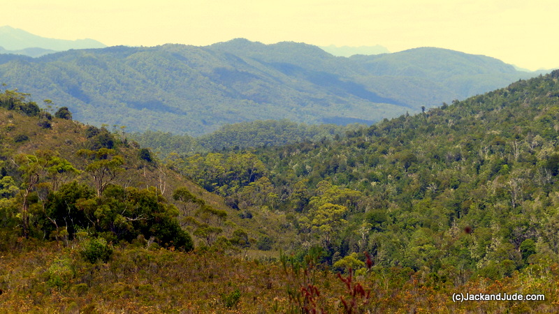
Looking down Sandstone Creek towards the Sprent River
Alas, that was the last of the nice days. Guess we’d used up our quota because the rains began next morning, and while the forest came alive in glorious exuberant colours, it got very cold and wet. After four days boat bound, at the same time Cyclone Debbie hit the Queensland coast, and our little shack came under its cross-sights, it was time to return to communications. But we’ll be back up there for another dose of pure Nature, you can bet on that.

a few of the adventurous people we met

Kayak camping up the Gordon. Using tourist boat from Strahan to Heritage Landing
Recent Blogs:
Feb ’22 ~ Eden to Hells Gate
Jan ’17 ~ Tiring turbulent times
Jan ’17 ~ Something to Ponder
Dec ’16 ~ Santa Claus
Dec ’16 ~ Christmas with a Thousand
I am in envy of your adventures….Such rewarding and satisfying lives you two live! Good lord, master’s and commander’s. Your adventures are never far from my thought’s, I’m totally envious, one day, yes one day…….
Aaron
Thanks Aaron, It’s a real pleasure to provide a bit of inspiration while at the same time getting heaps out of life – bonds Jude and I as soul mates, lovers and good friends. At the same time we are trying to give back something to our community and planet for providing these wonderful opportunities and our good health.
Cheers,
Hi Jack and Jude
Great blog and really enjoyed your video on Macquarie harbour.
Reggae is still in Port Arthur awaiting competition engine rebuild, may next season might try the west coast.
Will talk to my mates about your wildness group.Warren
Hi Warren – This new Wildcare Group will be having Field Days maintaining hard to reach tracks. Good opportunity for those who enjoy the wilderness.
Great to read of your adventures, hope to head to Tassie end of this year, you have inspired us no end. Presently awaiting better weather before heading North from Yamba on our ketch, Rhumbalara. Reside near Evans Head, so have been in the thick of the weather as a result of cyclone Debbie, I reckon your ‘shack’ at South Ballina should be OK. Regards stay safe.
Hello Mike and Lyn, always happy to meet neighbors 🙂 and hear good news regarding our shack. Poor Lismore – What a catastrophe! Swamped after building the dyke to prevent just this. We should have a coffee sometime this winter – unless of course you’re enjoying the warm Qld sun!