 We have just returned from living two weeks in a fridge at Sir John Falls in the upper Gordon. More on that in a moment. But first, Australia’s east coast has just been hit by cyclone Debbie, a massive category four system that gained power and moisture crossing the hot Coral Sea. After its destructive winds nearly levelled the towns of Airlie Beach and Bowen, stranding thousands without food, electricity or a means of escape, the still powerful and very wet rain depression moved south, flooding the capital city of Brisbane before setting its sights on Northern New South Wales. That’s where it dropped 500 mm (20”) overnight near our shack on the Richmond River. Our chief commercial town of Lismore was severely hit when the floodwaters breached the levee built a dozen years ago to prevent future flooding. As a result, the downtown area was engulfed in several metres of water. Further afield, homes and farms were flooded, animals affected, entire communities put to risk. In Queensland, more than a 100,000 homes were left without power, with little food and no refrigeration, no means to cook; little ones traumatized and put in fear of losing life. These massive waters are now flooding downstream, further destroying property and infrastructure, maybe even our little shack. Time will tell.
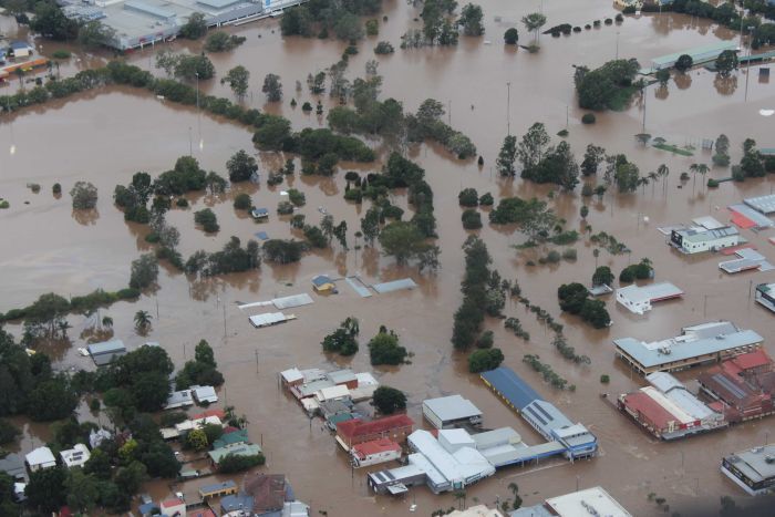
Commercial centre of Lismore Levee breached
It angers us that there is an increasing number of doubters who question that global warming is not a fact, who don’t believe humankind has an effect on the planet. Furthermore, we are dismayed when gazing aloft and see untold jet vapour trails, which might be only water vapour, but mark megatons of burnt fossil fuel, as do the tentacles of highways that encircle the planet emitting CO2 from burnt fossil fuels. All the while President elect of the most powerful and influential country on the planet claims global warming is a Chinese plot to undermine America’s power. Unbelievably the doubters are gaining strength with their mantra of jobs and growth over environment and sustainable living, encouraged by America’s President who had the temerity to appoint a skeptic of climate science as the administrator of the United States Environmental Protection Agency
![]() On the Brighter Side –
On the Brighter Side –
A step forward down here in world heritage Macquarie Harbour, where we have our own troubles with the farming of fish and the environment. The Good News is that a group of concerned locals who do not want to lose the area’s links to its historical past, Jack and Jude included, have formed a Wildcare Group called “Friends of Macquarie Harbour and Waterways.”
WHAT WE DO
Our group works in partnership with the Parks and Wildlife Service (PWS), Forestry Tasmania, and landowners to help maintain the cultural and heritage tracks and infrastructure within Macquarie Harbour and its waterways.
WHERE WE WORK
Macquarie Harbour and waterways are located on Tasmania’s west coast with the hamlet of Strahan at its head. Macquarie Harbour is the second-largest natural harbour in Australia, six times the size of Sydney Harbour. However, its real glory is not its size, but its setting surrounded by rugged mountains, ancient forests, wild rivers, and fascinating histories of convicts, mining, huon piners, and hydro.
Macquarie Harbour is fed by many rivers, not least is the Gordon River within Tasmania’s pristine World Heritage Area. There are many hiking trails amidst rainforests abundant with wildlife, waterfalls and raging rivers. Kayaking is popular within these waterways.
Because of the wet windy nature of this iconic area, the many tracks to spectacular sights must be regularly maintained to allow safe passage. Our group will organise working bees to do this, generally in the summer and autumn months. These will be listed in the group’s calendar.
Over the last three years the group has located, tagged, and cleared the heritage Eagle Creek Track that was used in 1842 to transport Sir John and Lady Jane Franklin from Tasmania’s East to the Gordon River, then used again throughout the piners era and during hydro exploration. Maintaining this important link with the Franklin River is ongoing.

Hut at Sir John Falls
We are currently initiating a project to restore the 1970s hydro hut at Sir John Falls on the Gordon River to a safe comfortable level for ongoing public use. Funds will be required to undertake this work and the group is planning the project in consultation with PWS, funding bodies and other interested groups.
In addition, our group requires tools and protective clothing for which funds are sought. We have our own Wildcare website where you can find information on our planned events, join our group, and/or contribute funds.
OUR CONTACTS
President – Ronnie Morrison
Secretary – Jack Binder captain.jack@jackandjude.com
 Longitude
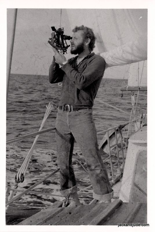
Last night we watched a very good movie close to our hearts based on an excellent book by Dava Sobel called “Longitude.” It tells the story of how John Harrison developed the first really accurate ship’s clock that enabled sailors to determine their East/West position on Earth. You may remember that we were sextant sailors for a couple of decades, and navigated thousands of miles around the world using time to determine our longitude. Doing this not only saved us from countless dangers, it also put us in contact with Earth and the universe. Swinging a sextant, measuring the sun or star’s angle to the horizon countless times during years at sea made the heavens our intimate friend. We can still tell which way we are travelling, and even the time, by simply gazing up to the heavens.
Younger, trim, and dark hair
Jude and I were intrigued to see John Harrison’s genius use layers of compensating devices in his first clock’s mechanisms to correct anomalies and achieve a better result. But, although his first clock was more accurate than other clocks of its time, it failed, being too reliant on those layers upon layers upon layers of fixes. Sound familiar? Like the way we govern ourselves? Harrison did wise up though; starting afresh with what he had learnt, to go on and design three further clocks. The fourth, and smallest, was so accurate that Britain could safely navigate anywhere in the world, and as a result, entered a new age as the greatest maritime nation.
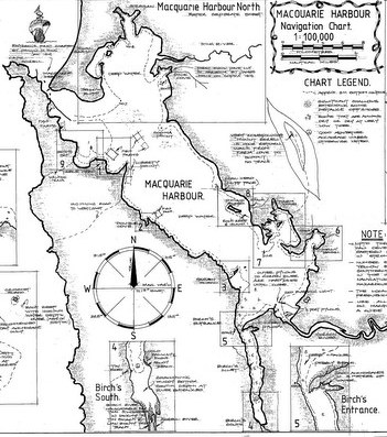
Macquarie Harbour chart by Trevor Norton
Voyage of Inspection
After forming this new Wildcare group, Jack and Jude set off on a voyage around Macquarie Harbour and Gordon River to inspect the many tracks that we might be maintaining. A few weeks ago, when a fine northerly wind was forecast, we stowed our chattels and sailed for the wilderness down harbour, losing contact with the world within the first hours. That night, secluded in Farm Cove under the mighty Mount Sorell, we watched a southerly front clobber the mountain. Then when glorious sunshine returned, we shifted next door to Kelly Basin to walk the fabulous Bird River track with friends Rob and Lou from the good ship Zeehan. The Bird River track is one of Tasmania’s sixty best short walks and is famous because the walk runs upon the bed of a railway, built circa 1900 to bring copper out of the North Mount Lyell mine near present day Queenstown. Two towns graced these shores and many relics remain of once busy East and West Pillinger, which only existed for a rather short time. Today lush forests have reclaimed the land. It was a fabulous sunny day, so we packed a picnic lunch then tramped up that rainforest stream under a thick green canopy, noting that much of the bracken near the start needs a tidy up before someone unknowingly trips over the maze of surface roots.

Bird River Track about 5 km on ex-rail bed along rainforest creek

Bird River – pushing through the bracken
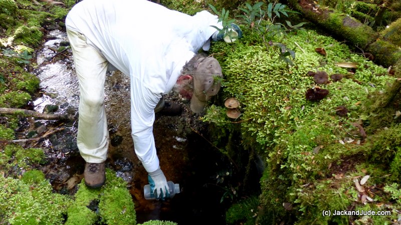
A few days later, we sailed to the Gordon River mouth then continued ten miles upstream to Eagle Creek, where early the next day, Jude and I trekked up the equally famous Eagle Creek track that was used to transport Governor Franklin and his wife from the east coast in 1842. It’s an arduous climb rising 400 metres and easy to lose one’s way through wet forests well decorated by marvellously coloured fungi. The first lower bit, which is the most walked, needs to be cleaned up and remarked. And the climb following this has a few larger trees fallen across the way. Where the track comes out into the open under the Elliot Range, the bauera and razor grass is flourishing, and the many bauera fingers are intertwining through the razor grass, making nasty obstacles. Clearing this back is essential as it’s presently hard to figure out which way to go. Oddly, our pink and red tapes marking the route seem to be fancied by the birds. A lot have been pecked off, their remains lying on the ground. Maybe the birds are trying to tell us they don’t want human interference in their world.
Eagle Creek walk – about 5 km to plateau
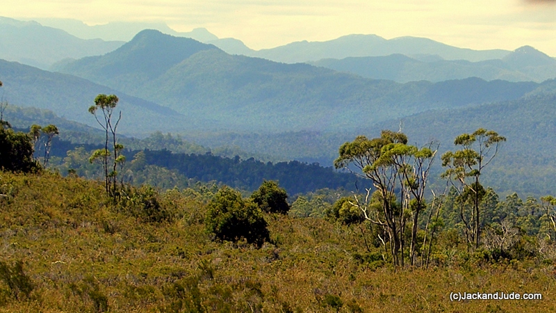
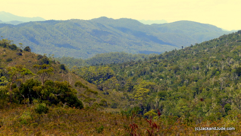
We still had marvellous sunny weather, actually too hot out in the open, which made the twenty-mile motor upriver past forested slopes and through gorges filled with reflections a glorious treat. At the furthest reach that a keeled boat can navigate, the Gordon narrows to a very steep gorge that keeps the sun out for most of the day, and, as the waters’ source is nearing the high country, they’re freezing cold. Banyandah soon became a floating refrigerator.
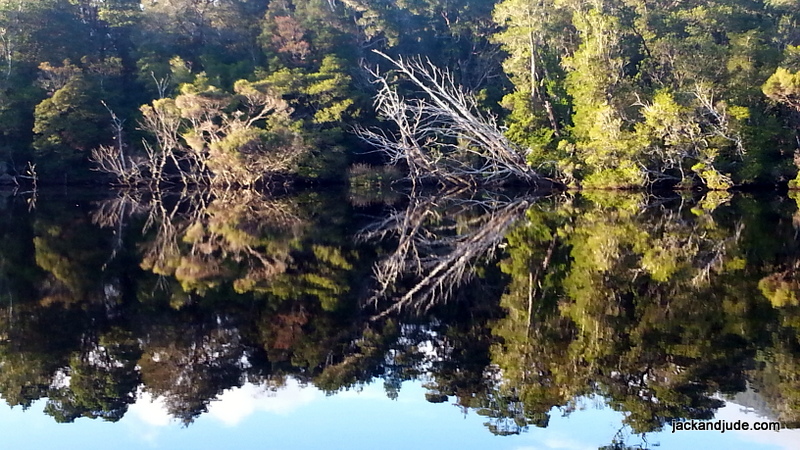
Gordon River reflections
The first day we had the whole Sir Johns Falls area entirely to ourselves and launched the Green Machine to paddle up to the confluence with the Franklin River, paddling right past where the “Gordon below Franklin Dam” was to have been sited. Tasmania Hydro, after last year’s debacle of running out of water in the Gordon Dam at Strathgordon, has been keeping the gates tightly shut this year. Therefore, there was negligible flow, making the paddle easy-peasy through some of the world’s best scenery.
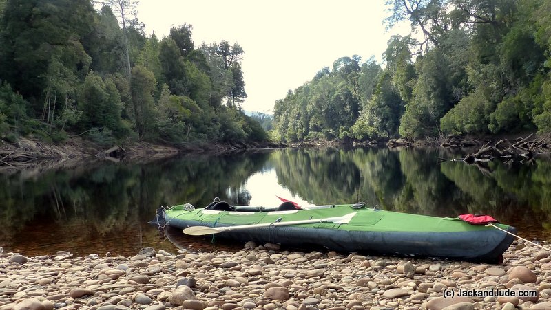
Pyramid Island – Confluence of Franklin and Gordon Rivers
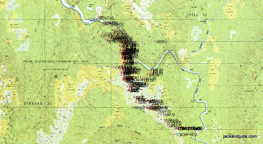
Some of ground we’ve explored
That evening, Trevor arrived with the Stormbreaker to pick up a group of rafters, and he brought along a care package for us containing mail and extra food. It’s great having mates who look after you. When he shoved off next morning at dawn, we slipped into the Sir John Falls wharf and wandered up for a bit of inspiration under the falls. While there, another vessel arrived, one we’d met in Eden, so we hunkered down with them to catch up over a cuppa, then a bite of lunch before heading with them over to the old Forestry house site to walk up the Goulds Track. This historically important route, which is maybe the most important and well used of all the forest tracks, is just so delightful. Cut in 1862 by Charles Gould and his crew, it linked Tasmania’s East Coast with the wild West Coast, so that miners and explorers could find wealth that would sustain the new colony. It was later used by the Huon Piners to get supplies to the upper reaches of the Gordon and then again by Tasmanian Hydro, who established a base camp up river to study water flows. But when this area was declared a national park, the cart wide track was quickly hidden by growth. There simply hasn’t been enough funding for Parks to maintain it. We’d not walked it since last summer and were super pleased to see how clear it had remained.
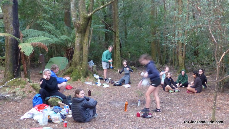
Launceston Grammar School Outing
On the day we’d arrived, the Launceston Grammar School had been there on an outing by kayaks and had walked the first easy kilometres, and when we talked to the kids, they were bubbling with excitement over such a wonderful exposure to the South West World Heritage wet forests. Many variety of trees line the old shoe road that this area is famous for – Huon pine, King Billy, Celery Top and Sassafras to name a few, plus vines, mushrooms, laurels, ferns, with very few demons like razor grass. It’s simply a very lovely walk in a park.
The lovely Franklin Gordon Wild Rivers National Park
Looking down Sandstone Creek towards the Sprent River
Alas, that was the last of the nice days. Guess we’d used up our quota because the rains began next morning, and while the forest came alive in glorious exuberant colours, it got very cold and wet. After four days boat bound, at the same time Cyclone Debbie hit the Queensland coast, and our little shack came under its cross-sights, it was time to return to communications. But we’ll be back up there for another dose of pure Nature, you can bet on that.

a few of the adventurous people we met

Kayak camping up the Gordon. Using tourist boat from Strahan to Heritage Landing