Blog of Jack and Jude
explorers, photographers, authors
April 2015 March 2015 >>
Continuing The Hunt
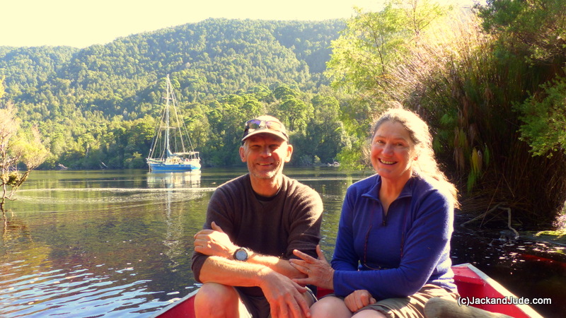
For a week after returning to Mill Bay, we fretted over what to do. Jude’s big birthday fast approached, and still the weather was bad, 27 days with rain out of 30. Should we start sailing back towards the mainland, hoping for better weather? Or should we celebrate her special day with west coast friends? If we stayed in town, a ride over the area we’d recently explored was a slim possibility. Then we might discover if the bridge we imagined seeing in satellite photos really existed. Or maybe we should sail back up the Gordon to continue searching for the bridge believed to lie along the historical Gould Track. All one night, what to do raced round my head.
 Next morning a lovely high-pressure cell centred itself over the Great Australian Bight, and as if normal weather had returned, several fine days were coming. Throwing up our hands in disbelief, there was even a northerly breeze for a sail down harbour, and since we were already re-provisioned, the unanimous call was easily made. In quick order the mooring lines were cast off for our return to paradise to solve the mystery of the Goulds Track Bridge. Did it exist? We sure as heck were going to discover that upon pain of further cuts and bruises and a lot more hard work.
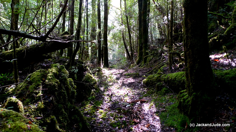
Just two weeks earlier we had hunted down fragments of the historical track that piners had used to haul their supplies to the upper reaches of the forest. But sixty years of regrowth had heavily disguised the shoe road carved out of virgin rainforest. Nevertheless, its telltale half-round furrow could be seen by experienced trackers and we had successfully followed its remains for nearly a kilometre before a massive tree fall at a collection of trailheads had sent us into oblivion. After that, in heavy, slow going thick understory, we never got closer than 1.5 km to a bridge that may or may not exist, before jelly legs and the tick-tock of time sent us searching for an easier out. Our route home that day miraculously turned up a pale yellow tin diamond with a faded red circle nailed to a tree, the sign of Tasmanian Hydro who had also used that historic track in the 1960s. Fatigued beyond belief we never really knew how we had rejoined the main track back to the old homestead site, it just melded into our way home. So, our first goal this time would be to find how the first part of the Goulds Landing track connected to the on-going one.
Gould’s Landing was named after Tasmania’s first Geological Surveyor, Charles Gould (1834-1893), who cut the original track in three expeditions into western Tasmania in the 1860s. Born in England, he landed in Hobart Town a strong young man of twenty-five to conduct surveys covering much of the colony for the princely sum of six hundred pounds a year. He added greatly to the geographical knowledge of western Tasmania. His peculiarity was naming peaks along the West Coast Range after contemporary English scientists like Darwin and Owen. The taller named after critics of Charles Darwin, the smaller after his supporters.
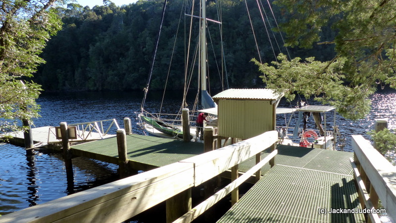
By mid morning April Fools Day, Banyandah once again lay serenely alongside Sir John Falls dock with a brilliant blue sky overhead, and us, in full wilderness garb, very much alone in one of the world’s most scenic wild rivers. The shallow rain event due a bit later sent us quickly climbing the steep Goulds Landing track to the start of the old shoe road both of us chuckling. The transformation from walking paved streets and hearing noisy machines improving the road to the new fish depot, to weaving and bobbing under tree limbs through a rugged forest had taken just one short day and night.
The first part of the track now visually clear was a delight to walk upon while imagining the horses hauling chaff along it. The going was easy like a walk in the park with compressed vegetation underfoot, carpeted by brown myrtle leaf litter. About two hundred metres along we began noticing that the tree fall across the track had been broken off, small branches snapped by people pushing through. Straight to mind popped the Launceston schoolchildren who we had met two weeks earlier ferrying themselves across Cataract Creek to gain access to the Goulds Landing homestead. Seeing the start of the shoe road quite visible, they probably could not have resisted rushing curiously ahead, ten of them clearing the way for others. What a natural playground. A living classroom surrounded by magical sights. They would have seen trees cohabitating, living together in a riotous mess; one falls down and, oh well, the others simply grow around it and continue on living. No complaining, just getting on with life, a tolerance between them. Wouldn’t it be wonderful if man could live like that?

Myrtle Leaves (Nothofagus cunninghamii)
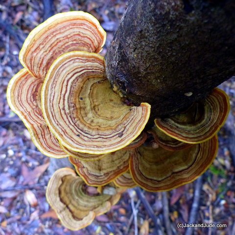
Knowing we’d be walking this route several times, as we went along we snapped off dead limbs lying across the track and shoved rotten trunks aside to make the route safer for us, and for those that might want to take the journey into this fabulous rainforest. As we did, the jumbled mess became a sublime platter of Nature. Close around us was such a wonderful mass of trees and scrubs. Amongst them Sassafras, their gloriously shiny lance-shaped leaves, which have a saw tooth edge, adorn trees that can grow to 45 metres tall and 150–200 years old. Its light grey to brown bark contains tannin and essential oils that smells strongly of cinnamon. Some think the piners harvested every Huon Pine, the prince of Tasmanian timbers, but everywhere along the track there were Huon Pines from tiny tots a decade old to ones growing for centuries. Averaging just a millimetre growth in girth a year, their drooping light green foliage made up of tiny scale-like leaves spirally arranged on twigs are easily spotted. Myrtles, the predominant specie in Tasmania’s cool temperate rainforests, were seen wherever we looked. In fact their leaves carpeted the forest floor in an amazing collage of red through to yellow colours. On Myrtles, new spring growth is red to bronze which develops into a glossy green leaf that becomes thick and stiff as they age, producing a dark green shade. Their millions of small leaves grow to about the size of triangular shaped confetti with a coarse tooth edge.

Sassafras and Huon Pine amongst our Nature’s treasures
Within half an hour, we were up to what we had dubbed ‘three ways,’ where three vague tracks lead away in different directions. It was at that point the first time that we’d come unstuck by taking the central track, so this time we spent time investigating the left track looking for telltale signs to confirm that we had indeed returned on that track.
Back again the next day we followed the left hand shoe road and re-found the hydro sign then continued on, breaking through or climbing round tree falls, clearing dead vegetation aside and marking with pink tape as we went. Slow going, we only managed to add another 500 m before being stopped by a huge Huon Pine fallen across the track. This became day two’s turn around point. When checking its GPS position that night we were still well short of the furthest point we’d been previously.
It shook so much, he feared it would fall into the pool far below.
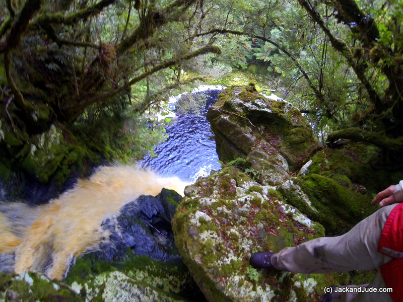
After two days of clearing and marking, a welcome drop of rain kept us in bed purring cuddled up. When the mist lifted, a leisurely climb to the top of Sir John Falls over the recently cleared track put Jack in Sir John’s seat at the edge of the drop off with bright amber water flowing over beautiful mossy rocks. But it shook. So much he feared it would fall into the pool far below.
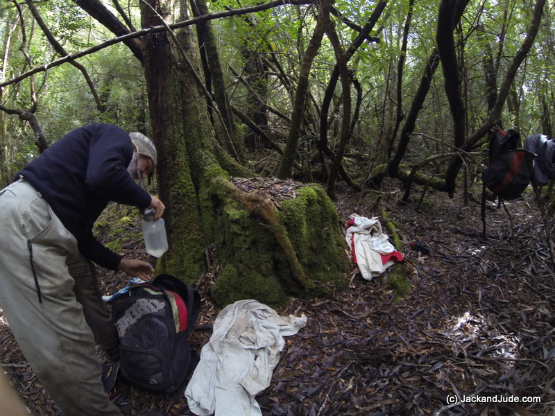
Easter Saturday was another fine weather day and we were off the boat early, keen to make an intensive effort to reach the button grass plains and find the elusive bridge. In the lead, this bush bashing is hard on Jack’s shins, which have little enough flesh after our earlier life exploring coral reefs. When it comes to looking after himself, he’s a bit dim witted, opting to just get on with it. But he must be getting a bit tired of bleeding shins because in a brain wave he made shin guards from camping mat foam held in place by soccer socks.
 In one hour, we were at the fallen Huon Pine and pushing around it. Then sighting the shoe-road at intervals, we forced our way round obstacles leaving pink tape as we went. With so much vegetation in our way, it was essential we left strategic markers so we could safely find our way home. Often Jack and I called to the other, the vegetation so thick we couldn’t see more than a few metres and our voices so muffled by the still forest that we found it best to use the bushman’s code, a simple ‘Cooee’ letting the other know we were okay. Relaying information often got confused until we came together. Ploughing ahead, Jack used a compass to not get turned around.
One of the grandest living Huon Pines we’ve ever seen
A tiny patch of glorious sunshine shining onto one of the grandest living Huon Pines we’ve ever seen called for an early lunch in a dry streambed. Then Jack climbed a nearby rise to see if he could sight the King Billy Range while marvellous thoughts filled my head. Had this pine been left for a rainy day? Or had it been too small to harvest?
After another hour of pushing through we were foiled again, but not before finding another hydro sign and two pieces of old red tape marking a route someone else had taken, plus a small trickle of flowing water, our first stream. Checking our map, medium forest with low dense vegetation lay a few hundred metres ahead. Would that be easier or more difficult to penetrate? Saturated with sweat, aching in legs and arms, with our bed at least two hours through darkening surrounds, we saw that our elusive bridge was still 1.5 km further on. So we tied one last tape and turned around. A wise decision. With some difficulty, we retraced our route through jungle, losing our way several frustrating times.
Three hours later, back on board at six-thirty with a mere hour of daylight up our sleeve, when plotting our last position we found that we were now 80 m further on from our furthest penetration, and more east. In discussing the possibility of yet another attempt, the long travelling time out and back would leave little time for further exploration, especially when the days are getting shorter. What was needed would be to take our camp with us and work from there. We’d found water so that wouldn’t be a problem. But before that, we needed time off.

Darkness falling, a rain shower threatens
On the smooth, river rumbled pebbles on Pyramid Island at the mouth of the Franklin
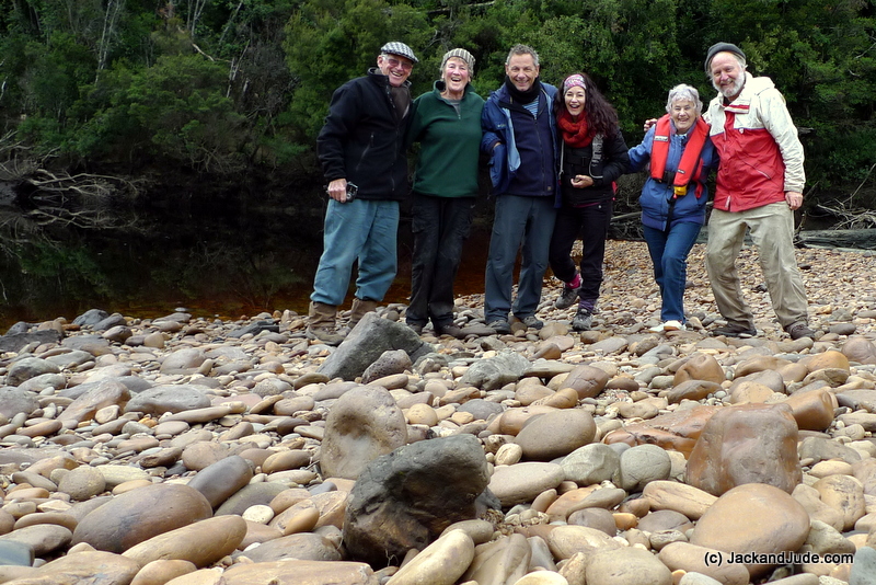
Max and Marie were up the Gordon in their yacht Fear Knot, tied to the trees in their usual spot upstream of Goulds Landing. Max rowed up just as Venus began to sparkle above the western ridge, saying that Geoff the sea-plane pilot had called out to him when preparing to take off, wondering if we were safe. Max and son in law Ian had then walked the shoe-road to the third hydro sign hoping to bump into us, but hadn’t.
On Easter Sunday, we took Little Red up the Gordon in company with Max and family, eating chocolate eggs on the smooth, river rumbled pebbles found on Pyramid Island at the mouth of the Franklin. The rivers were low, exposing earthen banks loaded with fallen tree and a few other surprises like a twisted wheelbarrow, and a black feline felon. Wonder how they got so far into the wild? Pushing on while the sun shone bright, we were lucky to reach the Gordon’s fourth set of rapids above the Franklin, knocking our prop only once when just scraping up the shallow river chutes.
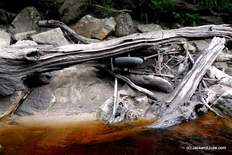
The rivers were low, exposing earthen banks loaded with fallen tree and a few other surprises like a twisted wheelbarrow
Seaplane Pilot Geoff transfers photos he took of our route
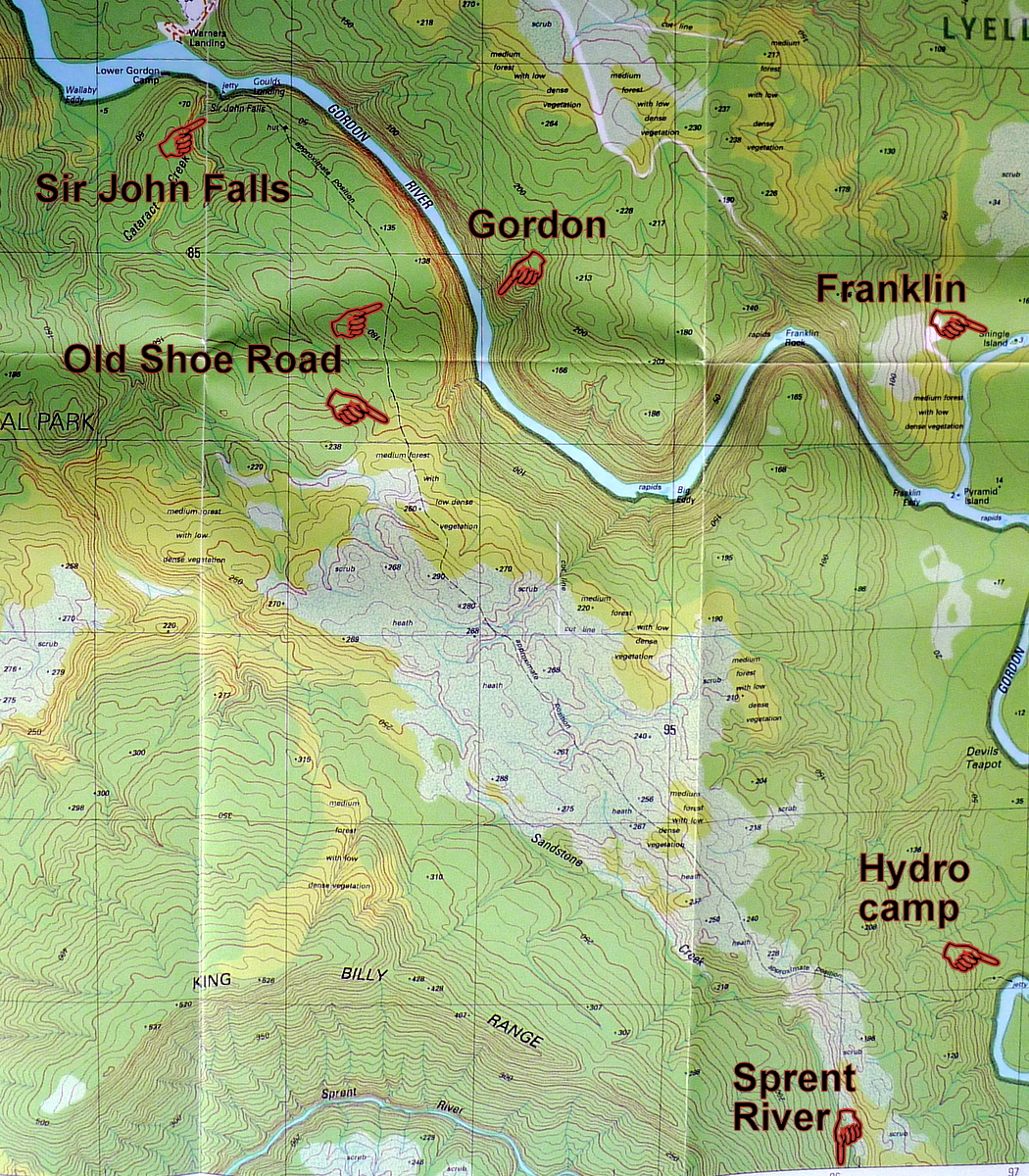
Max and family leaving for Birches Inlet left us alone again with our quandary as to whether we should take our camp in for a couple of nights. Fine weather was expected for the next few days. Seaplane Geoff helped us with our decision by taking photos of the button grass plains and of the creek that flows under the bridge we were hoping to find. It enters the Gordon at Big Eddy, a rocky bend twenty minutes upstream by tinny. Being only a kilometre of forest that way, we toyed with the idea of climbing up the side of this creek. It looked a tough climb.
The saying is you’re as old as you feel, but the reality is youth has strength while age has experience. We’ve taken on great challenges in our time. Most were a success, but the few failures were often scary, life threatening disasters. And so Jack and Jude have developed a creed. Be prepared; don’t make others risk their lives. A difficult decision lay before us.
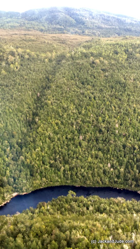
Up the left side of the creek to the button grass Photo by Seaplane Geoff
Although we had misty rain overnight, we were off Banyandah at first light, motoring up the Gordon to Big Eddy in Little Red. We had packed our day kits the night before and were making a run for it, the bridge just over a kilometre as the crow flies, but up a climb of 260 m in elevation through untouched primeval wilderness. Looking up as we landed on a tiny sandy beach, that’s not so much height was in our heads, the first part a gradient of one in three. Easy! The same as a route we take back home up and down Raspberry Ridge. After climbing over washed ashore logs we were swallowed up by a dark, silent world smelling sweet and dank. Straight away, the gods sent us a warning. Jack’s plotted GPS positions made no sense. While on Banyandah he’d entered a route up the highest points thinking they’d be the clearest, but his first pointed across the river, as did his second. Taking a deep breath, he lead off using his bush skills to find the path of least resistance and for the first hour, I was pretty buoyant about our progress.
Big Eddy climb of 260 m in elevation through untouched primeval wilderness
Giant, cascading tree ferns (Dicksonia antarctica) stealing all light infuse some people with ‘fern fever.’ But mixed with Gordon Lily (Blandfordia marginate) and Native laurel (Anopterus glandulosus) shining in gullies, and Pandani, the Queen of the Richeas, made this one of the most distinctive displays of Tasmanian flora. But be careful! Pandani demand respect. Their strap like leaves tapering to points that grow to a meter in length are finely serrated and can cut human skin. Young leaves are green, but as they age become dry and greyish brown and remain on the plant.
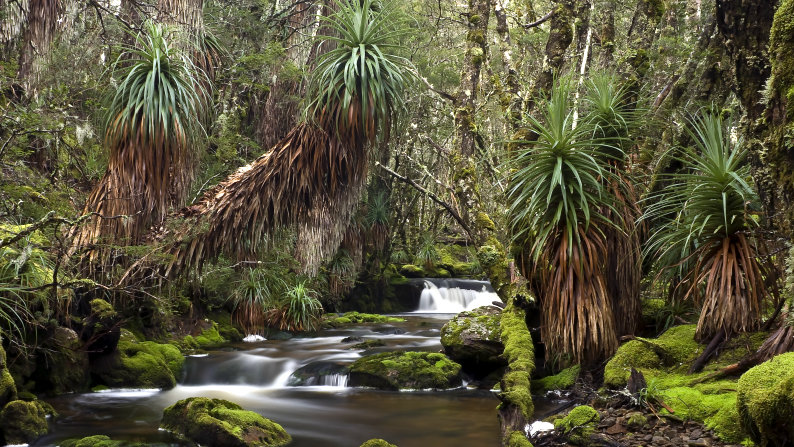
Pandani with serrated edged leaf
Tasmania has only one specie of Bauera (Bauera rubioides), and what a notorious pest it is. We dreaded running into it. It’s called wiry Bauera because it can form dense thickets several metres high decorated with trifoliate leaves and sessile leaflets so it appears to have whorled leaves. Sounds pretty, even innocuous, but it’s not. It’s insidious. A billion interwoven tiny branches form a nearly impenetrable net.
The climb up to 200 m went well and we were thinking that any minute we’d break free onto the button grass plains when we hit the wall of Bauera. At first we tore apart the strands to step forward a few centimetres, but our boots got tangled. The struggle never ended and our legs started to tire. When Jack fell after being tripped, he got up and threw himself bodily at the Bauera, forming a channel. When it was too high for that he got down on hands and knees to burrow through. I followed through the tube feeling glad to be still flexible, my loosely fitting pack sliding sideways so as not to get stuck. In two horrible hours, we barely gained another twenty metres in height. By noon, we were well into the open country shown on our map, but still totally encased in Nature’s prison and starting to cramp.
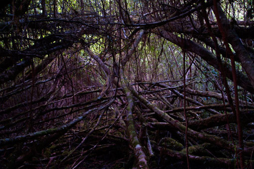
This is Horizontal – Bauera is finer and even more insiduous
Like prisoners granted last minute reprieves, we ran into a clump of button grass covered in Bauera. I’d like to say I strode after Jack through the channel that ran between other hip high clumps, and followed him onto wide-open plains. But it wasn’t quite like that. We had to place our feet carefully, in the unseen gaps between the clumps and then only got to a hillside of Manuka, close growing tea-tree, scratchy, but at least a bit more open. Swimming in sweat, we emerged onto open slopes with the King Billy Range in the distance and the creek bed running alongside us with our GPS telling us that only two hundred metres stood between our supposed bridge and us. But we could not see one, and the creek was steep and deep with not a hint of a shoe road. Two hundred metres sounds so little. Just down a slope and over a small hill. Now that had us pondering the map again. Our elusive little bridge could yet be around – over a different creek perhaps, twice as far away. How could we really tell!
Our elusive little bridge could yet be around – over a different creek perhaps, twice as far away. How could we really tell!
We sat on button grass clumps, stool high, eating lunch and feasting on the views. Our stream ran deep through a gully, a patch of button grass lay pale on the opposite hillside and the King Billy Range looked majestic. Even though we would not reach our goal, for good reason I felt quite elated sitting there in the sunshine. The view was splendid, not at all how I imagined. There were some slender eucalypts between the tea-tree and some grevillea. Yet the most striking contrast when emerging out the tall dark forest was the feeling of escape into the open. There was movement now. A breeze stirred the shrub and heath, and birds, mostly honeyeaters, were singing their heads off while flitting bush to tea-tree. The general forest green was out of sight too. Touches of flowers coloured the heath, yellow, white and creamy peach. Even the scent filling my nostrils was different.
It had taken five hours to reach this point, and only four remained until dusk. Picking up the GPS Jack started to rush across the small rugged hollow saying, as he does sometimes. ‘Stay where you are. Don’t move. I’ll be back in half an hour’, but he didn’t even get a boat length through the Manuka before turning back grimacing. “My legs just won’t do it.”
With no other real height to gain a better view, Jack gripped a button grass tussock to pull himself up then hooked himself into a small sugar gum. “No need to look any further,” he said smiling knowingly. “We’ve solved the riddle. There’s no bridge down there.” Sagely nodding his head a few minutes later, I knew the reason why.

An ancient giant. may have live for a couple thousand years
Many will think why? Why suffer such pain and hardship, and come out bush bruised and dinged? Well, by the time you read this I will have turned seventy. Crikey! I’ll be dead one day – who knows how or when but I don’t want to regret one minute. So far I’ve been fortunate living a glorious life filled with adventures, exploring Earth and being awed by her wonder. Yes, sometimes I’m frightened too. But each challenge has brought us greater skills to expand our endeavours. The sense of achievement quickly dulls the pain, while all my memories live forever in me. And just think of all the multitude of stories I can tell to inspire my grandchildren and anyone else that cares to listen.
Butler Island reflections from our kayak
March 2015
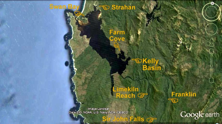
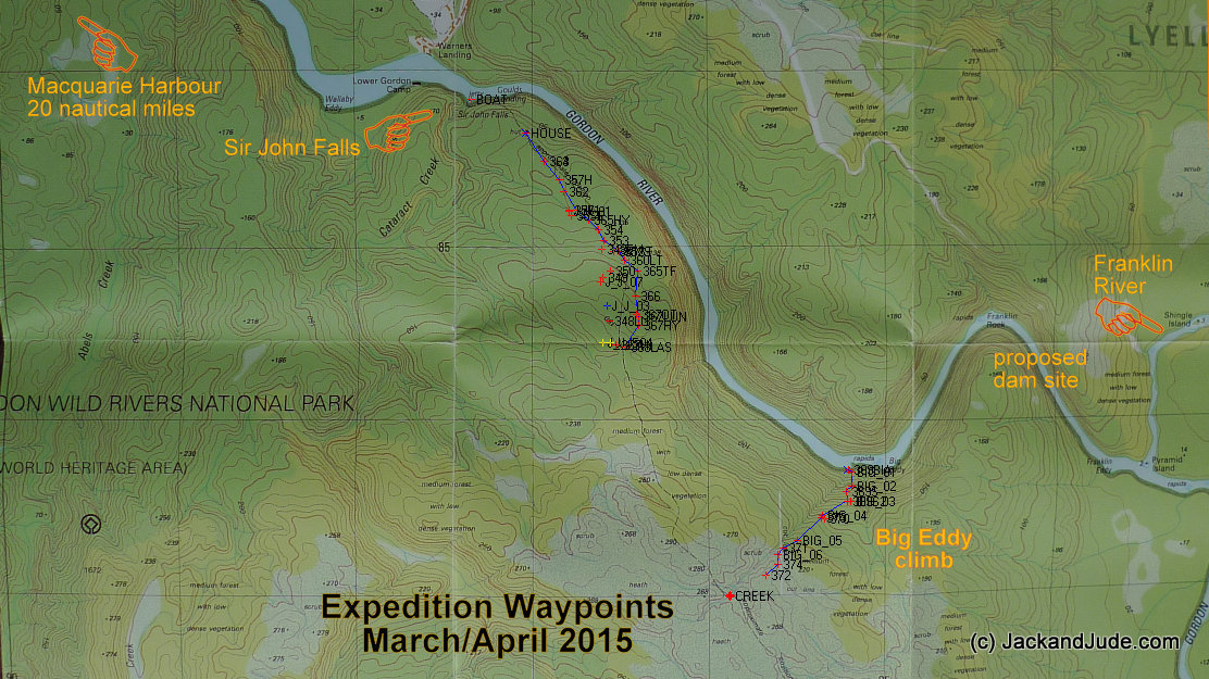
Macquarie Harbour and Gordon River, Tasmania
Search for Piner’s Shoe Road
 Bruce was a dreamer who was supposed to be our children’s teacher when we sailed for Africa many years ago. A horizon gazer, he’d sit for hours sublimely happy to just stare at the faraway blue line while distant thoughts filled his mind. He didn’t stay with us long. Instead, his short voyage on the Banyandah set him on a new direction through life.
Hopefully you will forgive me if the following sentences ramble or their construction is loose for we have been out in the wilds these past three weeks and I’m still connected to Earth in a rather feral fashion that requires little precision.
Early in March, stored up with fresh food and grog, under headsail alone we sailed from Mill Bay, a wonderfully secure hideaway next to the tiny hamlet of Strahan in western Tasmania. First stop, Swan Bay, a torturous place to enter but which boasts absolute security from Southern Ocean storms and the last connection to a phone tower before the communications abyss further down Macquarie Harbour. That night Jude chatted with her sister in England then we got an update on our house from neighbour Achim and both of us giggled with our grandkids before sailing into that abyss.
Although the weather of these past weeks has been less than perfect, in fact maybe because it was not, has added to our pleasure. Tasmania has experienced a poor summer, and autumn has carried on in the same vein of cold wet conditions. These conditions have been exacerbated by where we’ve been, ringside aboard Banyandah, horizon gazing on a world heritage river surrounded by tall mountainous rainforest draped in mist and sticky cloud. We’ve been lost in space, just the two of us looking for adventure with supplies enough to last forever or even longer if we made a few sacrifices.


Forestry Officer’s house, Goulds Landing circa 1939 The Department’s launch REGAL at the jetty
In addition to the beauty and solitude, we had come upriver on a mission. Years ago in the pining days there were various ways to get the logs to the river dependent on distance and available power. Early in the 1800s the convicts used rolling roads or the centipede system where gangs each side would carry a log. Later the piners used block and tackle when the trees grew near a river, but those logs that were further inland eventually brought teams of Clydesdale horses into this wild land. In the 1930s, towards the latter end of the pining era, the horses and supplies for the piners working the upper reaches of the Gordon were taken upstream aboard steamers to near the end of its navigable section where they were unloaded at Goulds Landing next to Sir John Falls. Residing in the house on the crown of the hill looking downstream a Forestry Commission officer recorded each log as it passed.
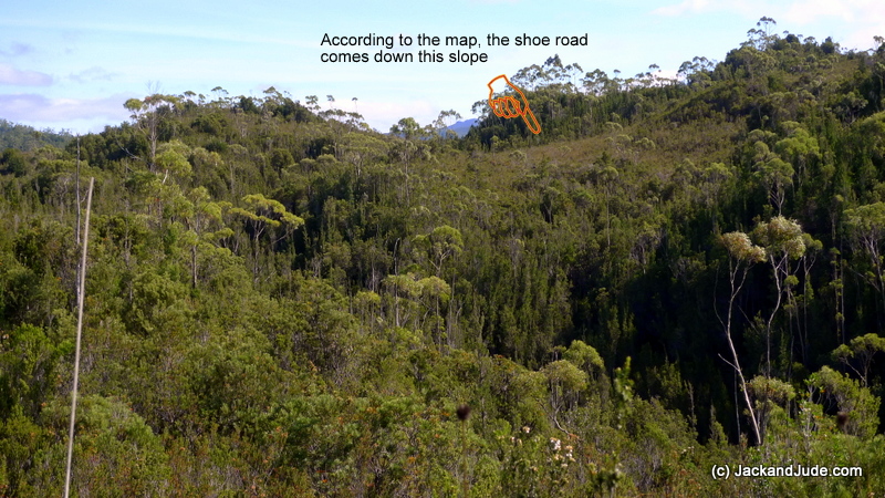
From Goulds Landing ran what is called a “Shoe Road” where the horses packed supplies to the upper reaches. This traffic wore a trench in the earth through what remained of the flattened forest, up to a buttongrass plain and then onwards to the Rocky Sprent River and Sandstone camp and further inland. In later years, The Hydro Electricity Commission used this track to bring supplies to their camp downstream of the Rocky Sprent. Today the forest has recovered lush and thick, but even now the remains of the shoe road in the buttongrass can be seen from satellites. Google Earth shows it clearly and it’s marked on the government topographical map as a dashed line.
Where the track crosses a ravine about three kilometres up from Goulds Landing, when we zoomed in close with Google Earth a vague shape of something like a bridge could be seen. The track runs up to it and then afterwards carries on across the buttongrass. The bridges made by the piners were mostly from Huon Pine and several still remain standing to this day. So we got wondering whether what we saw on the satellite image was another and got a hankering to reach it through the forest.
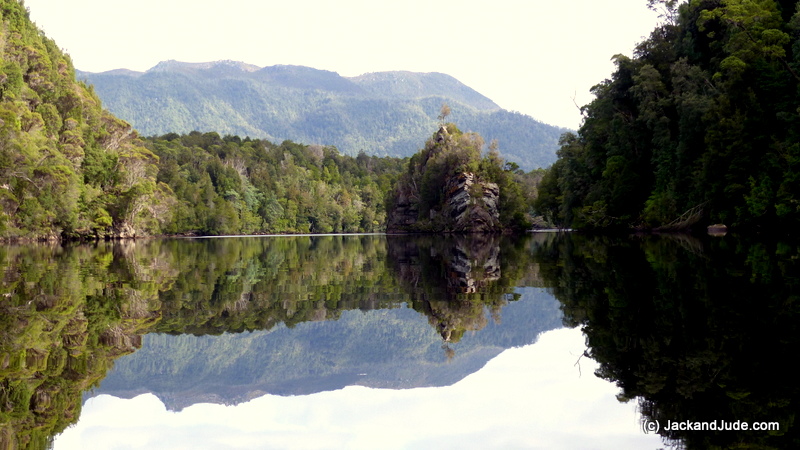
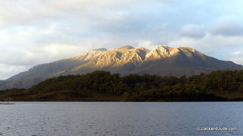
By some sort of miracle we sailed under brilliant sunshine from Swan Bay down to Farm Cove which has the most outstanding views of Mount Sorell. Entering that secure pocket of water the series of ghost white rocky peaks popped out the treeless buttongrass slopes, stark, hard, and majestic. No one witnessed our fast entry with Jack and Jude blissfully mastering what had become a boisterous blow knocking Banyandah about as she clawed upwind of Soldiers Island against white wavelets. Parking our lady after a magical sail past the increased numbers of fish farms we looked up and recalled our successful climb to Sorell’s peaks in 2012 after failing to reach the ridgeline our first attempt in 2009. To see that adventure and the superb views from atop a west Tasmanian mountain watch our Tasmania 1 DVD. While gazing upwards at those peaks, visions of bleached stunted trees tortured by countless wintry gales had us yearning to take a day walk up to the plateau to see again the splendid view over Macquarie Harbour and the mountains dominating it.
Mount Sorell – Tasmania 1 DVD features our climb to the peaks
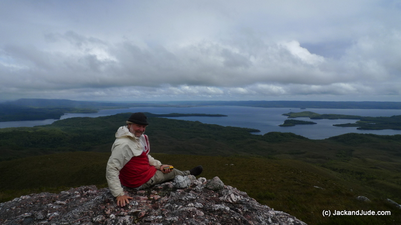
Farm Cove and Kelly Basin from the low Plateau
Without a fixed agenda the day after doing that we paddled the Green Machine around the cove’s shoreline spotting several species of ducks, a large flock of white billed coots and several nervous black swans who noisily took flight in pairs as we approached. Getting out at the narrow neck we took the short walk across to the harbour beach which disappointed us greatly. The beach facing the increased numbers of fish farms was littered with bits of plastic rope and pipe, and other manmade flotsam. Amazingly, we also found chunks of a yellow substance that floated and we wondered if we’d found pieces of amber.
Loving our freedom in the wide open space we sailed under headsail alone, leaving our rain awning stretched tightly atop the furled mainsail to shelter us from the frequent showers. Just a short sail around the headland and into Kelly Basin, plonking the anchor down under sail directly off Reindeer Lodge on a waypoint we’d made a few years earlier.
Bogies left from the North Lyle mine
The Bird River track starts from the eastern side of Kelly Basin at what was once the township of East Pillinger where in 1898 a railroad brought copper ore down from the North Mount Lyle Mine. Cut through thick rainforest by hardworking immigrants and work hungry locals, that railroad lasted a mere few years before the amalgamation of two mining companies saw the forest reclaim the land. Today the Bird River Track is on the easy rising railway bed through what is again splendid rainforest. Not even the threat of a rainsquall prevented us from enjoying that walk again, although we were disappointed that Parks had removed the picnic benches from alongside the scenic Bird River Bridge and rushing river. We found them instead several hundred metres up the road in the car park where there is neither a view nor sound of the beautiful river.
Surprising us, a feisty northwest wind sprang up the next day, and yes we were at it again. Love the headsail/awning combo that took us to the Gordon River mouth, then through the first gorge with a blustery wind astern producing high excitement all the way to where the river turns north. The last fifteen miles up to Sir John Falls we took in several easy day hops under engine. Who could be in a hurry when the inclement weather was perfect for gazing upon the mist shrouded mountains that were definitely not suited for trail blazing.
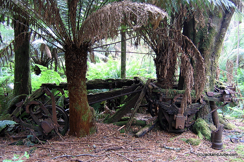
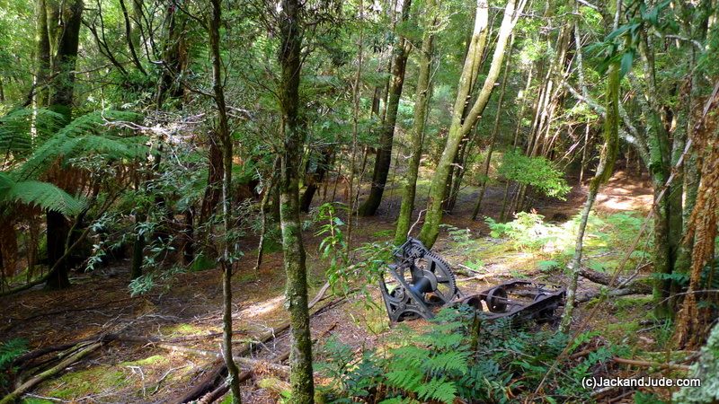
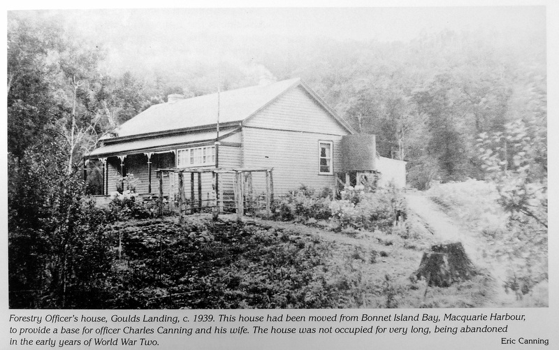 But given enough time, the weather gods gave us our moment. We gave the forest a day to dry out then on the second beautiful day we began our trek. Climbing out the dinghy through the tree limbs we followed the deteriorating track found directly across the stream from Sir John Falls to what remained of the forestry commission house. Reg Morrison had purchased it during the war when most of the pining had ended and floated it back to Strahan in pieces to use some parts to build the Morrison’s mill on the jetty at Strahan. In fact the iron on that mill once sat on the hill overlooking the Gordon above Goulds Landing. Today little remains of the house that once commanded a broad view down river. Just two collapsed fireplaces and a vibrant hydrangea bush full of flower, rather out of place in the dark landscape. Nearby, setting a great scene stands the rail trolley and hand winch used to pull loads up the hill from Goulds Landing.
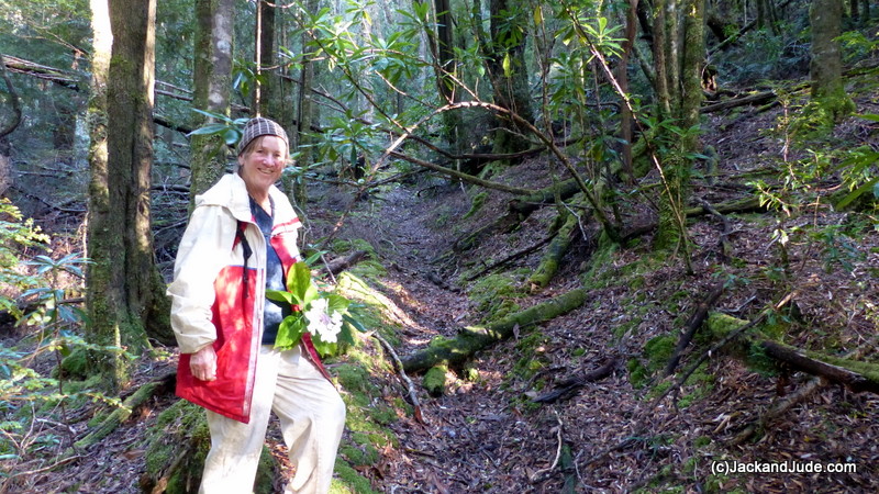
Jude at the start of the Shoe Road carrying a hydrangea blossom
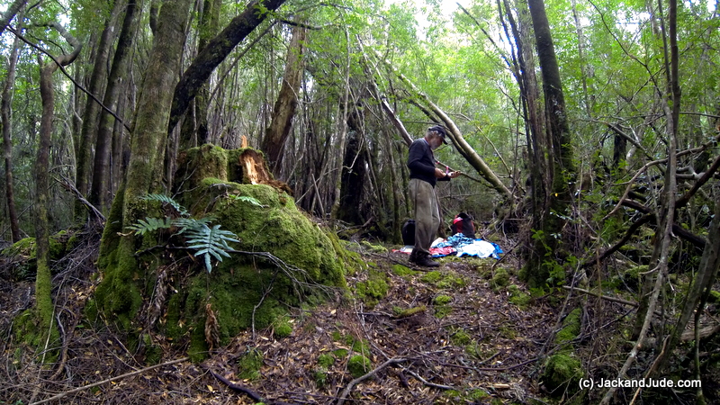
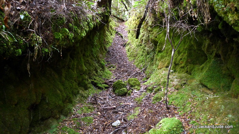
Standing on the flat ground in front of where the house stood it was easy to imagine bales of chafe for the horses and other supplies waiting to be hauled overland to the tree harvesting area. Following the obvious route further up the slope we picked out the beginning of a trench about the width a packhorse would make and made our first GPS position. Jude and I followed it into the thickening forest, our hearts beating faster from exertion and gleeful anticipation. Now imagine being totally surrounded by thick green forest, its floor thick with decaying branches and soft fallen leaf. Beneath the canopy is eerie. Even on a bright day sunlight barely pierces through. Now keep still, nothing is moving, and that stillness is timeless as if nothing could possibly ever change. That must be why our imagination could hear the clop of a horse’s hoof and a whinnying neigh.
Going up the rising slope, the shoe road got deeper. Its vertical sides, eroded by years of use and wild wet weather, were coated deep green in what we were sure would sparkle with glow worms once darkness fell. It would then be a spooky world. In night’s darkness strange rustling noises from unseen beasts would alarm anyone trapped within the twinkling vertical walls. It was easy to scamper under the first fallen tree but ahead three others crossed the trench requiring us to crawl under on our hands and knees. On the other side, as if crossing into a primeval world, all around us there was not a sign of man’s interference.
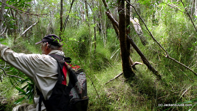 Jude and I are experienced wilderness trekkers in both open and closed forests. We have good balance, nimble bodies, and good eyes for what is natural or not. But that south-western Tassie forest is a tough one. The forest has grown back thick, and older trees have blown down. Razor grass and dense spaghetti vine fill open voids as does the wicked horizontal, Anodopetalum biglandulosum, a small tree endemic to western Tasmania. As horizontal grows, the trunk bends under its own weight until parallel with the ground. Vertical branches then grow from these which also bend over in time; hence the tree becomes a tangled mass of branches. Combine all those elements into one area and it’s an unpassable mess.
The beauty of Nature
With some difficulty we could detour around the fallen trees and on the rising slope could find the deepened shoe road again. But once we reached flatter ground we came across numerous small gullies, each looking vaguely like a manmade trench covered by thick patches of vine and heaps more horizontal. At that point, with about a half kilometre to the lighter forested area shown on our map, we chose to follow the path of least resistance and hopefully to forge ahead to find the shoe road where it emerged from the forest onto buttongrass. But by 1:30 PM we knew this was futile. There was zero chance of us reaching the buttongrass with anywhere near enough light to return home. Reluctantly, with a feeling of failure we made a turnaround waypoint on our GPS then looked back with deepening despair. Our legs were turning to jelly, our shins bled, and with increasing trepidation we badly needed an injection of energy and true grit.
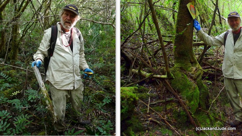 Silently we ate our lunch in a mild clearing while studying the topographical map and dashed line depicting the approximate route of the old shoe road. According to that we needed to be more east by a few hundred metres. Therefore after lunch we went that way hoping to pick up some sign of the old road. We’ve got to say it was heavy, slow going that couldn’t be rushed or we’d have a medical emergency which was paramount to avoid. Never did we spy any of our red ribbons, just dense saplings, occasional large trees mostly Myrtles and Blackwoods, and old cut stumps of Huon Pines, but always lots of obstructions like horizontal and razor grass. But then about 3 PM, we happened upon a whitish flat object half buried in the forest floor. My eye must have been attracted to its plain flatness in an uneven field. I knelt down and was astounded to pick up a short piece of dressed timber like part of an old sign. It didn’t have any signage remaining but Jude photographed it and I recorded its position before moving on towards a slightly more open spot. There I was very pleased to spot nailed to a tree the diagonal sign used by Tasmanian Hydro, a yellowish square with a faded red circle. Looking more closely, there were signs of human disturbance and enough change in landform for me to know we’d again found the shoe road. From that point back to our last known position filled in a large portion of missing data that made our efforts that day very worthwhile.
Alongside at Sir John Falls
Heavy rain fell the next day. Kicking back in the aft cabin, licking our wounds, Sir John Falls roaring loudly a short distance from the jetty, suddenly there came high pitched voices and laughter. Sliding back the aft cabin hatch we were astounded for there stood a gaggle of school kids. Crikey! How did they get here? Quickly we learned they were all year tens, ten of them, part of a high school outing with two teachers and a kayak guide. They’d paddled up from the Boom Camp in the lower reaches. How outstanding to learn that these week long outings were a regular event for Launceston High School.
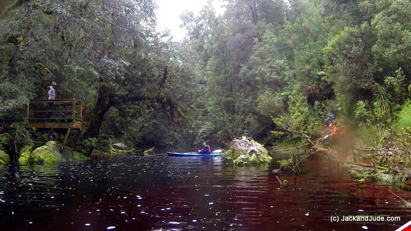
Next day in the pouring rain those fortunate children rigged up a kayak with ropes tied to trees and ferried themselves across the creek then trekked up to the abandoned Forestry House site. This got Jude and I thinking how great it would be if the old shoe road was open and passable. School children and ordinary folk alike would then have an opportunity to experience one of the grandest forests of our world. It would allow all of us to see the many trees and shrubs that flourish in the harsh wet climate found here. And it would also give us an opportunity to better assess what our forbearers had to endure to eke out a living bringing the unique Huon Pine to the greater world. It felt such a shame that this historical track had not been kept cleared and we thought that a valuable asset had been lost.
David and Judith at Little Eagle Creek
Saturday a week ago we were enjoying a day’s outing with two kayakers who had been camping in the river as long as we’d been there. It was their wedding anniversary and we had planned a romantic stroll up Little Eagle Creek and were making our way along Limekiln Reach when a speedboat suddenly appeared around the lower river bend. It’s unusual to see a speedboat in the Gordon which has a six knot speed limit, but our concerns turned to alarm when we saw that it was the Police Boat. Fenders were flicked over her side as she came up to us and after we’d grabbed a hold of her railing a young constable appeared. Then a Sergeant popped his head round from the steering position and said, “You must be Jack. And you must be Jude.”
Next a cardboard box suddenly appeared. “A care package from Trevor,” he said with a twinkling smile as he handed it across. That was startlingly enough, but he then added, “You’re son’s worried about you two.”
I must have done a double take because he went on to say that our son had reported that our ‘yellowbrick’ hadn’t recorded a position since the last phone contact with him three weeks ago. And while I turned to unlatch our ‘yellowbrick’ to check, he continued. “I rang a few folk in town. Trevor saw you a week ago, and Geoff (the seaplane pilot) said you were at Sir John Falls two days ago so I rang your son and told him that you were okay. Trevor said that if we came looking he’d give us a package for you, and since it was time for us to check out the river, on such a fine sunny day we thought we’d come up. Now! Aren’t you going to open the box? We’re dead curious.”
You can imagine that after three weeks away from a shop neither the kayakers nor we had much fresh food for their celebratory anniversary dinner that afternoon, and so we were absolutely delighted to open the box and find salmon steaks, broccoli, fresh bread and a chocolate bar. How perfect! Isn’t friendship wonderful?
The yellowbrick not performing turned out to be human error. Mine! I had forgotten to pay the line rental….Dah!
Overall our few weeks in the wild were as good as it gets. It was an event worth far more than the humdrum of everyday life. Of course, Jude and I are totally in love with Earth. Be it rain, drizzle or sunshine the natural Earth holds so many mysteries, begs so many questions, challenges us like nothing else can, and gives a reward not found in any other human experience. Protect Earth, she is life.
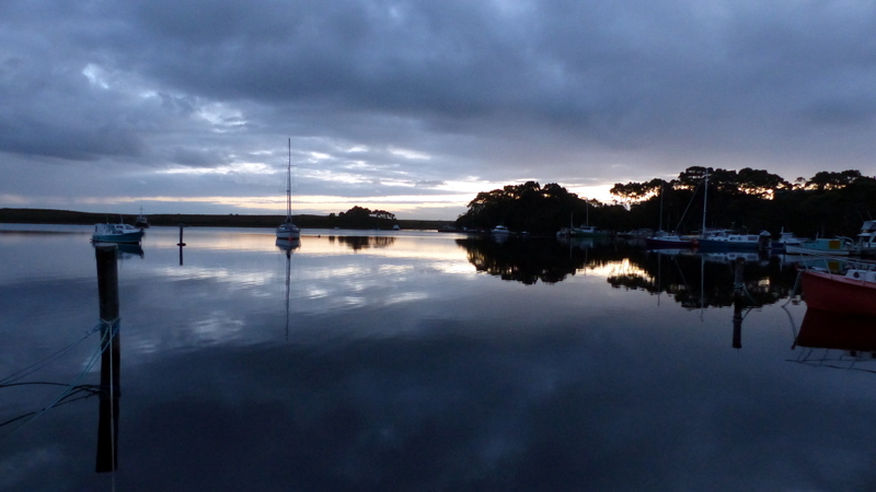
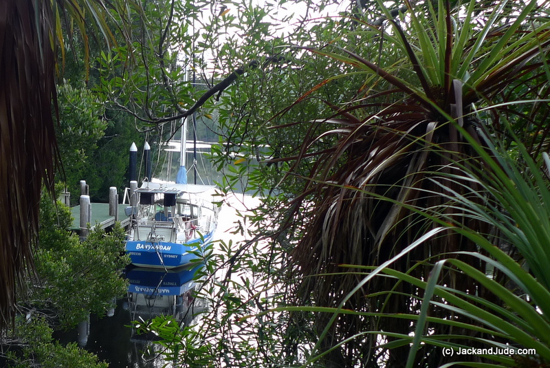
Safely back in Mill Bay after three weeks in the wilderness
#travel #travelvlog #sailingaroundtheworld #lifeafloat
Happy Birthday Jude .. What a wonderful place to celebrate and a great story.. Thanks for sharing and we look forward to having a yarn. Fabulous pictures .. What a stunning place .. Good on you both and keep up the good work! Lots of love xxxxxx
A nice read Jack and Jude it is pleasing to see that cruising and exploring is alive and well.
For the information of MV flash dancer and others. I cruise the coral sea reef and islands extensively, and would be pleased to share any information I may have.
Peter Sayre
Mvphoenixqld@bigpond.com.au
Facebook Peter Sayre.
Wonderful to continue to read of your adventures Jack and jude. And impressive the way you handle the technical stuff. For your info getting to Flora Reef was no problem, its narrow but we were ok in our cat. Although it is a much easier and more comfortable anchorage of the SE Holmes Reef in the obvious location.
Look forward to reading more of your amazing adventures.
Robin and Syl
M.V. Flash Dancer